

Oct 17: Coastal Storm Detected!
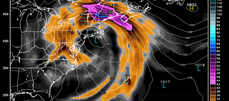
An upper level low pressure disturbance will move from Canada across the Great Lakes and stall out near the benchmark (70N/40W) next week. Impacts should be felt as early as Tuesday evening. There is uncertainty as to when it will clear out. My best guess right now is between Thursday evening and Friday morning. Once the low makes it into the Atlantic Ocean it will be met and enhanced by moisture and energy associated with the back (west) side of high pressure before moving away and out to sea.
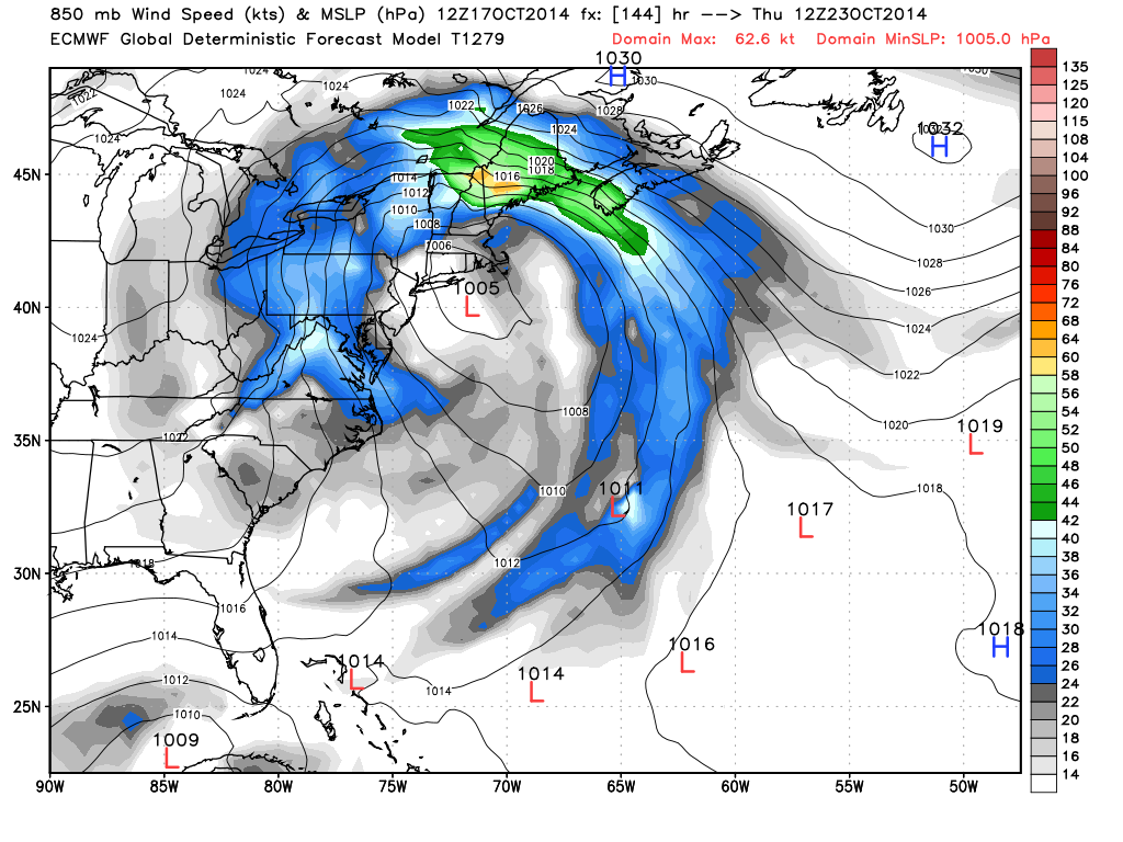
This is not a dangerous storm by any means…a run of the mill October coastal if you will. Low pressure intensity is not that impressive and neither are expected rainfall amounts. This is more of a prolonged nuisance event that could feature minor to moderate rain and wind, minor coastal flooding and beach erosion. This is the free public version of the European model (courtesy of WeatherBell Analytics) showing wind speed in knots at the 850mb level (~5000 ft above sea level) 144 hours out (Thursday morning at 8AM):
Even though there is decent model consensus at this point, we’re still 5-6 days away. That’s plenty of time for start and end times to shift left or right on the expected timeline. I’ll be closely monitoring this system very closely as it evolves and approaches. You know where to find the latest info! Be safe! JC
Jonathan Carr (JC) is the founder and sole operator of Weather NJ, New Jersey’s largest independent weather reporting agency. Since 2010, Jonathan has provided weather safety discussion and forecasting services for New Jersey and surrounding areas through the web and social media. Originally branded as Severe NJ Weather (before 2014), Weather NJ is proud to bring you accurate and responsible forecast discussion ahead of high-stakes weather scenarios that impact this great garden state of ours. All Weather. All New Jersey.™ Be safe! JC


LOCAL FORECAST | INTERACTIVE RADAR | LATEST NJ WEATHER ALERTS | WEDDING FORECAST| PRIVACY POLICY
© Copyright 2026 Weather NJ LLC. All Rights Reserved.
Some information that can be found on our website is provided by a private weather station and is not an officially recognized station for weather reporting. Though we always strive to achieve accurate reporting for our own use, it is important that you do NOT depend on the data provided here for any purpose.
