

Sept 8: Concerns Grow for East Coast Landfall
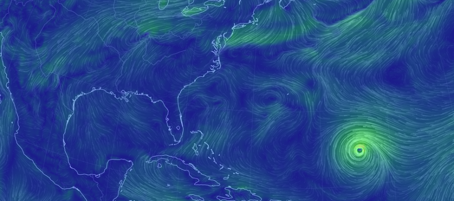
Discussion: Florence is now located at ~25N 55W (~700 miles SE of Bermuda) and moving very slowly to the W. It is still a strong tropical storm but expected to re-intensify into a hurricane as early as overnight tonight but likely by tomorrow afternoon.
Florence’s immediate future is fairly straight-forward. There is very little shear now between it and the US east coast as well as warmer sea surface temperatures. This screams intensification per basic meteorological principals. In my opinion, the 65W longitude (same longitude as Bermuda) is an important threshold. If Florence crosses 65W at or N of the 26N latitude, then landfall could occur closer to Hatteras. This would mean a stronger impact for New Jersey. If Florence crosses the 65W longitude closer to the 25N latitude then I think landfall would be S of Cape Lookout (S OBX). In that case, New Jersey might not even see rain but could still become breezy with some coastal flooding problems.
The GFS and Euro models are both seeing very strong ridging over the east coast. This ridging is first steering Florence into the SE US and then ultimately preventing the center of Florence from getting N of Virginia latitude. The Euro had impacts further inland than the GFS but both stall-out and bring substantial rain to the southern Mid-Atlantic US. A worthy note is that most model guidance has come N today…about half-way back from the N OBX landfall solutions prior to yesterday’s SC landfall solutions. As I mentioned in the video, this windshield-wiper effect when tracking cyclones on model guidance is normal. You simply have to consider the entire range a possibilities and figure out the approaching limit as time narrows before landfall.
There’s nothing showing a NJ landfall right now. There’s nothing showing a Delmarva landfall either. Most modeled landfalls today are between Myrtle Beach, SC and Cape Lookout, NC. In that case, New Jersey would escape the damaging eye-wall winds. The worst impact potential for NJ from this point IMO is the prolonged period of onshore flow (up to 3 days). This would likely cause coastal flooding problems for many along the Delaware Bay and SENJ ocean coasts. I think moderate-to-major flooding is possible in many of the remaining potential outcomes. The question is whether NJ sees run-of-mill rain and wind or something more damaging (but not catastrophic) as secondary post-landfall impacts.
In English: The period of interest for potential NJ Florence impacts is now looking like late-Thursday night through Sunday morning (overall period). My best gut call from this range is a landfall, possibly as a major hurricane, somewhere between Myrtle Beach, SC and Hatteras, NC on Thursday. This would spare NJ from the catastrophic winds of primary direct landfall but subject NJ to secondary impacts Friday and Saturday including rain, wind and coastal flooding. At this point a system that curves E of Hatteras, NC would likely miss out to sea. A landfall further S (closer to Myrtle Beach, SC) means less NJ impacts (run of mill stuff possibly little-to-no rain but windy and some coastal flooding). A landfall further N (closer to Hatteras, NC) means stronger NJ impacts (flash flooding, at least moderate coastal flooding and stronger winds). I cannot responsibly narrow this range of expectations down any further at this point. I can confidently say however that an east coast landfall concern continues to grow, especially for the coastal range I mentioned. Delaware Bay and ocean coasts should begin preparing for coastal flooding regardless. A reminder that we still have 5 days before the impact period begins. That is certainly time for more trending which I’ll continue to update daily. This is how I feel right now. Please be safe! JC
Jonathan Carr (JC) is the founder and sole operator of Weather NJ, New Jersey’s largest independent weather reporting agency. Since 2010, Jonathan has provided weather safety and forecasting services for New Jersey and immediate surrounding areas through the web, social media, and app spaces. Originally branded as Severe NJ Weather (before 2014), Weather NJ is proud to bring you accurate and responsible discussions ahead of high-stakes weather scenarios that impact the garden state. All Weather. All New Jersey.™


LOCAL FORECAST | INTERACTIVE RADAR | LATEST NJ WEATHER ALERTS | WEDDING FORECAST| PRIVACY POLICY
© Copyright 2024 Weather NJ LLC. All Rights Reserved.
Some information that can be found on our website is provided by a private weather station and is not an officially recognized station for weather reporting. Though we always strive to achieve accurate reporting for our own use, it is important that you do NOT depend on the data provided here for any purpose.
