

Storm Signal Showing for Dec 8-10
We should gradually clear tonight and stay dry through the weekend. But then a storm signal has been showing for next week on model guidance for a few runs now and the general pattern supports it. Unfortunately for snow lovers, there will likely not be much cold air to work with. With that said, we’re possibly looking at a rain and wind event in the December 8-10 period. Wind direction and intensity will be determined by low pressure intensity and track.
Right now, model guidance is struggling to nail down an exact track and intensity. What has been persistent is a surface low pressure system forming in the Gulf of Mexico and riding up the east coast while interacting with some northern energy. It doesn’t look like a full phase, stack or capture but close enough to bring at least nuisance weather to the east coast. If the low passes to our NW then we can expect a warmer rain with less wind. If the low passes to our SE then we can expect a colder rain with higher winds, especially along the east coast and off the ocean. A solution between that is what I’m currently monitoring.
As I explained in my Winter 2015-2016 primer, we are now in the long-range forecasting period of this system and therefore only discussing how the modeled storm signal correlates to the actual observed pattern for support. A quick glance at modeled teleconnections indicates polarity flips of the EPO, PNA, AO, and NAO around the Dec 8-10 period. The NAO and AO both gravitate from positive to neutral/slightly-negative territory. The PNA dives suddenly and the EPO peaks in positive territory and begins returning back to neutral (all around the December 8-10 period). Sudden flips like this are not clear cases of storm signals but tend to be such moreso than not.
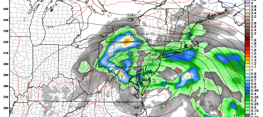
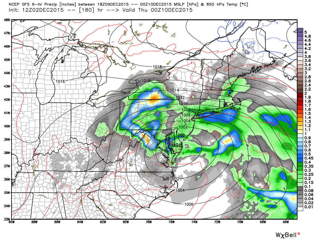
As far as the current pattern goes, jet stream analysis is unfavorable for this to be a snow storm. The southern jet is simply overpowering the northern jet across the US and not allowing northerly cold air to spill southward. There are however multiple troughs in the northern stream that span across the northern Pacific Ocean (NE. Asia through Bering Sea and Aleutians). Therefore, if the modeled southern stream storm signal in the Dec 8-10 period comes into fruition, it is feasible to expect “some” northern stream interaction—enough for “some” enhancement but again, not a true phase, capture or stack. Here’s the latest GFS model showing 850mb precipitation, pressure and temperature for the evening of Wednesday, December 9. This scenario would result in prolonged steady moderate rainfall and strong easterly winds:
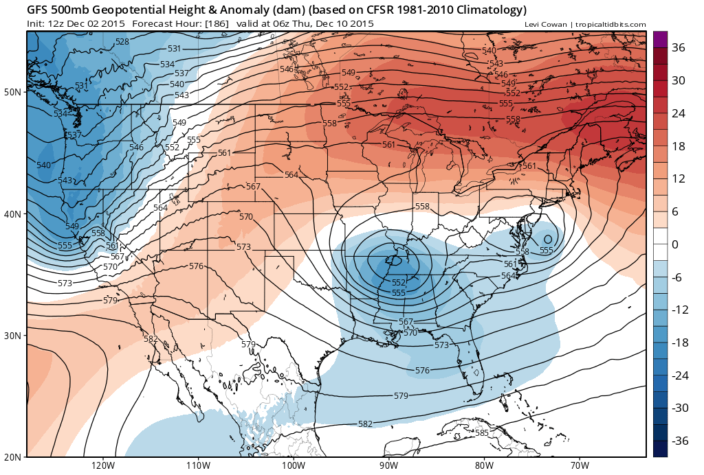
Here’s a look at 500mb showing the northern energy diving behind the southern energy—enabling the interaction. You can also see the higher heights to our north indicating the lack of cold we need for a widespread snow storm to occur:
While the GFS takes the storm closer to the New Jersey coast, the Canadian and European models have the system slightly offshore and stronger (down into 980mbs)…the Canadian a little earlier (Tuesday) and the European in alignment with GFS on timing (Dec 9-10). Regardless, all long-range models that I like to follow are showing a synoptic rainfall event for the general Dec 8-10 period.
In English: We dry out overnight and stay dry through the weekend with high pressure in control of the region. By mid-week next week, we could be looking at a rain and wind event. I’ll be tracking this possibility into the mid-range forecasting period over the next few days and will let you know of any changes. So that everyone is clear, this is discussion not a forecast. It will become a forecast once we are in the mid-range forecasting period. Be safe! JC
Model image used with permission from WeatherBell Analytics.
Jonathan Carr (JC) is the founder and sole operator of Weather NJ, New Jersey’s largest independent weather reporting agency. Since 2010, Jonathan has provided weather safety discussion and forecasting services for New Jersey and surrounding areas through the web and social media. Originally branded as Severe NJ Weather (before 2014), Weather NJ is proud to bring you accurate and responsible forecast discussion ahead of high-stakes weather scenarios that impact this great garden state of ours. All Weather. All New Jersey.™ Be safe! JC


LOCAL FORECAST | INTERACTIVE RADAR | LATEST NJ WEATHER ALERTS | WEDDING FORECAST| PRIVACY POLICY
© Copyright 2025 Weather NJ LLC. All Rights Reserved.
Some information that can be found on our website is provided by a private weather station and is not an officially recognized station for weather reporting. Though we always strive to achieve accurate reporting for our own use, it is important that you do NOT depend on the data provided here for any purpose.
