

Lottery Storms
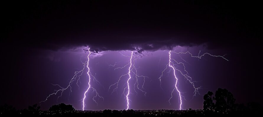
Discussion: The upper jet, observed at 250mb, is streaking across the Midwest US and splitting N and S over the Mid-Atlantic US. This is creating some divergence aloft to help power thunderstorms at the muggy surface. At 500mb I’m seeing a prolonged period of lower geopotential height anomalies over NJ from basically now through the last day of May. To me this indicates prolonged periods of unsettled conditions with a few 1-2 day periods between of immaculate conditions. It’s not daily washout stuff. It’s more of a “most luck out/some get hit” scenario each day. For this weekend, I am calling the storms lottery storms because most should stay dry and nice—avoiding the storms while very isolated areas get hit with small cell thunderstorms, still capable of producing heavy downpours and gusty winds. Conditions should improve statewide by Sunday morning allowing a beautiful stretch from Sunday through at least Tuesday. A potent upper low then moves into the region to bring rain and storms Wednesday through at least Friday, possibly Saturday. Suboptimal for first half of Memorial Day Weekend however Sunday and Monday would be the better outdoor days. Seems like mother nature is catching up on water tables after such a dry Fall 2024/Winter 2024-2025/start of Spring 2025. We have a ways to go still but this will all certainly help with fire spread/risk. No major storm systems on the near-horizon however some of these isolated pop-up storms can pack a punch if your location realizes them…if your location “wins the storm lottery.”
Forecast
Friday (May 16) high temperatures should reach into the 70s for most NJ locations with a very muggy feel. The main batch of rain and thunderstorms has already pushed through but isolated pop-ups are still possible while most locations will stay dry from here on. Winds should remain light out of the S. Overnight lows should only fall to about ~65 as more isolated thunderstorms remain possible into Saturday morning.
Saturday (May 17) high temperatures should reach the low-to-mid 80s for most NJ locations with continued humidity. Skies should be mixed with sun and clouds. Most areas have a good chance of staying dry. I’m calling these lottery storms because isolated areas could get hit with downpours and thunderstorms while surrounding areas miss out and ask, “what storms?” Winds should be light-to-breezy out of the SW. Overnight lows should fall back into the 50s statewide as conditions improve into Sunday morning.
Sunday (May 18) high temperatures should reach the low-to-mid 70s for most NJ locations. Humidity should be noticeably lower with a mix of sun and clouds. Can’t rule out an isolated shower or two, especially across SNJ, but most of NJ should stay dry. Winds should be breezy out of the W/NW. Overnight lows should range from 50-60 NNJ to SNJ as conditions remain fair and dry.
An early look at next week (May 19-23) indicates dry and fair conditions lasting through Tuesday. Wednesday through Saturday looks very unsettled…a rather suboptimal start for Memorial Day Weekend. Sunday into Monday looks like the better days for outdoor activity. I’ll take a much closer look at the MDW outlook on Monday. Have a great weekend and please be safe! JC
Premium Services
KABOOM Club offers ad-free content, inside info forecast discussion, your questions answered, and early storm impact maps and video releases (ahead of the public). At two bucks per month, it’s an extremely feasible way to show additional support for Weather NJ. Think of it as a tip jar with perks. Available onFacebook or Patreon.
My Pocket Meteorologist (MPM), in partnership with EPAWA Weather Consulting, offers professional/commercial interests, whose businesses depend on outdoor weather conditions (snow plowing, landscaping, construction, etc.), with hyper-local text message alerts/forecasts and access to the MPM premium forum—the most comprehensive and technical forecast discussion available for PA and NJ.
Jonathan Carr (JC) is the founder and sole operator of Weather NJ, New Jersey’s largest independent weather reporting agency. Since 2010, Jonathan has provided weather safety discussion and forecasting services for New Jersey and surrounding areas through the web and social media. Originally branded as Severe NJ Weather (before 2014), Weather NJ is proud to bring you accurate and responsible forecast discussion ahead of high-stakes weather scenarios that impact this great garden state of ours. All Weather. All New Jersey.™ Be safe! JC


LOCAL FORECAST | INTERACTIVE RADAR | LATEST NJ WEATHER ALERTS | WEDDING FORECAST| PRIVACY POLICY
© Copyright 2025 Weather NJ LLC. All Rights Reserved.
Some information that can be found on our website is provided by a private weather station and is not an officially recognized station for weather reporting. Though we always strive to achieve accurate reporting for our own use, it is important that you do NOT depend on the data provided here for any purpose.
