

Unsettled but Relief On Deck
Discussion: Thanks to an overnight cold front, today feels better. The zonal upper level patten should continue through the weekend until a ridge sets up in the Midwest US and puts NJ under N/NW upper flow for Monday-Tuesday. The zonal pattern will allow Saturday to feel more like Friday in the sense of lower humidity and temps not as hot and not without rain. Saturday and Sunday both look unsettled meaning random showers and thunderstorms possible both days. Sunday then looks to flex a bit with heat and humidity before the N/NW flow takes over. Monday and Tuesday then look very comfortable after this last relentless stretch of heat and humidity. We’re looking at dew points possibly dipping into the 50s for Monday-Tuesday which should feel amazing. Wednesday dew points should be back into the low-to-mid 60s but that should still feel great. It looks like 70+ dew points could hold off returning until Thursday-Friday for a warm and humid next weekend…and all the shower and thunderstorm chances that comes with such. For now, enjoy the immediate partial relief this weekend. But boy is the good stuff coming for Monday morning!
Forecast
Friday (July 18) high temperatures maxed out (as of 430pm) in the low-to-mid 80s. Skies were mixed with sun and clouds with a less humid feel. Winds should remain light out of the W/NW. Overnight lows should range from 60-70 NNJ to SNJ.
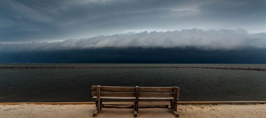
Saturday (July 19) high temperatures should reach the low-to-mid 80s for most NJ locations. Skies should be mixed with more clouds than sun as humidity returns from the S. NNJ will be last to see the humidity bump back up. Showers and thunderstorms are possible anytime after mid-to-late morning into the overnight. Winds should be light out of the SE. Overnight lows should stay above 70 statewide as humidity continues to build back in and that’s a good indication that Sunday will be the warmest feeling day of the weekend.
Sunday (July 20) high temperatures should reach the mid-to-upper 80s for most NJ locations with CNJ/SNJ likely breaking 90 away from the ocean and along I-95/NJTP. Skies should be mixed with sun and clouds with showers and thunderstorms around. Humidity should stick around (dad joke smirk) during the day but lower overnight. Overnight lows should fall to the 60-70 range NNJ to SNJ.
An early look at next week (July 21-25) indicates a solid feel of relief for Monday and at least Tuesday. Its still yet TBD if Wednesday will be a third day of relief of the return of humidity. Thursday into next weekend then returns to warmer and more humid and all the random shower/thunderstorm chances that come with such. Let’s take another look in a few days. Everyone have a great weekend and please be safe! JC
Premium Services
KABOOM Club offers ad-free content, inside info forecast discussion, your questions answered, and early storm impact maps and video releases (ahead of the public). At two bucks per month, it’s an extremely feasible way to show additional support for Weather NJ. Think of it as a tip jar with perks. Available onFacebook or Patreon.
My Pocket Meteorologist (MPM), in partnership with EPAWA Weather Consulting, offers professional/commercial interests, whose businesses depend on outdoor weather conditions (snow plowing, landscaping, construction, etc.), with hyper-local text message alerts/forecasts and access to the MPM premium forum—the most comprehensive and technical forecast discussion available for PA and NJ.
Jonathan Carr (JC) is the founder and sole operator of Weather NJ, New Jersey’s largest independent weather reporting agency. Since 2010, Jonathan has provided weather safety discussion and forecasting services for New Jersey and surrounding areas through the web and social media. Originally branded as Severe NJ Weather (before 2014), Weather NJ is proud to bring you accurate and responsible forecast discussion ahead of high-stakes weather scenarios that impact this great garden state of ours. All Weather. All New Jersey.™ Be safe! JC


LOCAL FORECAST | INTERACTIVE RADAR | LATEST NJ WEATHER ALERTS | WEDDING FORECAST| PRIVACY POLICY
© Copyright 2025 Weather NJ LLC. All Rights Reserved.
Some information that can be found on our website is provided by a private weather station and is not an officially recognized station for weather reporting. Though we always strive to achieve accurate reporting for our own use, it is important that you do NOT depend on the data provided here for any purpose.
