

Rainstorm Approaching with Gusty Winds to Follow
Discussion: The E US trough formation is well underway. Luckily, Melissa will not be captured by it or else the east coast might have seen another Sandy-like scenario. If you’ve been following along, especially in Weather NJ premium areas, I was mildly sweating that since about Oct 14. Instead, the steering currents rounding the bottom of the trough will instead keep Melissa out to sea with a track from the Bahamas out towards Bermuda and further NE into the N Atlantic Ocean. Jamaica, you are in our thoughts and we hope for the best recovery possible after such a tragic, catastrophic and historical hit.
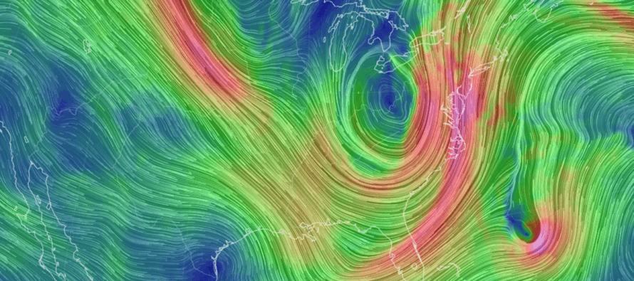
Our approaching rainstorm will instead come from a different cyclogenesis formed from the negative tilting difluence jet streak (speed-stretching of the atmosphere) and divergence (separating of the atmosphere) within the area of greatest positive vorticity advection (the lower front of the trough). This surface low is currently forming over W TN and will button hook down to GA and the Carolinas before turning N into PA. An inland cutter (NOT A NOR’EASTER). This puts NJ in the warm sector of the low tonight (Wed night)/tomorrow (Thursday) with mostly S/SW winds (a period of onshore flow) and rain moving from S/SW to N/NE until the cold front pushes through Friday morning. For this to be a nor’easter, the low would have to track to the SE of NJ and stall/retrograde. Instead it will track NW of NJ. Let’s break the hazards down by type:
Rain should push into NJ this evening. There might be a few leading isolated showers ahead of everything that could fall anytime after now. But the steadier rain should push into NJ after midnight tonight. There should be statewide rainfall happening for Thursday’s rush hour commute and that should persist for much of the day. Just as the rain arrives S/SW to N/NE, it should end the same way. SWNJ should end first around Thursday afternoon and NENJ should end last by midnight Thursday night/early Friday AM. .75 to 1.5 inches of rainfall is a conservative safe bet IMO when all is said and done. However, I expect some areas to exceed 2 inches and possibly flirt with 3 inches of rainfall depending on where the heaviest banding sets up. We won’t know that until storm time but a solid soaker is expected for Thursday.
Winds should begin picking up tonight (Wednesday night), peak Thursday morning and subside some for Thursday night. I think gusts to 25-30mph are a safe bet however areas closer to the coast could reach 40-45mph possibly slightly higher. This is the kind of system where the strongest winds occur after the rain has stopped (would be Friday) due to the intensifying low tracking into the NE US. Models have this low dropping below 990mb, some data sub-980mb once the low is over Maine Friday night. Therefore, I think we will see common gusts to 30-40mph for periods on Friday with peak gusts to the 40-50mph range. Winds tonight and Thursday (during the rain) will be out of the S/SW at first, switch to a period of onshore flow off the ocean and then switch with the cold frontal passage to W/NW or NW for Friday.
For Halloween, this means that the rain ends well in-time for trick-or-treating hours. Good news for the kids but it should be windy with dropping temperatures. Dress for wind and dress for cold when heading out Friday afternoon/evening. I’m very glad that this will work out for the kids but again, plan for wind.
In English: A rainstorm is approaching that will likely bring 1-2 inches of rainfall for many NJ areas between midnight tonight (Wednesday night) and midnight tomorrow night (Thursday night). It could get a little windy during the rainfall but the highest winds should be felt on Friday, well after the rain shuts off. Trick-or-treating hours should therefore be dry but very windy (gusts over 40mph possible) with dropping temperatures. Please dress accordingly. Small human beings should avoid sailful costumes. We then slip into a dry weekend when I assume a lot more leaves will be off the trees. If you’re doing early leaf cleanup, you might want to wait until later in the weekend. Have a great rest of your Wednesday evening and please be safe! JC
Premium Services
KABOOM Club offers ad-free content, inside info forecast discussion, your questions answered, and early storm impact maps and video releases (ahead of the public). At $1.99 per month, it’s an extremely feasible way to show additional support for Weather NJ and you can turn it on and off for however many months you wish. Think of it as a tip jar with perks. Available onFacebook or Patreon.
My Pocket Meteorologist (MPM), in partnership with EPAWA Weather Consulting, offers professional/commercial interests, whose businesses depend on outdoor weather conditions (snow plowing, landscaping, construction, etc.), with hyper-local text message alerts/forecasts from real meteorologists and access to the MPM premium forum—the most comprehensive and technical forecast discussion available for PA and NJ.
Jonathan Carr (JC) is the founder and sole operator of Weather NJ, New Jersey’s largest independent weather reporting agency. Since 2010, Jonathan has provided weather safety discussion and forecasting services for New Jersey and surrounding areas through the web and social media. Originally branded as Severe NJ Weather (before 2014), Weather NJ is proud to bring you accurate and responsible forecast discussion ahead of high-stakes weather scenarios that impact this great garden state of ours. All Weather. All New Jersey.™ Be safe! JC


LOCAL FORECAST | INTERACTIVE RADAR | LATEST NJ WEATHER ALERTS | WEDDING FORECAST| PRIVACY POLICY
© Copyright 2026 Weather NJ LLC. All Rights Reserved.
Some information that can be found on our website is provided by a private weather station and is not an officially recognized station for weather reporting. Though we always strive to achieve accurate reporting for our own use, it is important that you do NOT depend on the data provided here for any purpose.
