

Closing out 2025
Discussion: This outlook will be in article format covering a few things including a storm recap of what and why it happened, the rest of this weekend’s outlook and lastly a look ahead at the next signals.
Storm Recap
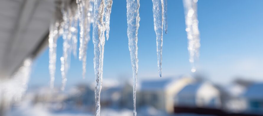
Our system arrived on time yesterday. A mix of snow and sleet broke out by 5pm but the warm air advection stuck its nose all the way into NNJ from SWNJ. As warm air advection saturated the lower levels, precipitation became slightly convective in the sense that heavier precipitation rates would collapse the shallow warm layer into an all-snow situation…and lesser precipitation rates would allow the warm layer to open back up and create sleet. This is why areas went back and forth between snow and sleet rather than starting as snow and ending as sleet. This is why we did our best to communicate the uncertainty of the warm air advection. This resulted in the little expected snow across SNJ and CNJ failing to materialize. It really wasn’t much snow that was expected in SNJ/CNJ (a coating to an inch or so would have verified) before the changeover but the snow did not happen as much as the ice did in which case our ice forecasts verified nicely across SNJ and CNJ. So for zones A through F we did pretty well. It was zones G and H where the forecast fell the most apart. While these areas initially suffered from the mixed snow/ice, rather than a snowy start changing to ice, they still went back and forth. It was a dry slot in precipitation that robbed these areas with about 3-6 inches of additional snowfall to what finalized on the ground this morning. The dry slot was an atmospheric response of subsidence to the intense lifting under a jet streak that formed over NY State into Coastal New England. It eventually filled in some after 3am and brought much of NNJ up into the 1-3 range for zone G and 3-5 zone for zone G, but that was a still a few inches short of making into the lower end of expected range. Add the 3-6 from the dry slot robbery, and NNJ would have seen 6-10 easy N of I-78 and down into Monmouth County. Today, we have an inverted trough dumping some snow showers across parts of CNJ/SNJ but this should gradually make its way to the coast over the next few hours after dropping an additional fresh coating to an inch or so of snow on top of the icy crust. And that will conclude this event.
Weekend Outlook
Most of NJ, less immediate coastal areas, will stay at or below freezing today with a decent amount of ice meltage, especially areas subject to the fresh departing layer of snow from the inverted trough. These snow showers are gradually making their way to the coast but not before whitening everything up a bit more. We don’t really have strong winds to help dry anything either. Treated roads should be fine for travel this evening (just wet). But untreated roads could be slick as temps drop overnight. Please use extra caution if traveling tonight (Friday night) as overnight lows dip into the teens-20s NNJ-SNJ. On Sunday, a warm front will push some rain through a cloudy and milder NJ in the upper-30s to mid-40s. There is a small concern for some NWNJ areas to see some of that rain freeze if it falls early enough on the still-cold surface early enough in the day. NWNJ surfaces will eventually warm just above freezing. But until then (before noon), freezing rain is a small possibility for typical elevations. The rest of NJ (lower 2/3 of NJ) subject to just plain rain showers on Sunday. Once the warm front is through, we then see a milder Sunday night through Monday with highs well-above freezing Monday while we bask in warm sector flow. A cold front will then push through some more rain through Monday night and rapidly cool the region for the last few days of the year (Tuesday-Wednesday) with no additional weather disturbances expected in 2025.
The Next Signals
2026 looks to start with the active pattern continuing. The low responsible for the Sunday warm front and Monday cold front will alter the jet pattern into more of a W US ridge/E US trough pattern with Greenland Blocking as reflected on telleconnective oscillation (-NAO/-AO/+PNA). I see the potential for three signals. One in the shorter range (Jan 1-2) in the form of a sliding wave/weak coastal. Another in the mid-long range (~Jan 6) as possibly a stronger coastal storm. And lastly another stronger Miller-A storm potential in the distant long-range (Jan 10-12). The latter two signals are just signals that I will be casually tracking. The Jan 1-2 signal is obviously closer and will be given stronger consideration if still showing later this weekend or Monday. Watching until then.
In English: A storm recap is above if you want to know the scientific details of what happened last night through this morning. This weekend looks rather uneventful but wet outside of some temp changes and possible freezing rain for NWNJ Sunday morning. We’re milder Monday but then turn colder for Tuesday-Wednesday as we eye up the next wintry potential (a weak sliding wave) for Thursday-Friday. Have a great weekend and please be safe! JC
Premium Services
KABOOM Club offers an ad-free environment, inside info (Above and Beyond) forecast discussion, your questions prioritized, and early storm impact maps and video releases (ahead of the public). At $1.99 per month, it’s an extremely feasible way to show additional support for Weather NJ and you can turn it on and off for however many months you wish. Think of it as a tip jar with perks. Available onFacebook or Patreon.
My Pocket Meteorologist (MPM), in partnership with EPAWA Weather Consulting, offers professional/commercial interests, whose businesses depend on outdoor weather conditions (snow plowing, landscaping, construction, etc.), with hyper-local text message alerts/forecasts from real meteorologists and access to the MPM premium forum—the most comprehensive and technical forecast discussion available for PA and NJ commercial interests.
KABOOM Shop is live if you want some KABOOM or Weather NJ Merch!
Sign up for ZoneWatch Radar and get 10% off
Jonathan Carr (JC) is the founder and sole operator of Weather NJ, New Jersey’s largest independent weather reporting agency. Since 2010, Jonathan has provided weather safety discussion and forecasting services for New Jersey and surrounding areas through the web and social media. Originally branded as Severe NJ Weather (before 2014), Weather NJ is proud to bring you accurate and responsible forecast discussion ahead of high-stakes weather scenarios that impact this great garden state of ours. All Weather. All New Jersey.™ Be safe! JC


LOCAL FORECAST | INTERACTIVE RADAR | LATEST NJ WEATHER ALERTS | WEDDING FORECAST| PRIVACY POLICY
© Copyright 2026 Weather NJ LLC. All Rights Reserved.
Some information that can be found on our website is provided by a private weather station and is not an officially recognized station for weather reporting. Though we always strive to achieve accurate reporting for our own use, it is important that you do NOT depend on the data provided here for any purpose.
