

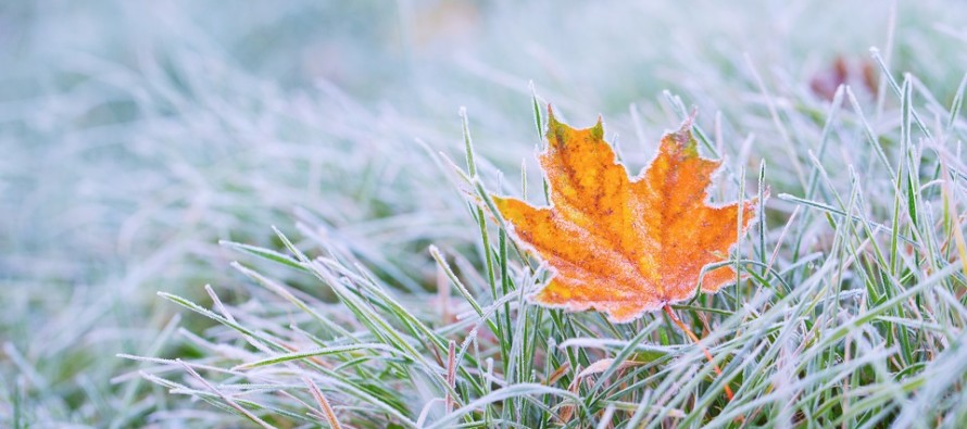
A Taste of Winter (Nov 8-10)
Discussion: Rainfall is pushing through NJ as expected. Rain to start and finish for most areas with just a chance of NWNJ elevations ending with wintry precipitation. Elevations greater than 1200 feet should expect anything from just rain ending as snowflakes to trace accumulations on non-paved surfaces only. Once the precipitation shuts off the Arctic air mass will invade the entire state by sunrise tomorrow (Friday) morning. NWNJ should feel it by midnight tonight (Thursday night). Friday and Saturday should then be very cold especially overnight. Windier on Friday than Saturday. Temperatures then moderate for Sunday and Monday before we repeat a similar setup for next Tuesday-Thursday. A rain-to-snow situation Tuesday like tonight but probably colder meaning more of NJ will see finishing snow not just NWNJ elevations. Tuesday night through next Thursday then looks even colder than this Friday-Saturday will be. And lastly I’m watching a second storm signal for Friday Nov 15.
Friday (Nov 8) high temperatures should only reach the mid-40s for most areas. NNJ elevations might fail to escape the upper-30s. Watch out for any frozen surfaces that do not evaporate in the early AM hours. This concern should fizzle away once the sun is up. Skies should be mostly sunny with a few clouds here and there. The sky should have a wintry look and feel to it especially the glow surrounding sunset. Winds should be breezy, sometimes gusty, out of the NW. Overnight lows should fall into the 20s for most areas with the coldest locations (NWNJ + SNJ Pine Barrens) possibly down into the teens.
Saturday (Nov 9) high temperatures should only reach the low-to-mid 40s for most areas. Skies should be mostly sunny with a continued wintry cold feel. Winds should be light out of the SW. Overnight lows should fall into the 30s for most areas. NNJ elevations and SNJ Pine Barrens likely dipping into the upper-20s.
Sunday (Nov 10) high temperatures should reach back into the 50s for most areas. Skies should be mixed with sun and clouds. Winds should remain light out of the SW. Overnight lows should range from near-freezing to lower-40s NNJ to SNJ.
An early look at next week indicates snow or a rain-to-snow situation Tuesday which sets up another Arctic cold blast for Tuesday night through at least Thursday morning. Looks like temperatures then moderate some for next weekend depending on what the Friday Nov 15 storm signal does. I’ll be following the Tuesday Nov 12 snow potential closely over the next few days. I might even dust off the old green screen video equipment. Everyone have a great weekend and please be safe! JC
Download the new free Weather NJ mobile app on Apple and/or Android. It’s the easiest way to never miss Weather NJ content. Our premium services go even further above and beyond at the hyper-local level. Looking for industrial-caliber long-range forecasting data that I personally recommend? Check out WeatherTrends360!
Jonathan Carr (JC) is the founder and sole operator of Weather NJ, New Jersey’s largest independent weather reporting agency. Since 2010, Jonathan has provided weather safety discussion and forecasting services for New Jersey and surrounding areas through the web and social media. Originally branded as Severe NJ Weather (before 2014), Weather NJ is proud to bring you accurate and responsible forecast discussion ahead of high-stakes weather scenarios that impact this great garden state of ours. All Weather. All New Jersey.™ Be safe! JC


LOCAL FORECAST | INTERACTIVE RADAR | LATEST NJ WEATHER ALERTS | WEDDING FORECAST| PRIVACY POLICY
© Copyright 2026 Weather NJ LLC. All Rights Reserved.
Some information that can be found on our website is provided by a private weather station and is not an officially recognized station for weather reporting. Though we always strive to achieve accurate reporting for our own use, it is important that you do NOT depend on the data provided here for any purpose.

)