

A Windy Wednesday Night Expected
Discussion: A potent upper-level shortwave will graze through NNJ Wednesday night into Thursday morning. It’s not a trough or even an upper low, just a potent shortwave as seen below here in both 500mb geopotential heights and 500mb vorticity (solid vort!) views:
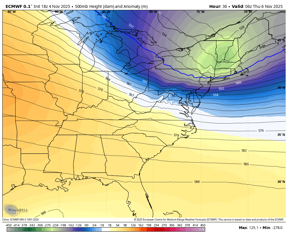
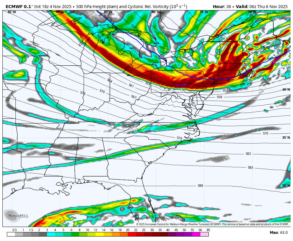
At the surface, the shortwave will contain enough energy to deepen the surface low to about 989mb as it tracks across NY State, Vermont, New Hampshire and into the Gulf of Maine. This should 1) drag a progressive cold front through the NorthEast US and Northern Mid-Atlantic US (including NJ) and 2) tighten the isobars enough, in the wake of the low, to produce a windy Wednesday night into Thursday morning for most of NJ, especially NNJ:
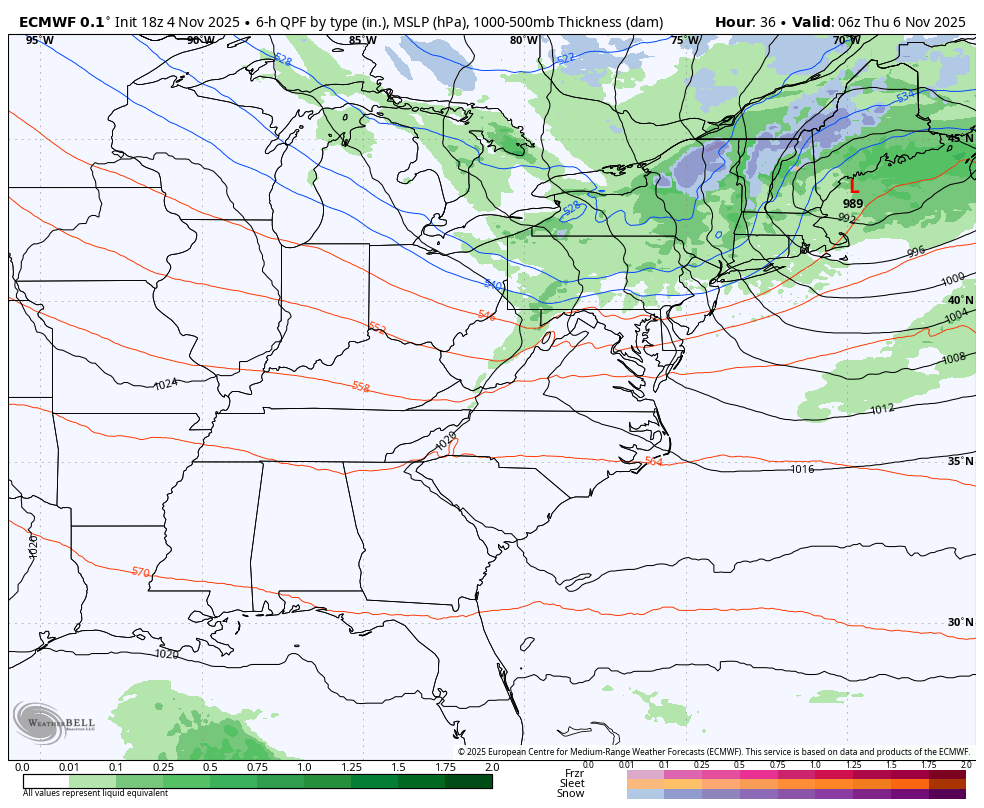
Winds should gradually pick up out of the W/SW throughout Wednesday as a weak area of high pressure tracks across the SE US and begins the pressure squeeze. Then, between about 8pm and midnight, the winds should intensify and switch from W/SW to NW as the low deepens and gets to about New Jersey’s 1-2 o’clock. That should mark the passage of the cold front and bring some rain to at least NNJ. This doesn’t look like a solid rainmaker. I’ll be surprised if even NNJ squeezes out a tenth of an inch of total liquid. The wind will likely be the headline for Wednesday night into Thursday morning.
The National Weather Service at Mount Holly, NJ has issued high wind watches for most NJ counties N/NW of the turnpike with language suggesting NW wind gusts of 50-60mph possible. I think this will be more of an isolated higher range of what winds will be. IMO most NNJ areas should experience NW wind gusts in the 40-50mph range. Either way, a windy night for NNJ and loose/small outdoor items should probably be secured. CNJ and SNJ should see a breezy gusty night as well but not as high as NNJ. One thing this WILL do is clear a lot more leaves off the trees. We then continue our volatile week of weather conditions leading up to the big chill down early next week.
In English: Winds should gradually pick up throughout Wednesday and become gusty Wednesday night into Thursday morning. A little bit of rain should fall across NNJ overnight as a cold front pushes through with the winds from NW to SE. We clear for Thursday-Friday, see some more rain Saturday morning, clear for Sunday and then drop much colder for early next week. Have a great rest of your Tuesday night and please be safe! JC
Premium Services
KABOOM Club offers ad-free content, inside info forecast discussion, your questions answered, and early storm impact maps and video releases (ahead of the public). At $1.99 per month, it’s an extremely feasible way to show additional support for Weather NJ and you can turn it on and off for however many months you wish. Think of it as a tip jar with perks. Available onFacebook or Patreon.
My Pocket Meteorologist (MPM), in partnership with EPAWA Weather Consulting, offers professional/commercial interests, whose businesses depend on outdoor weather conditions (snow plowing, landscaping, construction, etc.), with hyper-local text message alerts/forecasts from real meteorologists and access to the MPM premium forum—the most comprehensive and technical forecast discussion available for PA and NJ.
Jonathan Carr (JC) is the founder and sole operator of Weather NJ, New Jersey’s largest independent weather reporting agency. Since 2010, Jonathan has provided weather safety discussion and forecasting services for New Jersey and surrounding areas through the web and social media. Originally branded as Severe NJ Weather (before 2014), Weather NJ is proud to bring you accurate and responsible forecast discussion ahead of high-stakes weather scenarios that impact this great garden state of ours. All Weather. All New Jersey.™ Be safe! JC


LOCAL FORECAST | INTERACTIVE RADAR | LATEST NJ WEATHER ALERTS | WEDDING FORECAST| PRIVACY POLICY
© Copyright 2025 Weather NJ LLC. All Rights Reserved.
Some information that can be found on our website is provided by a private weather station and is not an officially recognized station for weather reporting. Though we always strive to achieve accurate reporting for our own use, it is important that you do NOT depend on the data provided here for any purpose.
