


Another Damaging Storm Period Detected

Discussion: The weak low that was over the Mid-Atlantic US and contributed heavily to yesterday’s flash flooding/heavy consistent rainfall, is now offshore just S of Cape Cod. This is now producing northerly flow behind it (to the W of it over NJ) which should last into Thursday morning. While it knocked the temps down, the humidity is still high due to higher dew point temperatures remaining across the region. It wasn’t a solid cold front that came through out of Canada, more like a cooler sector created naturally by Norwegian Cyclone Model theory within an overall warm E US air mass. Right now a temp of 72 dew of 67 is the coolest part of the cyclone model. Is it cooler for NJ? Yes, but I wouldn’t call it comfortable. Feels more like a gloomy warm front day.
But that’s going to change. Skies should generally improve from this point forward. There are a few remaining isolated showers across the region, but they’re squashing out. Stars should be out tonight (Tuesday night) with comfortable temps but again, annoying humidity. Will feel a lot better than past few nights and will be dry and free from storms for a change. Wednesday should remain dry with sun and clouds and reach typical mid-summer day conditions (highs 80-85 lows 65-68). Thursday looks similar to Wednesday temperature-wise but slightly more humid and with thunderstorms back on the table for Thursday afternoon-evening. 90s are then possible again Friday with more thunderstorms possible during afternoon-evening hours. So basically this week is a step up in temps and humidity each day from now until Friday with Thursday and Friday being the next chances for thunderstorms. These would be the kind of thunderstorms that produce moderate-to-heavy rainfall at times, moderate frequency lightning, and moderate winds capable of rearranging small outdoor furniture and lose items and possibly dropping some small tree limbs. The weekend then looks pretty average summery. Plenty of sun. Highs in the 80s. Lows in the 60s. More garden variety thunderstorms possible during afternoon-evening hours. Cooker but humid mid-summer nights.
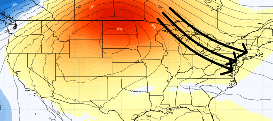
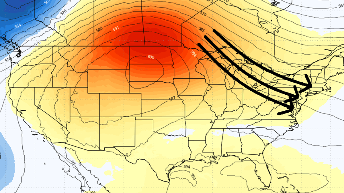
Now I would like to discuss the reason for replacing the traditional weekly outlook with an article. The pattern we just had last week is known internally to some of the meteorological community as a death ridge/ring of fire pattern. In that case, the ridge axis centered over the Great lakes and allowed the ridiculous heat and humidity to rise up from the SE US into the Mid-Atlantic US. NJ was only aligned in the ring of fire storm highway towards the end of the ridge influence. Prior to that, the best storm dynamics were aligned from the Great Lakes towards New England. I now see another ridge but it looks to center and flex a little W of the Great Lakes, more over N and S Dakota. This should remove NJ from the hottest part of the ridge but subject NJ to the ring of fire storm highway. Basically, any thunderstorms that form in the hottest part of the ridge can be steered over the Great Lakes (moisture pickup) and into NJ as mesoscale convective systems or complexes. If these systems/complexes form into linear bowing segments and satisfy certain geographic definitions, then they can become a Derecho like in June 2012. Derechos are rare so let’s not get ahead of ourselves. However, this setup could easily produce thunderstorms with damaging winds (not just fallen tree limbs). This is what I will be watching for the July 13-16 period. Here is the latest Euro model showing the ridge and storm highway starting next Monday:
In English: Clouds should give way to some clearing this evening. Temps will remain cooler overnight but still humid for its temp. Wednesday looks dry and summery. Thursday and Friday look summery too but warmer, more humid and with afternoon-evening routine thunderstorm chances. The weekend looks like more of the same but not as warm (after Friday storms break the heat). Fortunately the heat does not look like 100+ again…more like upper-80s/lower-90s typical summer heat with typical summer humidity. I’m then watching next week, Monday-Thursday (July 13-16) for stronger thunderstorm chances in another ring of fire pattern like what happened this past Friday night through yesterday (Monday). The primary threats would again be wind damage and flash flooding. More to come. For now, have a great rest of your week! I’ll be back Friday with the weekend outlook or possibly earlier for radar observations for Thursday and Friday thunderstorms. Be safe! JC
Premium Services
KABOOM Club offers an ad-free environment, inside info (Above and Beyond) forecast discussion, your questions prioritized, and early storm impact maps and video releases (ahead of the public). At $1.99 per month, it’s an extremely feasible way to show additional support for Weather NJ and you can turn it on and off for however many months you wish. Think of it as a tip jar with perks. Available onFacebook or Patreon.
My Pocket Meteorologist (MPM), in partnership with EPAWA Weather Consulting, offers professional/commercial interests, whose businesses depend on outdoor weather conditions (snow plowing, landscaping, construction, etc.), with hyper-local text message alerts/forecasts from real meteorologists and access to the MPM premium forum—the most comprehensive and technical forecast discussion available for PA and NJ commercial interests.
KABOOM Shop is live if you want some KABOOM or Weather NJ Merch!

Jonathan Carr (JC) is the founder and sole operator of Weather NJ, New Jersey’s largest independent weather reporting agency. Since 2010, Jonathan has provided weather safety discussion and forecasting services for New Jersey and surrounding areas through the web and social media. Originally branded as Severe NJ Weather (before 2014), Weather NJ is proud to bring you accurate and responsible forecast discussion ahead of high-stakes weather scenarios that impact this great garden state of ours. All Weather. All New Jersey.™ Be safe! JC



LOCAL FORECAST | INTERACTIVE RADAR | LATEST NJ WEATHER ALERTS | WEDDING FORECAST| PRIVACY POLICY
© Copyright 2026 Weather NJ LLC. All Rights Reserved.
Some information that can be found on our website is provided by a private weather station and is not an officially recognized station for weather reporting. Though we always strive to achieve accurate reporting for our own use, it is important that you do NOT depend on the data provided here for any purpose.

