

April 14: Thunderstorms Approaching
Discussion: A well-organized low pressure system will track through Ohio, NW NY State and ultimately into Maine overnight into tomorrow. We’re in the correlating warm sector today (I don’t need to tell you that) but the cold front should push through behind the storm line later tomorrow morning.
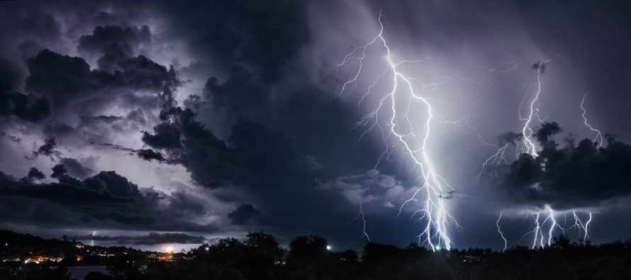
This should push an hour-or-less period of heavy rainfall, gusty winds, and possibly frequent lightning through the region between about 2am and 6am tomorrow (Monday) morning—Approaching NWNJ/WNJ around 2am and clearing the SENJ/ENJ coast by 6am. Areas between can estimate timing based on that W to E movement.
Since today was mostly cloudy there hasn’t been a lot of diurnal instability. There has been some but not exactly higher levels of Convective Available Potential Energy (CAPE). There is lots of vertical wind shear however and that should be the main driver of the storm front. We also have a sub-1000mb low passing relatively close by (to our NW) which could enhance lifting as a near-proximity trigger (more influence for NWNJ). Most ingredients for severe weather are on the table however so all the standard safety issues and concerns apply.
Per usual, marine influence could weaken the convective nature of the storm line before reaching the ENJ coast. Therefore WNJ has the best chance to see severe criteria met. ENJ is still on the hook for such but with a lesser chance. Typically these storm fronts cross the Delaware River with frequent lightning and severe wind gusts but fizzle to just heavy downpours and moderate/strong winds before reaching the coast. This is the case 9 out of 10 times but there’s always that one time. It’s best to prepare just in case.
The most rational wind type expectation are straight line winds however a tornado cannot be ruled out completely with this setup…also a typical assessment. Regardless wind gusts of 60mph or greater are possible which are capable of producing damage. Again, it should all push through by 6am tomorrow morning with improvement expected by mid-to-late Monday morning.
In English: A thin line of rain and thunderstorms should push through the entire state of New Jersey from W to E between about 2am and 6am Monday morning. It will not rain and storm for that entire period but it will take that long for the thin strip of downpours, gusty winds and lightning to move across the region. The actual duration of impacts should be an hour or less but it could pack quite a punch. Wind gusts of 60mph or greater are possible along with the typical other possibilities that come with severe weather potential (hail, frequent lightning, a possible tornado, etc.). I recommend securing loose outdoor items and bringing all small people indoors overnight. I expect WNJ to see greater impact than ENJ due to typical marine influence. But please do not lower your guard in case the storms retain their intensity through the coast. I’ll have the Monday-Friday outlook posted tomorrow morning. For tonight the focus is on the overnight severe weather potential.
Download the new free Weather NJ mobile app on Apple and/or Android. It’s the easiest way to never miss Weather NJ content. Our premium services go even further above and beyond at the hyper-local level. Looking for industrial-caliber long-range forecasting data that I personally recommend? Check out WeatherTrends360!
Jonathan Carr (JC) is the founder and sole operator of Weather NJ, New Jersey’s largest independent weather reporting agency. Since 2010, Jonathan has provided weather safety discussion and forecasting services for New Jersey and surrounding areas through the web and social media. Originally branded as Severe NJ Weather (before 2014), Weather NJ is proud to bring you accurate and responsible forecast discussion ahead of high-stakes weather scenarios that impact this great garden state of ours. All Weather. All New Jersey.™ Be safe! JC


LOCAL FORECAST | INTERACTIVE RADAR | LATEST NJ WEATHER ALERTS | WEDDING FORECAST| PRIVACY POLICY
© Copyright 2026 Weather NJ LLC. All Rights Reserved.
Some information that can be found on our website is provided by a private weather station and is not an officially recognized station for weather reporting. Though we always strive to achieve accurate reporting for our own use, it is important that you do NOT depend on the data provided here for any purpose.
