April 2: Widespread Rain Approaching!
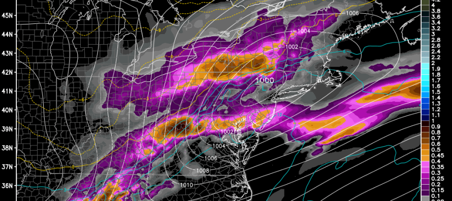
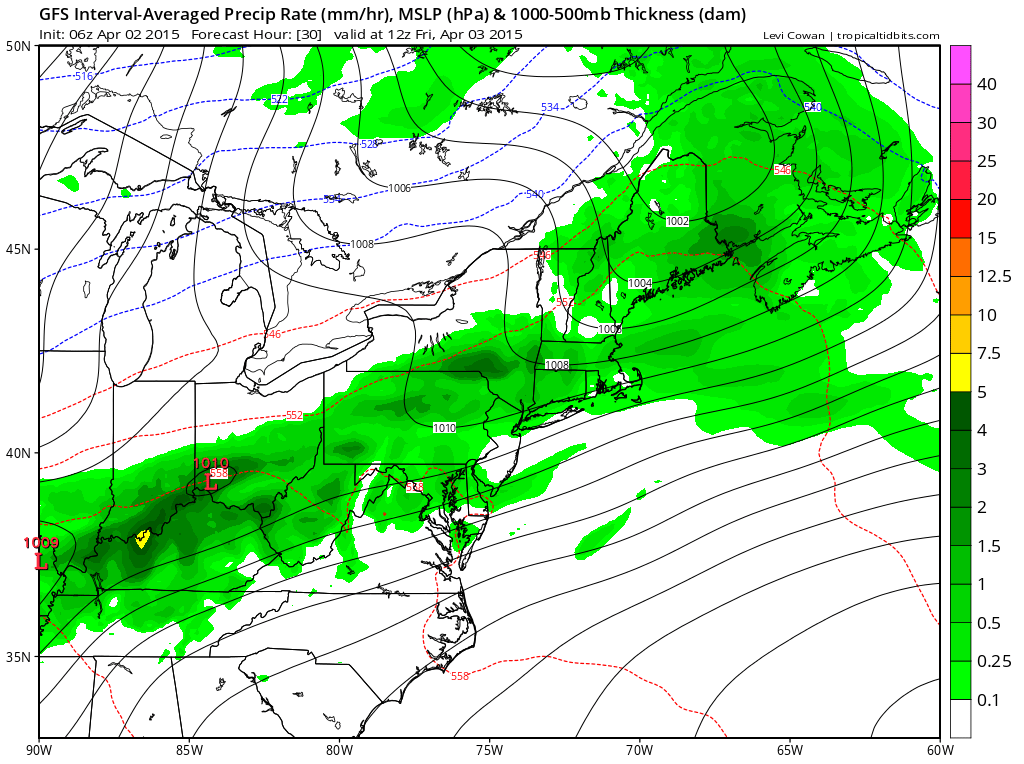
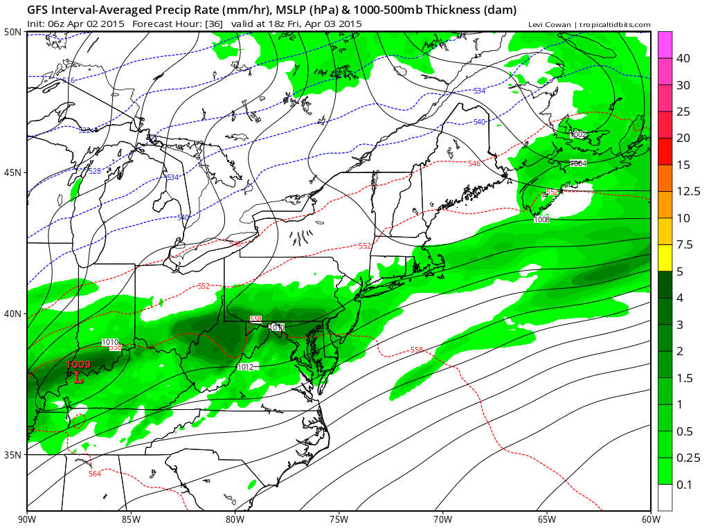
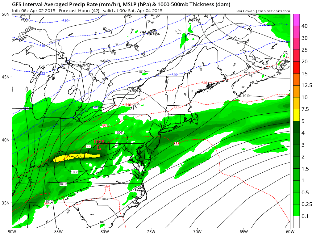
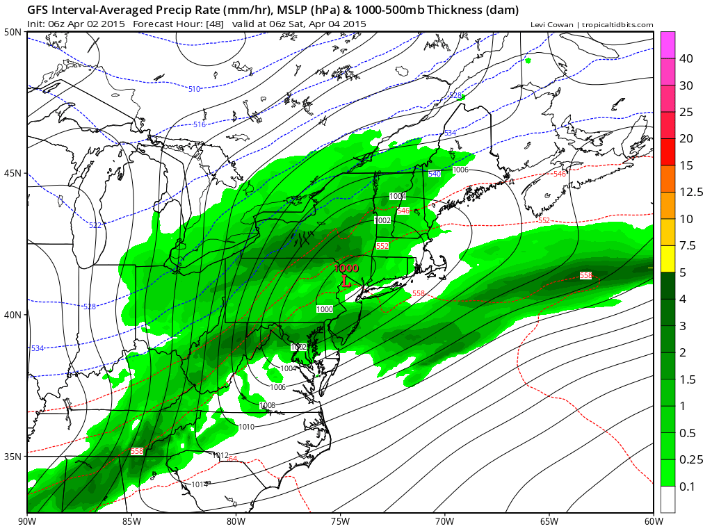
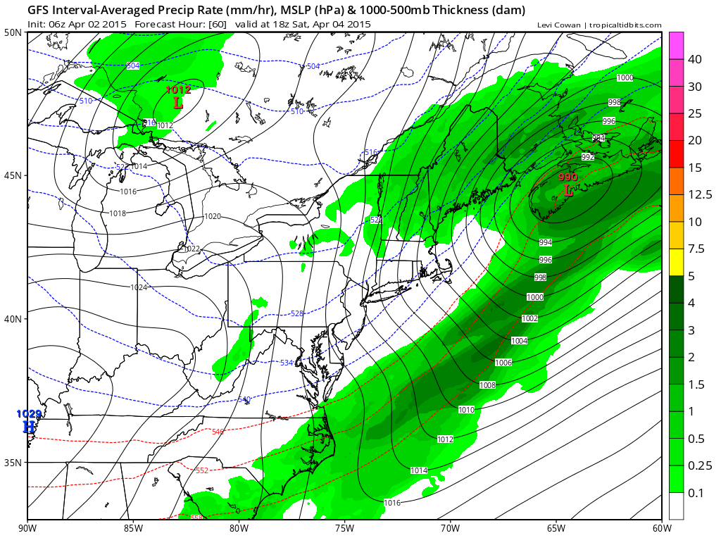
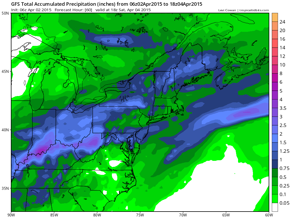
An area of weak low pressure will track over Kentucky, West Virginia, and Pennsylvania before passing over NNJ this Friday-Saturday. This will bring a 24-30 hour period of widespread rainfall with light-to-moderate winds to the entire region between early Friday morning and Saturday morning. Let’s look at 850mb GFS guidance for a better idea of timing and precipitation distribution. Here are six 6-hour model image slides covering the entire period of precipitation as well as a total expected precipitation map:
Rainfall between 2AM-8AM on Friday:
Rainfall between 8AM-2PM on Friday:
Rainfall between 2PM-8PM on Friday:
Rainfall between 8PM Friday and 2AM Saturday:
Rainfall between 2AM-8AM on Saturday:

Rainfall between 8AM and 2PM on Saturday:
Total Rainfall through 2PM on Saturday:
As indicated above, total rainfall should vary from .25-.5″ in NNJ to 1-1.25″ in SNJ. Temperatures are expected to be very mild tomorrow, ranging from 60-70F statewide for highs. Winds will be stiff out of the SW since the low will pass to the NW of most of us. Basically, we”’ be dealing with the SE quadrant of cyclonic flow for most of tomorrow. Once the low passes over NNJ tomorrow night and continues NE through Saturday morning, winds will switch to the north and drop temperatures. Back end snow flurries are an old tale but possible Saturday morning, especially for the elevations of NWNJ. By noon on Saturday, if not a little sooner, the low pressure disturbance will be well out of our region. Skies should gradually clear between late Saturday morning and early Saturday afternoon. From that point on the weekend looks pretty dry, breezy and mild with highs in the 50s both Saturday and Sunday.
In English: Expect on-and-off periods of widespread rainfall early Friday morning through late Saturday morning. Skies should remain overcast during periods between rainfall. Temperatures will feel very mild tomorrow but cool down overnight into Saturday morning. Once the rain stops by noon or sooner on Saturday, the weekend looks dry, sunny, mild and breezy through Sunday night. I’ll have a detailed Weekend Outlook posted later this evening.
Check out our friends at Mid-Atlantic Waterproofing—serving all of New Jersey and the general Mid-Atlantic US with waterproofing, foundation repair and basement dry-out services. With the rainiest season of the year approaching, it’s probably not a bad idea to schedule a FREE foundation inspection. Be safe! JC
Jonathan Carr (JC) is the founder and sole operator of Weather NJ, New Jersey’s largest independent weather reporting agency. Since 2010, Jonathan has provided weather safety discussion and forecasting services for New Jersey and surrounding areas through the web and social media. Originally branded as Severe NJ Weather (before 2014), Weather NJ is proud to bring you accurate and responsible forecast discussion ahead of high-stakes weather scenarios that impact this great garden state of ours. All Weather. All New Jersey.™ Be safe! JC


