

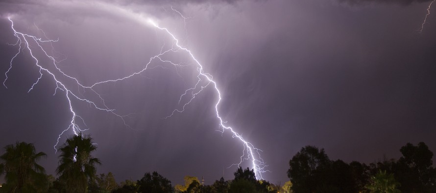
April 8: Friday Thunderstorms Detected!
The coastal low pressure disturbance responsible for current cool and damp conditions will depart our offshore region by Thursday evening. Another low pressure disturbance will then track over the Great Lakes and drag a cold front across the east coast on Friday. This will create a warm sector of southerly flow ahead of the cold front which should set up a thunderstorm threat. Right now the timing looks like late Friday afternoon/early evening for storm impacts with the cold front well out to sea by early Saturday morning. That will set up a beautiful and sunny weekend but first lets look at the storm potential in detail.
There’s are more pieces to the puzzle but let’s focus on diurnal heating, instability and wind shear:
Diurnal heating (simply solar heating during daylight hours) creates a pool of warm air at the surface that wants to rise into colder air aloft until air parcels are saturated. This is what creates towering cumulonimbus clouds that produce thunderstorms. The more heated the surface is diurnally, the better the chance for such clouds and storms. Therefore areas where the sun is allowed to reach the surface will see a greater storm chance than areas blocked by cloud debris. I’ll be looking for the areas of highest diurnal surface heating on Friday once the sun is up. Satellite imagery is a great tool for this.
Instability is directly linked to diurnal surface heating. The more surface heating, the more destabilized the region becomes. Two instability parameters I like to use are CAPE (Convective Available Potential Energy – measured in Joules per Kilogram) and LI (Lifted Index). When CAPE is over 1500 j/kg and/or the LI is -4 or less, then frequent light shows are much more likely (typical in May-July). On Friday, we’re looking at CAPE values between 500-800 j/kg (at all levels – SBCAPE and MLCAPE) and a LI of -2 for SNJ—representing marginal instability but enough for thunderstorms to happen.
Wind shear represents the change in wind direction & speed at different altitudes. When surface, mid-levels, and upper levels are all aligned…you have a windy day with minimal shear. When you have a strong southerly flow ahead of a cold front with NW winds behind, then you have measurable shear from the change in wind direction along the frontal boundary. This is also described as lower and upper jets. When strong jets are pulled down to the surface, they can create high wind gusts. When conflicting jets are blowing in different directions at different levels, they can create horizontal roll (parallel to the surface). If enough lifting from either diurnal instability and/or updrafting occurs, it will stand that parallel rolling air mass upward allowing a tornado to reach the surface. You need mid-west caliber shear for that though. It DOES happen from time to time but is not common for New Jersey. Friday looks to have about 55-60 knot wind shear from 0-8km. That’s enough to trigger severe thunderstorm warnings when wind gusts reach 58mph or greater.
So we have a setup where most diurnal heating will likely occur in SNJ with marginal instability and decent wind shear. Traditionally that spells thunderstorms embedded within widespread rainfall with only isolated cases of severe criteria being met…basically heavy rain, high wind gusts, and some lightning. We should watch the Friday afternoon-evening period regardless but how strong the storms are will depend directly on where the strongest surface heating profile sets up. Friday is expected to have a mixed bag of sun and clouds while topping out at around 70 degrees. If we hit 75 with mostly clear skies ahead of the front then we’re talking about an entirely different animal.
In English: Expect cool and damp conditions to last through Thursday. Then we warm up Friday to about 70 in the early afternoon before a cold front brings rain and thunderstorms through the region between late afternoon and early evening. Thunderstorms will likely be strong with isolated cases of severe criteria possible. If severe weather parameters increase tomorrow then we might be looking at stronger storms. Saturday and Sunday look great as of now with temps in the low 60s with plenty of sun.
Check out our friends at Mid-Atlantic Waterproofing—serving all of New Jersey and the general Mid-Atlantic US with waterproofing, foundation repair and basement dry-out services. With a rainy spring anticipated, it’s probably not a bad idea to schedule a FREE foundation inspection. Be safe! JC
Jonathan Carr (JC) is the founder and sole operator of Weather NJ, New Jersey’s largest independent weather reporting agency. Since 2010, Jonathan has provided weather safety discussion and forecasting services for New Jersey and surrounding areas through the web and social media. Originally branded as Severe NJ Weather (before 2014), Weather NJ is proud to bring you accurate and responsible forecast discussion ahead of high-stakes weather scenarios that impact this great garden state of ours. All Weather. All New Jersey.™ Be safe! JC


LOCAL FORECAST | INTERACTIVE RADAR | LATEST NJ WEATHER ALERTS | WEDDING FORECAST| PRIVACY POLICY
© Copyright 2026 Weather NJ LLC. All Rights Reserved.
Some information that can be found on our website is provided by a private weather station and is not an officially recognized station for weather reporting. Though we always strive to achieve accurate reporting for our own use, it is important that you do NOT depend on the data provided here for any purpose.
