

April 9: Saturday Morning Observations
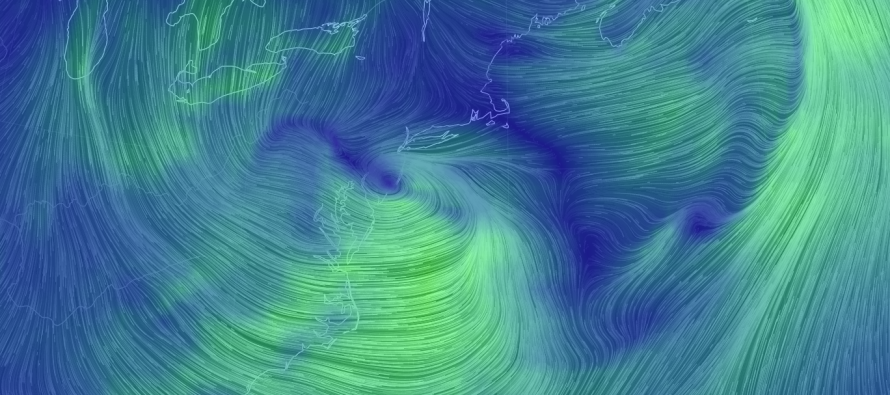
Precipitation, associated with the low pressure system currently heading out to sea, has moved into the area. You can see the low pressure center over NJ on the above Earth Map image. That will continue heading east while leaving an elongated area of low pressure in its wake resembling an inverted trough. This should be the culprit for pockets of heavier precipitation under the greatest areas of convergent lifting that run back through NJ into PA. While a general snow-rain line is setting up just NW of the I-95 corridor, precipitation rates are having an impact on precipitation types SE of the snow-rain line.
The coast is pretty toasty for wintry precipitation with temperatures ranging in the upper-30s to lower-40s. Pockets of intense precipitation however have brought down enough colder air aloft to cause a snow/sleet/rain mix in some locations. That’s the general idea setting up here. Heavy precipitation = wintry precipitation types and possible sloppy stickage. Light precipitation = less wintry precipitation/plain rain/melting..
Interior locations, especially the elevations of NNJ (NW of the snow-rain line), are still looking at a coating to a few sloppy inches of slushy snow (mostly on natural surfaces). Treated roads and highways should be fine. Untreated side roads could see a slushy coating.
All of New Jersey is currently above freezing and the April sun angle is fully at work. I just don’t see much ground disruption happening from this system for New Jersey given that all remaining snow will fall mostly during light hours. I do however think a heavy band of precipitation is possible at some point this afternoon/early evening. Parts of PA are certainly seeing a late-season light accumulation event but climatology E of the Delaware River should win this one out regardless of how much the sky pukes snow throughout the rest of today.

In English: A mix of rain, sleet and snow has already spread into New Jersey. This will continue through the afternoon and evening, heavy at times. A decent amount of snow could fall during afternoon-early evening hours however the surface temperature profile should be unfavorable for road accumulations, especially areas SE of I-95. Areas NW of I-95 and especially elevations have the best chance of a few slushy inches at most. Main roads should only be as disruptive as a strong rain event as most snow will melt on contact. Side roads could become slick but should not become plowable. Saltable maybe. Everything should taper off by overnight hours as temperatures drop well below freezing between midnight and 6AM tomorrow morning. With that said, the greatest threat I see from all of this is black ice overnight into tomorrow morning. Enjoy the rest of your weekend and be safe! JC
Jonathan Carr (JC) is the founder and sole operator of Weather NJ, New Jersey’s largest independent weather reporting agency. Since 2010, Jonathan has provided weather safety discussion and forecasting services for New Jersey and surrounding areas through the web and social media. Originally branded as Severe NJ Weather (before 2014), Weather NJ is proud to bring you accurate and responsible forecast discussion ahead of high-stakes weather scenarios that impact this great garden state of ours. All Weather. All New Jersey.™ Be safe! JC


LOCAL FORECAST | INTERACTIVE RADAR | LATEST NJ WEATHER ALERTS | WEDDING FORECAST| PRIVACY POLICY
© Copyright 2026 Weather NJ LLC. All Rights Reserved.
Some information that can be found on our website is provided by a private weather station and is not an officially recognized station for weather reporting. Though we always strive to achieve accurate reporting for our own use, it is important that you do NOT depend on the data provided here for any purpose.
