

Arctic Air Approaching
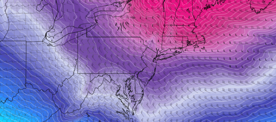
Discussion: So we’ve been in first gear of the cold that started earlier this week and allowed some light snow across NJ, mainly CNJ/SNJ, yesterday morning. At some point between late tonight and tomorrow morning, we’ll shift into a whole new gear of cold. A low in SE Canada and Arctic high over the Great Lakes will work together to push another lobe of the Tropospheric Polar Vortex (TPV) through the NorthEast and Mid-Atlantic US. Just like the air mass around Christmas time. A short but potent blast of Arctic Cold between late-tonight and early Sunday morning. The Arctic front arrives first for NWNJ late-tonight, possibly with some snow showers/swualls, and then pushes through all of NJ by Friday noon with precip likely breaking up/fizzling out. Friday PM winds should pick up (gusts to 40mph+) which will make it feel even colder. I have no doubt wind chills will be in the negatives for much of NJ Friday PM into early Saturday AM. Saturday/Saturday night then looks to stay cold but with relaxed winds. By Sunday morning, we’re back to SW flow and we start a warm-up that should last until the Feb 11-15 period. Obviously, no snow in this period. My next point of focus for possible snow would be in that Feb 11-15 period with cold air returning. There are a few deterministic models straying from the ensembles (on both Euro and GFS) but it just might be some unwanted noise in the data. Plenty of time to monitor any evolutions. For now, stay warm for the transient cold shot tonight through Sunday morning and get ready for more mild weather Sunday-forward.
Real quick, overnight temperatures tonight (Thursday night) should range from upper-teens in the NWNJ elevations to lower-30s along the immediate SENJ coast. This puts much of NJ in the 20s just before sunrise tomorrow (Friday AM). The Arctic front will be arriving first in NWNJ and therefore snow showers and squalls are possible overnight. Winds should pick up later tonight just ahead, along, and behind the front, eventually settling out of the NW direction.
Friday (Feb 3) high temperatures should max in the 20s for most areas. Only SENJ could make it to lower-30s due to experiencing the Arctic front last. Skies should be mostly clear with a few cold-looking friendly clouds (flat bottoms). There might be a snow shower or even squalls passing through early AM but worst case scenario a coating to an inch with NW areas favored for such. Precip should break apart with the cold air blast for lower areas of NJ. Winds should be breezy-to-gusty out of the NW with gusts to 40mph+ at times especially later in the afternoon/evening. Overnight lows should range from negative/near-zero to 15 from elevations to coasts. That’s right, even cape may will dip below 20 to give you an idea of how cold it will be. Winds should start to relax closer to sunrise Saturday but should howl for the first part of Friday night into early Sat AM hours.
Saturday (Feb 4) high temperatures should stay in the 20s (below freezing) for all NJ areas. Skies should be mixed with sun and clouds. Winds should gradually relax to just light-to-breezy out of the W/NW. Overnight lows should range from 15-25 from elevations to coasts.
Sunday (Feb 5) high temperatures should reach the 40s for all NJ areas, maybe even flirt with 50 for SNJ locations away from the ocean. This should feel quite mild after Fri-Sat. Skies should be mixed with sun and clouds. Can’t rule out some early AM fog. Winds should be light out of the SW. Overnight lows should fall back into the 20s/30s for most areas.
An early look at next week indicates a prolonged mild stretch setting up that begins Sunday. We’re talking mid-to-upper 40s for NWNJ elevations and 50s for much of the rest of the state. This should last until somewhere in the Feb 11-15 range. The Feb 6-8 signal that I’ve been watching has evolved into an offshore storm, far enough away from the coast to bring precipitation. Had it tracked a little closer to the coast with proper phasing, it could have pulled colder air into the equation and produced. But at this point it should not. The next period I’m looking at is the Feb 11-15 window when the milder temps could take a break and allow another cold shot. Plenty of time to watch it evolve. The snow lover torture continues, and winter is running out of time. Anyone who knows anything about NJ weather however knows not to discount the second half of Feb and at least the first half of March. Let’s see how it goes. Have a great weekend, please stay as warm as possible, take whatever precautions you need to (pipes, outside hoses, etc.), and most of all be safe! JC
Premium Services
KABOOM Club offers inside info forecast discussion, your questions answered, and early storm impact maps (ahead of the public). At a buck per month, it’s an extremely feasible way to show support.
My Pocket Meteorologist (MPM), in partnership with EPAWA Weather Consulting, offers professional/commercial interests, whose businesses depend on outdoor weather conditions (snow plowing, landscaping, construction, etc.), with hyper-local text message alerts/forecasts and access to the MPM premium forum—the most comprehensive and technical forecast discussion available for PA and NJ.
Jonathan Carr (JC) is the founder and sole operator of Weather NJ, New Jersey’s largest independent weather reporting agency. Since 2010, Jonathan has provided weather safety discussion and forecasting services for New Jersey and surrounding areas through the web and social media. Originally branded as Severe NJ Weather (before 2014), Weather NJ is proud to bring you accurate and responsible forecast discussion ahead of high-stakes weather scenarios that impact this great garden state of ours. All Weather. All New Jersey.™ Be safe! JC


LOCAL FORECAST | INTERACTIVE RADAR | LATEST NJ WEATHER ALERTS | WEDDING FORECAST| PRIVACY POLICY
© Copyright 2026 Weather NJ LLC. All Rights Reserved.
Some information that can be found on our website is provided by a private weather station and is not an officially recognized station for weather reporting. Though we always strive to achieve accurate reporting for our own use, it is important that you do NOT depend on the data provided here for any purpose.
