

Arctic Conditions Expected (Jan 5-7)
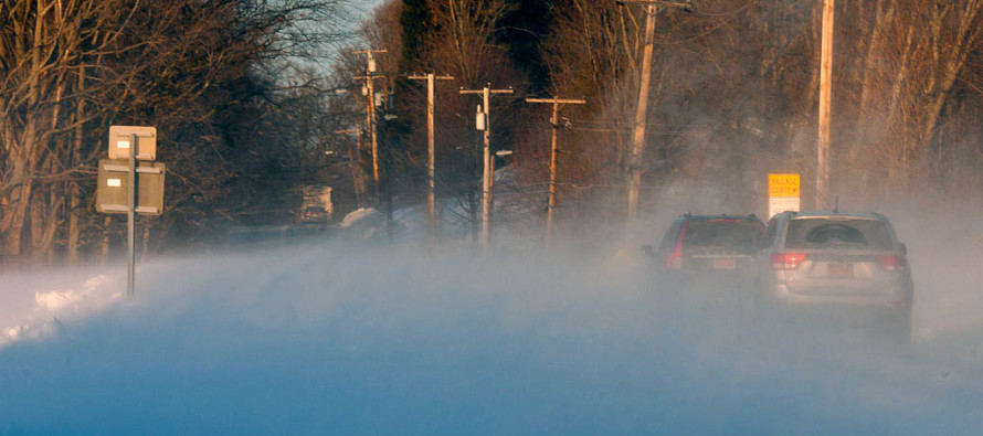
Discussion: The coastal winter storm has moved out. Now we are subject to dangerously cold temperatures with high winds out of the N/NW as Arctic air wraps in behind the departing system’s cyclonic energy. Tonight (Thursday night) we’re probably going down into the single digits for most of the state with negative wind chill values. We remain well below-average in temperature through the weekend before warming up for next week. We can thank the southerly flow associated with transient ridging for the moderation period. Monday could feature an ice event if the warmer precipitation moves in too fast, especially for NNJ/CNJ. I’m watching this very closely and will likely report again on it this Saturday.
Friday (Jan 5) high temperatures should struggle to escape the teens. Skies should be mostly sunny. Winds should be strong and gusty out of the NW (maybe W/NW). This should lead to even lower wind chill values both day and night. Overnight lows should fall into the single digits statewide with NNJ possibly dipping below zero.
Saturday (Jan 6) high temperatures should struggle to escape the low-to-mid teens statewide. Skies should be mostly sunny. Winds should be breezy-to-gusty out of the W/NW. This should sustain the wind chill factors. Overnight lows should range from -5 and 5 from NNJ to SNJ as winds finally begin to subside.
Sunday (Jan 7) high temperatures should struggle to escape the teens statewide. SNJ has the best chance to reach into the low-20s. Skies should be mostly sunny. Winds should be light out of the W/SW. Overnight lows should range from single-digits to teens from NNJ to SNJ.
An early look at next week indicates a possible ice event on Monday. It’s the kind of event where NNJ starts as snow, changes to ice and ends as rain. CNJ starts as ice and changes to rain. SNJ deals with minimal ice to start and sees a mostly rain event. Factor in the colder surface and snowpack however and things could get interesting for NJ. Let’s revisit this idea on Saturday. Otherwise next week should moderate with high temperatures reaching back into the 30s/40s statewide and overnight lows only dropping into the 20s/30s. Everyone have a great weekend and please be safe! JC
For comprehensive and interactive hyper-local analysis that goes way above and beyond the detail of this public forecast, check out our premium services which include text notifications and forum access.
Jonathan Carr (JC) is the founder and sole operator of Weather NJ, New Jersey’s largest independent weather reporting agency. Since 2010, Jonathan has provided weather safety discussion and forecasting services for New Jersey and surrounding areas through the web and social media. Originally branded as Severe NJ Weather (before 2014), Weather NJ is proud to bring you accurate and responsible forecast discussion ahead of high-stakes weather scenarios that impact this great garden state of ours. All Weather. All New Jersey.™ Be safe! JC


LOCAL FORECAST | INTERACTIVE RADAR | LATEST NJ WEATHER ALERTS | WEDDING FORECAST| PRIVACY POLICY
© Copyright 2026 Weather NJ LLC. All Rights Reserved.
Some information that can be found on our website is provided by a private weather station and is not an officially recognized station for weather reporting. Though we always strive to achieve accurate reporting for our own use, it is important that you do NOT depend on the data provided here for any purpose.

)