

Aug 12: Wet Night Expected
Widespread heavy rainfall has already fallen over portions of southern New Jersey. Northern New Jersey is up next as precipitation pushes north along the occluded frontal boundary. Occluded simply means that the cold front has caught the warm front just south of the low pressure center (which is to our north). This normally results in enhanced dynamics so we could be in for an interesting night. The trend so far has been more rain in SENJ and very little in NWNJ. Regartdless, I think this will all clear by noon tomorrow…at the latest. Here’s a quick radar capture:
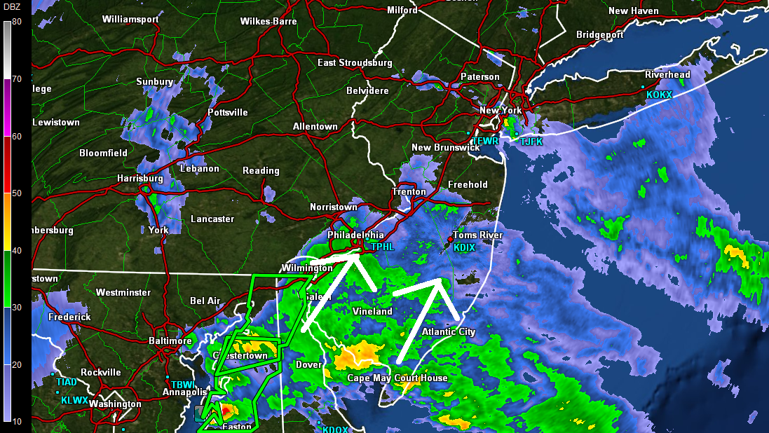
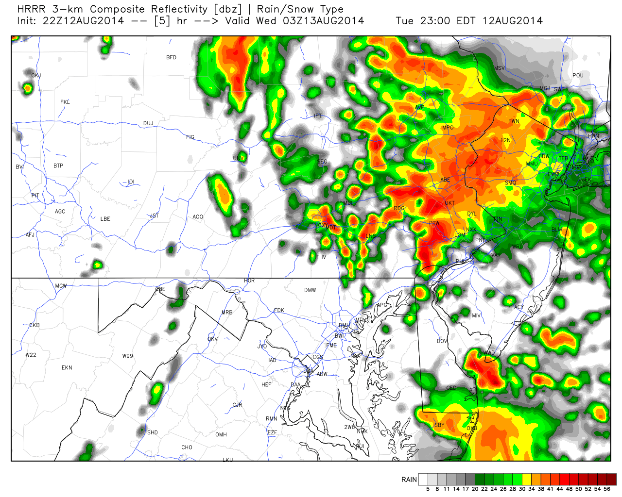
Green boxed areas above represent flash flood statements from the National Weather Service. There’s some decent storm energy that will come through with the rainfall between 10PM and sunrise. Here’s the ultra short-range HRRR model from WeatherBell Analytics showing estimated precipitation at 11Pm tonight. More importantly, it’s showing the back edge progressing towards the coast.
 In English: Expect rain widespread rainfall to continue in SNJ and fill in for NNJ between now and sunrise. Rain should then taper off by noon. I’ll be watching in-case any storms form overnight in addition to more rainfall. In the meantime, stay dry, make smart flooding decisions and be safe! JC
Jonathan Carr (JC) is the founder and sole operator of Weather NJ, New Jersey’s largest independent weather reporting agency. Since 2010, Jonathan has provided weather safety discussion and forecasting services for New Jersey and surrounding areas through the web and social media. Originally branded as Severe NJ Weather (before 2014), Weather NJ is proud to bring you accurate and responsible forecast discussion ahead of high-stakes weather scenarios that impact this great garden state of ours. All Weather. All New Jersey.™ Be safe! JC


LOCAL FORECAST | INTERACTIVE RADAR | LATEST NJ WEATHER ALERTS | WEDDING FORECAST| PRIVACY POLICY
© Copyright 2026 Weather NJ LLC. All Rights Reserved.
Some information that can be found on our website is provided by a private weather station and is not an officially recognized station for weather reporting. Though we always strive to achieve accurate reporting for our own use, it is important that you do NOT depend on the data provided here for any purpose.
