

Aug 17: Monitoring the Tropics
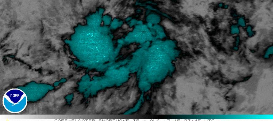
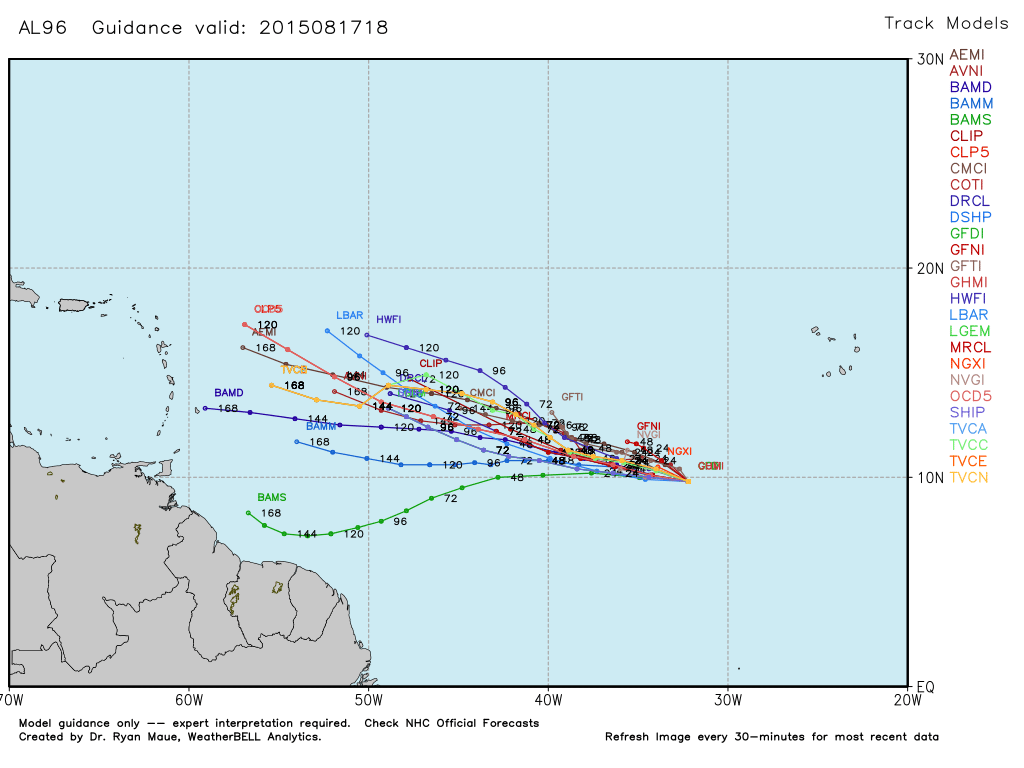
Invest 96L will continue to cross the Atlantic Ocean from where it originated SW of the Cape Verde region towards the Lesser Antilles. It’s current heading is W/NW at 10-15mph and is showing signs of organization per the NWS National Hurricane Center’s latest update. Formation of a tropical depression is possible in the next few days. Here’s the current tropical model spread, used with permission from WeatherBell Analytics:
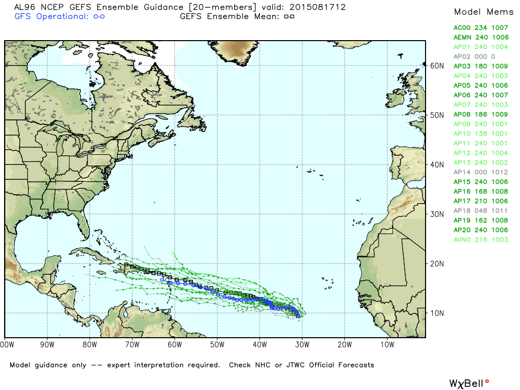
In English: I’ll continue to monitor this tropical activity as well as its projected guidance and downstream observations. Can’t say anything for certain at this point except that it’s crossing the Ocean and heading towards the NW Caribbean area. Given the general pattern running over the US and Western Atlantic, anything from a Caribbean/Gulf hit to a complete fish storm (miss out to sea) is possible. Let’s continue to track this day by day for now. Be safe! JC
Jonathan Carr (JC) is the founder and sole operator of Weather NJ, New Jersey’s largest independent weather reporting agency. Since 2010, Jonathan has provided weather safety discussion and forecasting services for New Jersey and surrounding areas through the web and social media. Originally branded as Severe NJ Weather (before 2014), Weather NJ is proud to bring you accurate and responsible forecast discussion ahead of high-stakes weather scenarios that impact this great garden state of ours. All Weather. All New Jersey.™ Be safe! JC


LOCAL FORECAST | INTERACTIVE RADAR | LATEST NJ WEATHER ALERTS | WEDDING FORECAST| PRIVACY POLICY
© Copyright 2026 Weather NJ LLC. All Rights Reserved.
Some information that can be found on our website is provided by a private weather station and is not an officially recognized station for weather reporting. Though we always strive to achieve accurate reporting for our own use, it is important that you do NOT depend on the data provided here for any purpose.
