

Aug 19: Tropical Storm Danny Update
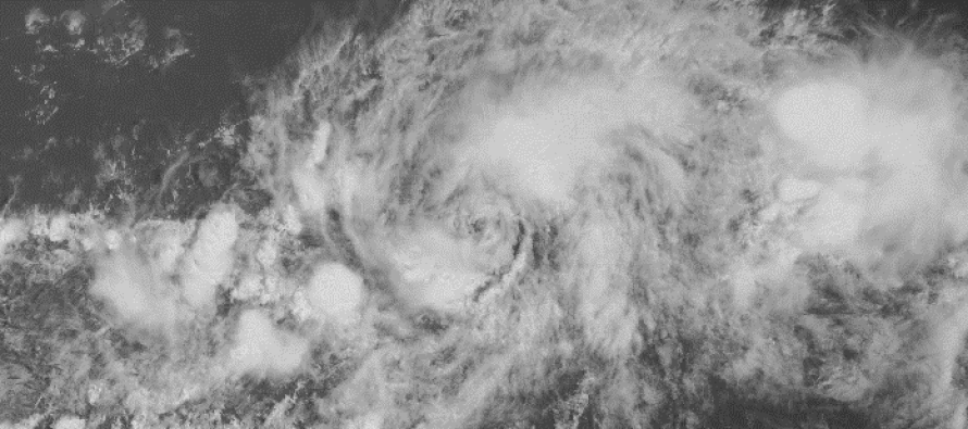
Tropical Storm Danny is currently located at 11.3N 40.2W and heading in the general direction of the NE Caribbean region (~Northern Lesser Antilles). He should intensify into a hurricane by no later than tomorrow evening but possibly as early as overnight tonight. Current maximum sustained winds are 50mph and the system is moving W at 14mph. Central pressure is down to 1000mb and is expected to drop during intensification. Here’s the latest tropical spaghetti plot, used with permission from WeatherBell Analytics:
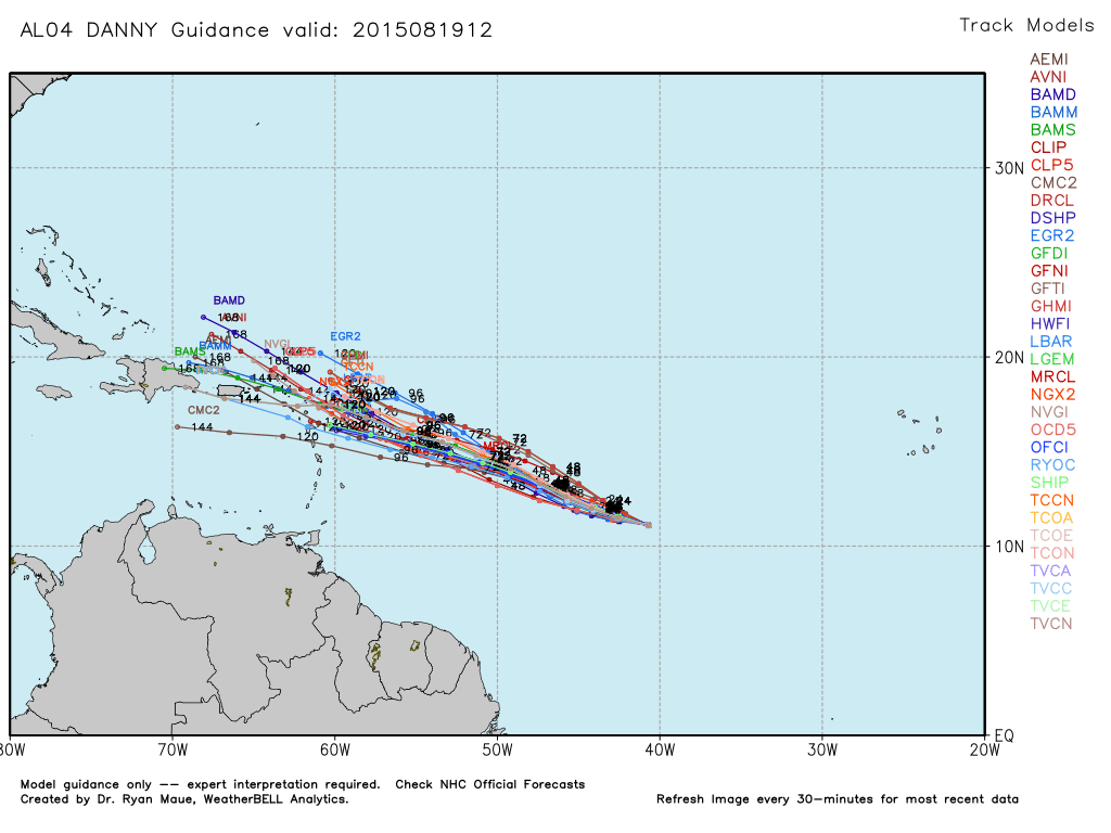
In English: The track is beginning to indicate a path towards the NE area of the Caribbean. This lessens the chance for a storm that enters the Caribbean and stays south. It raises the chances for a storm that either impacts the US coast or stays out to sea as a fish storm. Regardless, I expect dry air and the strong shear environment of the Caribbean to take a toll on Danny once closer to the N. Lesser Antilles. With that being said, I would expect it to get stronger in the near-future then weaker near the NE Caribbean before seeing what this thing is going to do with regard to possible Bermuda Triangle passage. One thing is for sure, if it does head into the Bermuda Triangle, there is no shortage of warm water and low-shear factor which means a favorable environment for re-intensification. Still to early to sound any alarms. We can only take computer guidance day by day. I’ll be watching. Be safe! JC
Jonathan Carr (JC) is the founder and sole operator of Weather NJ, New Jersey’s largest independent weather reporting agency. Since 2010, Jonathan has provided weather safety discussion and forecasting services for New Jersey and surrounding areas through the web and social media. Originally branded as Severe NJ Weather (before 2014), Weather NJ is proud to bring you accurate and responsible forecast discussion ahead of high-stakes weather scenarios that impact this great garden state of ours. All Weather. All New Jersey.™ Be safe! JC


LOCAL FORECAST | INTERACTIVE RADAR | LATEST NJ WEATHER ALERTS | WEDDING FORECAST| PRIVACY POLICY
© Copyright 2026 Weather NJ LLC. All Rights Reserved.
Some information that can be found on our website is provided by a private weather station and is not an officially recognized station for weather reporting. Though we always strive to achieve accurate reporting for our own use, it is important that you do NOT depend on the data provided here for any purpose.
