

Aug 21: Unsettled Weather Expected Today
Good morning! The onshore flow will persist today with unsettled conditions across the mid-Atlantic US region. That means you should expect variable clouds, a little bit of sun and possible rain showers that can happen anytime. This evening and through the overnight hours presents the best chance for rain.
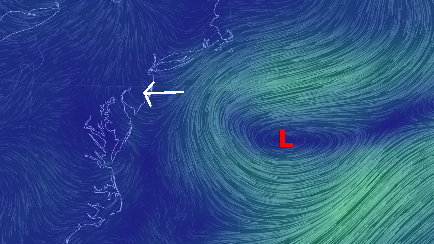
Here’s an image of surface wind flow. You can view the full animation by clicking here. You’ll notice the low pressure system still parked about 500 miles east of the Delmarva Peninsula. Since we’re still on the fringe of the NW quadrant (of this low pressure system’s cyclonic flow), winds will remain out of the east today despite whatever moisture and convection approaches from the west.
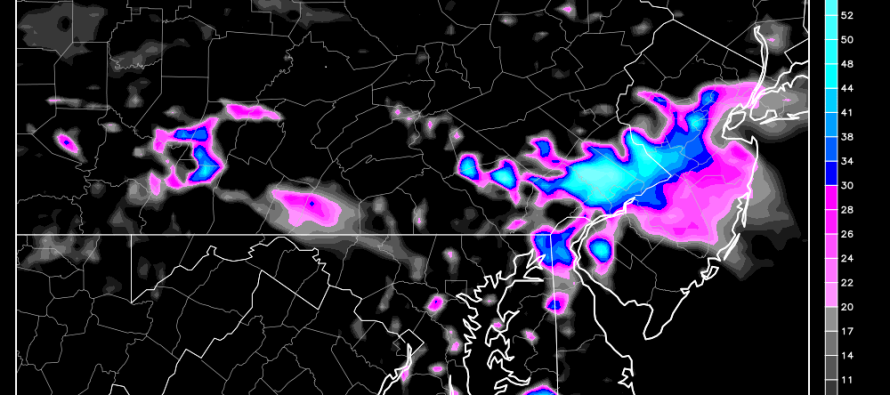
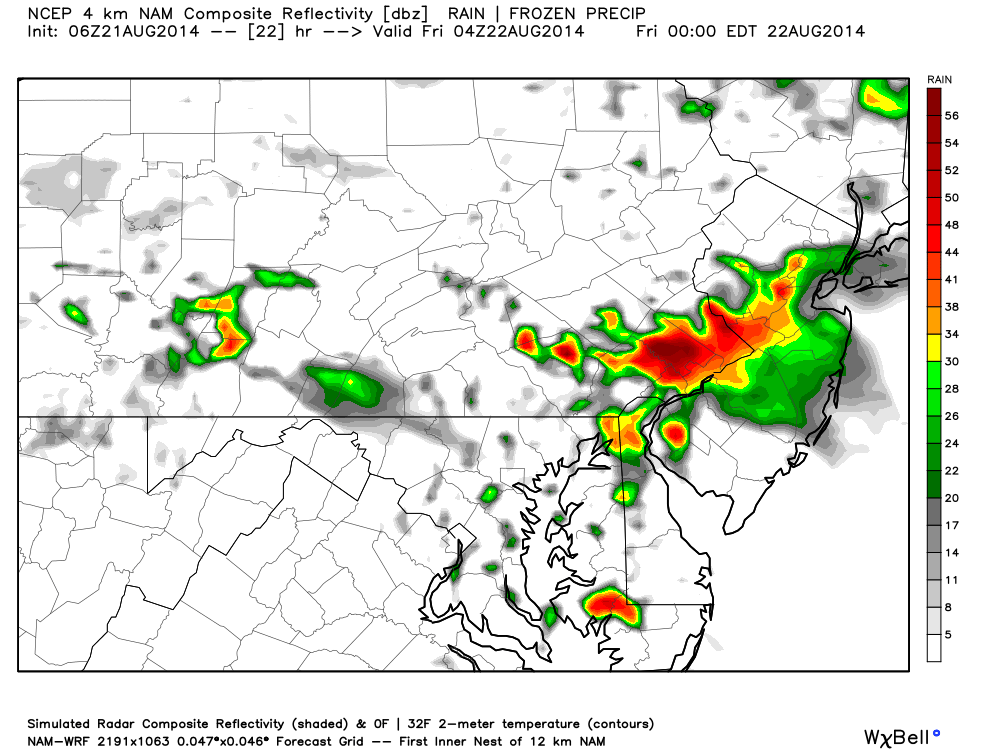
Model guidance allows for showers to happen at any point today. The easterly onshore flow is sending in lots of moisture which will keep dew points and humidity elevated. With such a moist air mass over the region, the slightest lower-level disturbances can ring out precipitation. The short-range high resolution 4KM NAM is highlighting concentrated showers and possibly a few storms later this evening (between 5PM and the early morning hours of tomorrow). Here is the output for midnight tonight from WeatherBell Analytics:
In English: Expect variable clouds, some sun and possible rain showers, especially overnight tonight. While today’s temperatures will not be hot for this time of year, the increased humidity could make it feel quite muggy. I’ll have the full weekend outlook posted this evening. Be safe! JC
Jonathan Carr (JC) is the founder and sole operator of Weather NJ, New Jersey’s largest independent weather reporting agency. Since 2010, Jonathan has provided weather safety discussion and forecasting services for New Jersey and surrounding areas through the web and social media. Originally branded as Severe NJ Weather (before 2014), Weather NJ is proud to bring you accurate and responsible forecast discussion ahead of high-stakes weather scenarios that impact this great garden state of ours. All Weather. All New Jersey.™ Be safe! JC


LOCAL FORECAST | INTERACTIVE RADAR | LATEST NJ WEATHER ALERTS | WEDDING FORECAST| PRIVACY POLICY
© Copyright 2026 Weather NJ LLC. All Rights Reserved.
Some information that can be found on our website is provided by a private weather station and is not an officially recognized station for weather reporting. Though we always strive to achieve accurate reporting for our own use, it is important that you do NOT depend on the data provided here for any purpose.
