

Aug 26: Weekend Impacts from Hurricane Laura
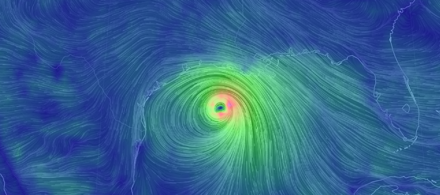
Discussion: Laura is a category 4 (major) hurricane in the Gulf of Mexico heading for a landfall just on the LA side of the TX/LA gulf coast border later this evening. There’s actually a small chance of reaching category 5 prior to landfall but at this point it doesn’t matter. Destructive conditions are likely regardless.
This should place everyone from Galveston to Marsh Island, possibly wider, in tropical storm force winds. Areas between Sabine Lake and Calcasieu Lake are the most likely to see hurricane force winds. The area between Mae’s Beach and Cameron should experience eye wall force winds.
Laura’s initial landfall does not mean much for New Jersey however it is a life-threatening situation for the areas of landfall interest later this evening, primarily from wind damage and storm surge. If you have any family or friends in that area please tell them to obey evacuation orders should they be given by appropriate government offices.
After making landfall tonight, Laura will weaken as it tracks northward through E TX/W LA and Arkansas Thursday through Friday morning. The mid-latitude westerlies will then turn Laura’s remnants to the E/NE out over the Atlantic Ocean. Therefore, whatever is left of the core energy should eject into the Atlantic Ocean passing over either SNJ or Demlarva this Saturday (Aug 29). By the time it reaches NJ this Saturday, the core will likely be very unorganized but still capable of producing periods of widespread rainfall with embedded thunderstorms. Any damaging winds would likely be caused by smaller mesoscale thunderstorm clusters, not the synoptic cyclonic winds around the unraveled core. As we’ve seen with the last few tropical storm/remnant hits, even the remnant hits can cause power outage problems and flash flooding. Once that clears out we’re then looking at another majestic day on Sunday (like today).
In English: Major Hurricane Laura is going to hit the E TX/W LA gulf coast pretty hard tonight and then track across the central and eastern US—ultimately over the NJ/Delmarva area this Saturday. This means rain and possibly some wind this Saturday followed by an amazing “after storm” feel day on Sunday. I’ll focus more on any specific NJ hazards for Saturday as we closer approach but the rainy/stormy washout theme has held on model guidance for a few days now. Have a great day and please be safe! JC
Download the new free Weather NJ mobile app on Apple and/or Android. It’s the easiest way to never miss Weather NJ content. Our premium services go even further above and beyond at the hyper-local level. Looking for industrial-caliber long-range forecasting data that I personally recommend? Check out WeatherTrends360!
Jonathan Carr (JC) is the founder and sole operator of Weather NJ, New Jersey’s largest independent weather reporting agency. Since 2010, Jonathan has provided weather safety discussion and forecasting services for New Jersey and surrounding areas through the web and social media. Originally branded as Severe NJ Weather (before 2014), Weather NJ is proud to bring you accurate and responsible forecast discussion ahead of high-stakes weather scenarios that impact this great garden state of ours. All Weather. All New Jersey.™ Be safe! JC


LOCAL FORECAST | INTERACTIVE RADAR | LATEST NJ WEATHER ALERTS | WEDDING FORECAST| PRIVACY POLICY
© Copyright 2025 Weather NJ LLC. All Rights Reserved.
Some information that can be found on our website is provided by a private weather station and is not an officially recognized station for weather reporting. Though we always strive to achieve accurate reporting for our own use, it is important that you do NOT depend on the data provided here for any purpose.
