

Aug 27: Erika Likely to Threaten SE US Coast
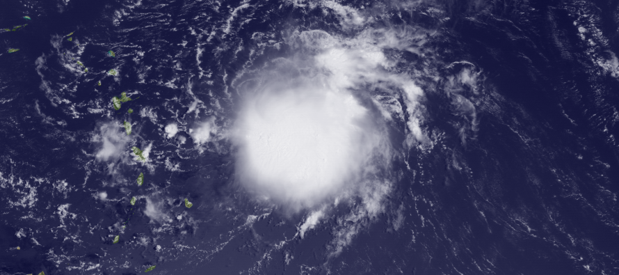
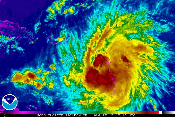
Tropical Storm Erika remains weak in the NE Caribbean Sea. She will battle a strong upper-level wind shear environment over the next 24-36 hours as well as possibly the higher elevations of Hispaniola. This should keep her weak despite healthy convection now showing on rainbow infrared satellite imagery:
Once Erika emerges out of the strong shear environment, she’ll be welcomed with warm waters and calm shear of the Bermuda Triangle. If she slips N of Hispaniola then less weakening is to be assumed but if she passes over Hispaniola then more weakening is expected. Erika should then slightly re-intensify on her way to Florida as a tropical storm or possibly a weak hurricane. This puts everyone from the Keys to OBX on alert as Erika now presents a reasonable tropical threat for said area.
What will Erika do beyond that? It all depends on what the upper-level pattern does. The main players right now are a a digging trough into the Gulf of Mexico as well as the Bermida High. The trough is expected to dissipate but the Bermuda high should turn her north in a centrifugal nature about the SW quadrant of its anti-cyclonic flow. By that point a strong ridge should be building to our north. This would either block Erika from coming up the coast and send her out to sea just SE of OBX (most likely solution) or allow Erika to slip up its back side if the ridge moves to far to the NE. This would mean New Jersey impact (less likely solution). Most current guidance agrees with the former scenario but I am not ready to dismiss the latter yet. A few models, such as the Canadian and GDFL, develop an upper level low along the Appalachian Mountains which weakens the ridge and pulls Erika inward. Possible? Yes. Probable? It goes against the grain of the overall setup.
In English: Erika should impact Florida, Georgia, South Carolina, and possibly North Carolina in the Sunday (Aug 30) to Wednesday (Sept 2) time period. Whether or not landfall happens is yet TBD but confidence is gaining on at least some level of tropical threat. We’ll have to wait a few more days to see what Erika wants to do beyond that. The SE US coast, especially Florida, should begin planning for at least heavy rainfall and tropical storm force winds. Everyone north of that should only continue to monitor. The likely outcome re: New Jersey impact is either remnant rainfall that slides up the interior E. US or simply rough surf if the storm curves out to sea after impacting the SE US. Be safe! JC
Jonathan Carr (JC) is the founder and sole operator of Weather NJ, New Jersey’s largest independent weather reporting agency. Since 2010, Jonathan has provided weather safety discussion and forecasting services for New Jersey and surrounding areas through the web and social media. Originally branded as Severe NJ Weather (before 2014), Weather NJ is proud to bring you accurate and responsible forecast discussion ahead of high-stakes weather scenarios that impact this great garden state of ours. All Weather. All New Jersey.™ Be safe! JC


LOCAL FORECAST | INTERACTIVE RADAR | LATEST NJ WEATHER ALERTS | WEDDING FORECAST| PRIVACY POLICY
© Copyright 2026 Weather NJ LLC. All Rights Reserved.
Some information that can be found on our website is provided by a private weather station and is not an officially recognized station for weather reporting. Though we always strive to achieve accurate reporting for our own use, it is important that you do NOT depend on the data provided here for any purpose.
