

Aug 28: Coastal Storm Approaching
A coastal storm is approaching from the south. Let’s break it down…
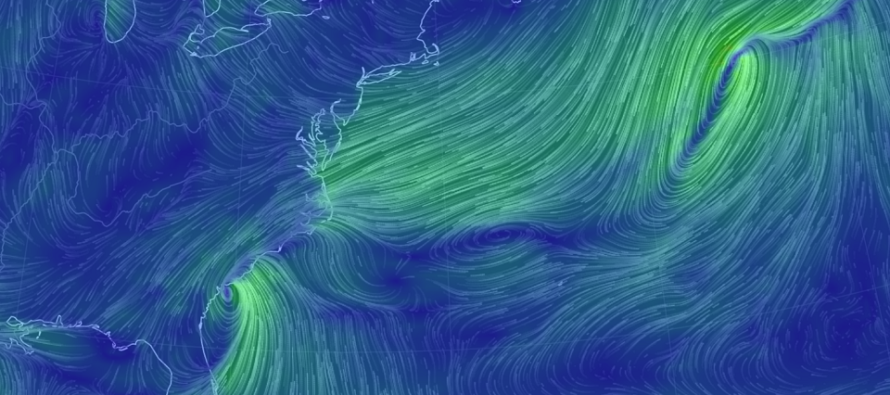
Discussion: An upper-level shortwave is maturing into a closed off upper-level low while swinging through the Great Lakes. It will interact with Harvey’s upper-level energy which will hold it back some while interacting with the upper-level coastal energy moving up the coast. The biggest influence of Harvey’s upper-level remnants will be towards the positive trough axis that kicks everything away from the coast in a progressive flow. Also an area of high pressure over Maine will help hold the coastal frontal boundary to our SE. The coastal boundary is the highway for the coastal surface low to travel along. The latest tropical model guidance is unanimously on board with said observations.
With that said, the center of circulation of this coastal surface low will pass by to our SE (from SW to E/NE) but not far enough SE to avoid rain and wind from the northern and western segments of the low’s cyclonic flow. Therefore, New Jersey (especially SENJ) is on the hook for coastal storm conditions tomorrow. Not a nor’easter, IMO, as the track lacks a stall and/or retrograde. But definitely a period of coastal storm influence. Influence can include up to 2 inches of rainfall, sustained winds of 20-25mph along the coast with gusts to 40mph, minor coastal flooding and beach erosion. Pretty run-of-mill stuff for a Jersey coastal low and much less impact away from the ocean.
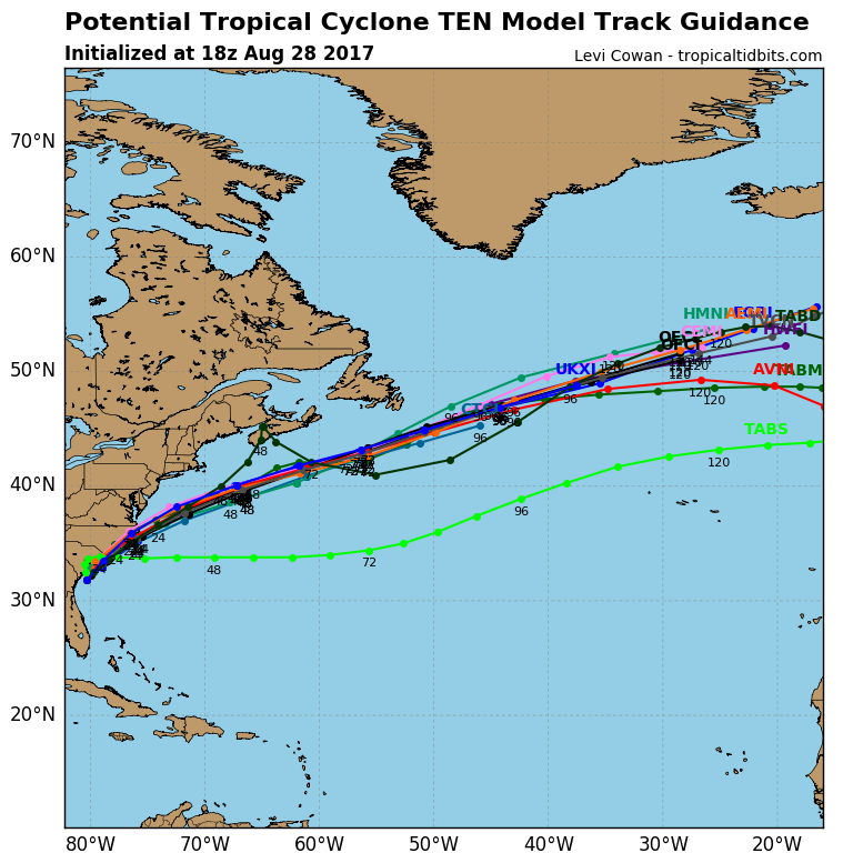
This approaching system is now being called “Potential Tropical Cyclone 10” by the National Hurricane Center. This is because it is difficult to classify it given the elongated are of low pressure. If the National Hurricane Center decides that there’s enough of a tropical core then this will become Tropical Storm Irma. If not then it might be classified as a sub-tropical hybrid low. Regardless, what you need to know is that it’s a cyclone and it will throw moisture and wind off the ocean as a cyclone does with this kind of parallel track to New Jersey.
Conditions could take a dive anytime after the early AM hours of tomorrow. I would expect most rainfall to be onshore by afternoon hours with peak wind gusts occurring tomorrow afternoon into the evening. By late tomorrow night (Wednesday morning at the latest) it should be well on its way out to sea (to our E/NE). I expect conditions to improve Wednesday pretty fast.
The tropics are certainly hot right now. Another wave is departing Africa (currently known as Invest 93L). It is expected to develop into a named tropical system soon. If the coastal low is not named Irma, then Invest 93L will be named Irma. If the coastal low is named Irma then Invest 93L would become Jose. We’re a long ways away from knowing Invest 93L’s future track but for now it will steam across the Atlantic Ocean (from the Cape Verde region towards the Lesser Antilles). There are some raised concerns about a favorable upper-level pattern over the E US should Invest 93L make it all the way there. We have time to watch these trends.

In English: A coastal storm is approaching which will bring up to 2 inches of rainfall to at least SENJ (possibly further into New Jersey). Expected rainfall amounts should taper off as you go NW, especially to the NW of I-95. Winds should be felt most along the coast. I’m thinking 20-25mph sustained with gusts to 35-40mph. Areas away from the ocean should feel lesser winds. Minor coastal flooding is possible for areas that normally see water in the streets. Beach erosion is likely. Wind is just starting to pick up and will peak tomorrow afternoon-evening. Rainfall could start any time after midnight tonight but should be well underway by noon tomorrow. Rain should then shut off from NW to SE tomorrow night. Let’s allow it to last through the early AM hours of Wednesday. Wednesday should then improve as the system races away to the E/NE out to sea. Have a great night and please be safe! JC
Jonathan Carr (JC) is the founder and sole operator of Weather NJ, New Jersey’s largest independent weather reporting agency. Since 2010, Jonathan has provided weather safety discussion and forecasting services for New Jersey and surrounding areas through the web and social media. Originally branded as Severe NJ Weather (before 2014), Weather NJ is proud to bring you accurate and responsible forecast discussion ahead of high-stakes weather scenarios that impact this great garden state of ours. All Weather. All New Jersey.™ Be safe! JC


LOCAL FORECAST | INTERACTIVE RADAR | LATEST NJ WEATHER ALERTS | WEDDING FORECAST| PRIVACY POLICY
© Copyright 2026 Weather NJ LLC. All Rights Reserved.
Some information that can be found on our website is provided by a private weather station and is not an officially recognized station for weather reporting. Though we always strive to achieve accurate reporting for our own use, it is important that you do NOT depend on the data provided here for any purpose.
