

Aug 29: Tropics Update
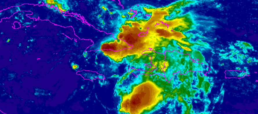
Erika has remained extremely weak and has been downgraded to just a tropical depression. This is due to land interaction and the stronger shear environment of the northern Caribbean. Because of this, she has drifted westward considerably before making the northward turn towards the SE US. The storm has been more under the influence of the lower easterly winds than the upper-level steering currents that would have turned her northward earlier. This is why almost every single model has busted on her track.
With that said, there is now zero chance of a land falling hurricane on the US east coast. I expect Erika’s remnants to pass over the western Florida/eastern Gulf of Mexico region before dissipating into simply remnants somewhere in the SE US. Despite Erika remaining weaker, she has been a huge rainmaker for Hispaniola and surrounding islands. If her remnants ride up the western coast of Florida, then pretty much the entire state of Florida should expect scattered-to-widespread rainfall between Monday and Thursday. This would occur from S to N, peaking over the Orlando region between Tuesday and Wednesday. With high pressure blocking, associated with the developing ridge, there is very little energy that could make it anywhere near New Jersey. Remnant showers at the absolute most, IF that.
Another tropical wave (Invest 99L) has formed near the Cape Verde region off western Africa as peak hurricane season (~September 10) approaches. This currently poses no threat to the US and is only in its infancy stage. Should Invest 99L form a named system, he will be called Fred.
So widespread rainfall without destructive wind is the current call for Florida and I’ll continue to watch the tropics. Otherwise, everyone should enjoy the rest of this weekend and be safe! JC
Jonathan Carr (JC) is the founder and sole operator of Weather NJ, New Jersey’s largest independent weather reporting agency. Since 2010, Jonathan has provided weather safety discussion and forecasting services for New Jersey and surrounding areas through the web and social media. Originally branded as Severe NJ Weather (before 2014), Weather NJ is proud to bring you accurate and responsible forecast discussion ahead of high-stakes weather scenarios that impact this great garden state of ours. All Weather. All New Jersey.™ Be safe! JC


LOCAL FORECAST | INTERACTIVE RADAR | LATEST NJ WEATHER ALERTS | WEDDING FORECAST| PRIVACY POLICY
© Copyright 2026 Weather NJ LLC. All Rights Reserved.
Some information that can be found on our website is provided by a private weather station and is not an officially recognized station for weather reporting. Though we always strive to achieve accurate reporting for our own use, it is important that you do NOT depend on the data provided here for any purpose.
