

Aug 3: Thunderstorms Possible for NNJ Later
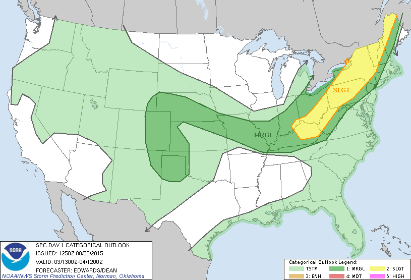
Today should be mostly sunny in New Jersey however some funky energy should move through to our NW later this evening and overnight. The main player is a low pressure disturbance in SE Canada which will drag a series of frontal activity through the Ohio Valley/PA region between this afternoon and tomorrow morning. The lower 2/3 of New Jersey should generally miss out on this but NWNJ could see showers and thunderstorms. The National Weather Service Storm Prediction Center (NWS SPC) has issued the following convective outlook which illustrates the threat being mostly to our NW (SLGT area is better chance of storms):
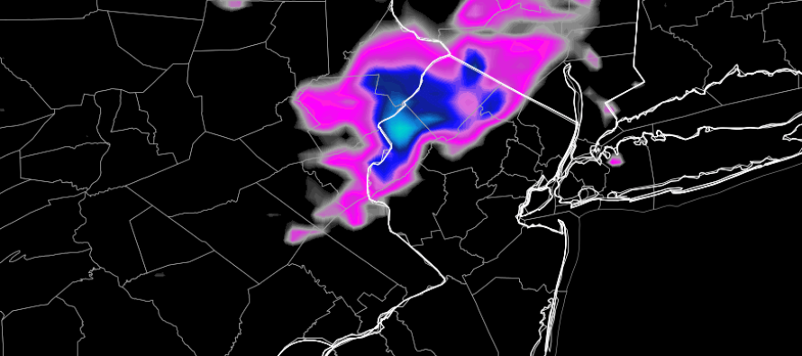
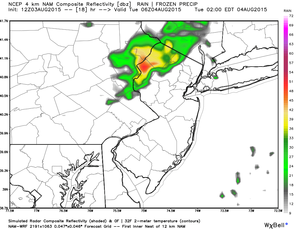
Expected timing is extremely hard to pin-point given the dynamics and axis (W/NW-E/NE) of the energy. The best I can do is between a general period between 8PM and 3AM for the more organized storms to roll through NWNJ. Isolated showers and thunderstorms are possible earlier in the afternoon but that’s a lesser chance. This is the high-res NAM showing estimated precipitation between 1AM and 2AM. Again, I believe this can happen anytime between the general period I stated. Also please note that the rest of New Jersey is dry:
 In Eng
In English: Most of New Jersey can expect a mostly sunny, warm and humid day today. NWNJ has a chance for isolated showers and thunderstorms later in the afternoon and then a more concentrated area of showers and thunderstorms overnight. The NWS will issue Severe Thunderstorm Warnings should wind gusts exceed 58mph and/or hail reaches a diameter of 1 inch or greater. I would expect most storms to stay just under severe criteria with only isolated and localized instances of severe. I’ll be watching. Be safe! JC
Jonathan Carr (JC) is the founder and sole operator of Weather NJ, New Jersey’s largest independent weather reporting agency. Since 2010, Jonathan has provided weather safety discussion and forecasting services for New Jersey and surrounding areas through the web and social media. Originally branded as Severe NJ Weather (before 2014), Weather NJ is proud to bring you accurate and responsible forecast discussion ahead of high-stakes weather scenarios that impact this great garden state of ours. All Weather. All New Jersey.™ Be safe! JC


LOCAL FORECAST | INTERACTIVE RADAR | LATEST NJ WEATHER ALERTS | WEDDING FORECAST| PRIVACY POLICY
© Copyright 2026 Weather NJ LLC. All Rights Reserved.
Some information that can be found on our website is provided by a private weather station and is not an officially recognized station for weather reporting. Though we always strive to achieve accurate reporting for our own use, it is important that you do NOT depend on the data provided here for any purpose.
