

Aug 31: Heavy Rain Expected Overnight!
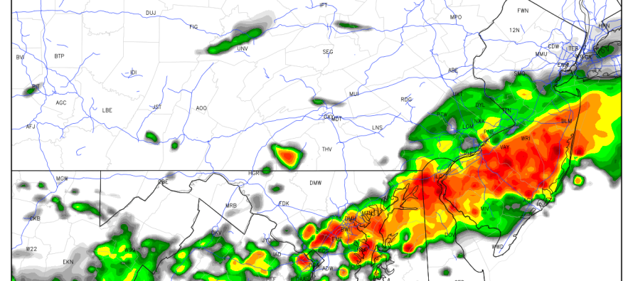
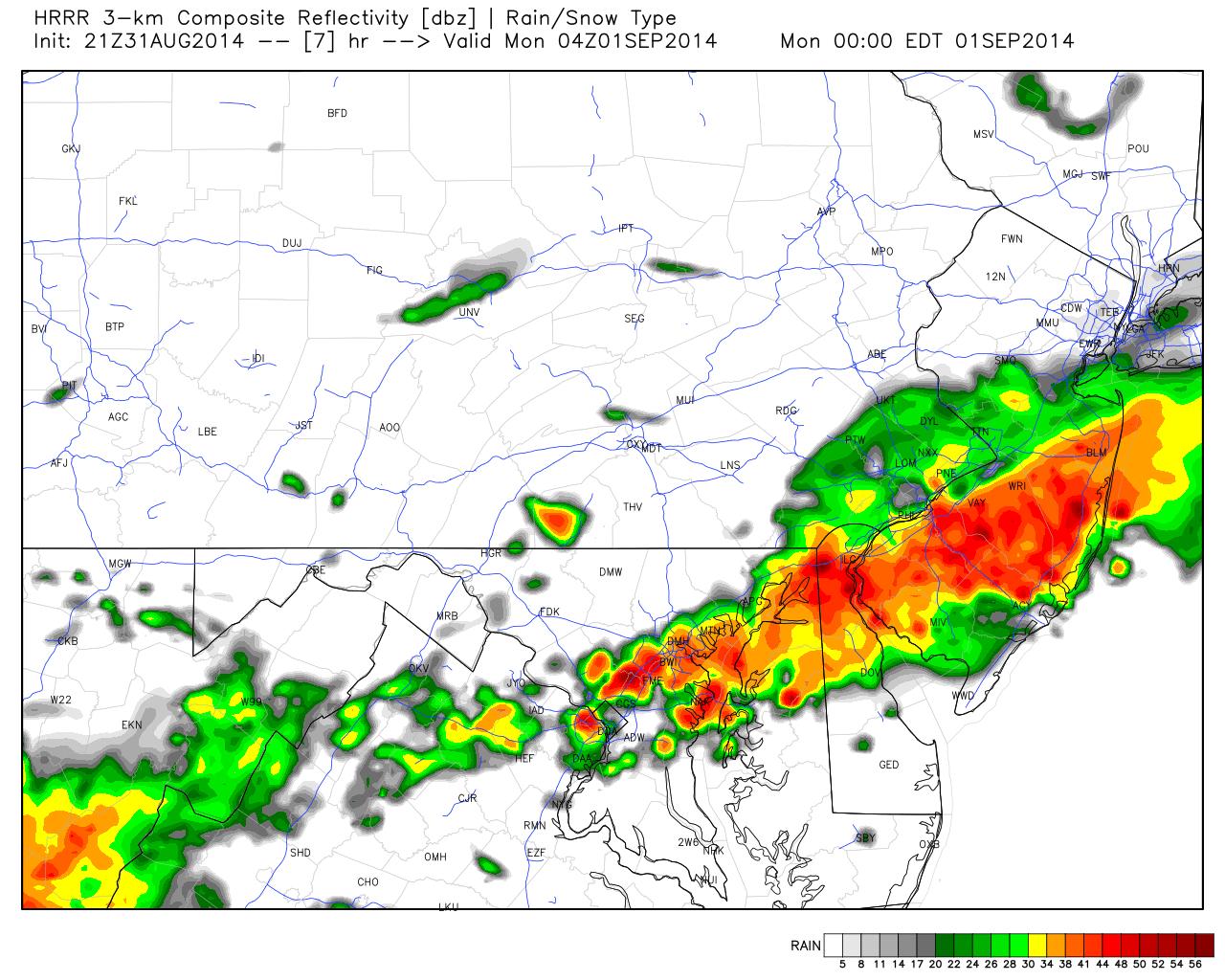
Ultra short-range model guidance is picking up heavy rainfall for CNJ and SNJ later tonight. There’s a lot of moisture in the atmosphere which I’m sure you felt today. Basically this moisture will continue to be squeezed out of the atmosphere from a series of frontal passages between now and the end of the weekend. First let’s look at the HRRR model which is experimental but normally accurate in the mesoscale range. The 21Z HRRR favors heavier rainfall for all of SNJ (south of I-195). This map shows expected precipitation intensity at midnight tonight. Basically red = heavy rainfall:
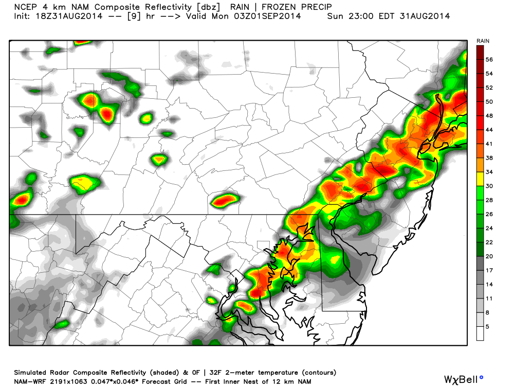
The 18Z NAM however, keeps the heavy stuff along the I-95 corridor (well into NENJ and possibly robbing SENJ). This map shows expected precipitation intensity around 11PM. Again, red = heavy rainfall:
In English: I don’t think the heavy stuff’s gonna come down for quite awhile (Caddyshack 1980). Expect heavy rain to set up somewhere over CNJ/SNJ overnight. Tomorrow still looks very unsettled. I will update about that tomorrow morning after fresh AM guidance. In the meantime be safe and stay dry! JC
Model images reproduced with permission from WeatherBell Analytics.
Jonathan Carr (JC) is the founder and sole operator of Weather NJ, New Jersey’s largest independent weather reporting agency. Since 2010, Jonathan has provided weather safety discussion and forecasting services for New Jersey and surrounding areas through the web and social media. Originally branded as Severe NJ Weather (before 2014), Weather NJ is proud to bring you accurate and responsible forecast discussion ahead of high-stakes weather scenarios that impact this great garden state of ours. All Weather. All New Jersey.™ Be safe! JC


LOCAL FORECAST | INTERACTIVE RADAR | LATEST NJ WEATHER ALERTS | WEDDING FORECAST| PRIVACY POLICY
© Copyright 2026 Weather NJ LLC. All Rights Reserved.
Some information that can be found on our website is provided by a private weather station and is not an officially recognized station for weather reporting. Though we always strive to achieve accurate reporting for our own use, it is important that you do NOT depend on the data provided here for any purpose.
