

Aug 31: Rain and Thunderstorms Approaching!
Hopefully everyone is having a great weekend so far! By now you should feel the humidity across the region thanks to our dominant SW flow. All the ingredients are on the table for showers and thunderstorms (some severe) to form this afternoon-evening. Exact timing is hard to gauge since the axis of the storms runs NE to SW. Therefore NWNJ could get hit as early as 5-6PM and SENJ as late as midnight. As always (9 times out of 10) these storms should weaken as they cross the state and meet the Atlantic Ocean’s marine influence.
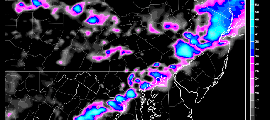
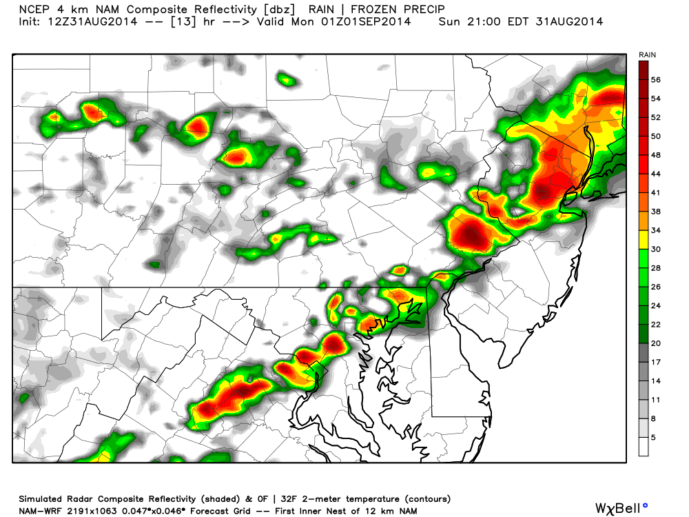
Let’s look at some guidance. Here’s the short-range 4km NAM showing expected precipitation at 9PM tonight. As you can see, NWNJ has already felt impacts while SENJ has yet to see any. Again, this is because the axis of storms and their west to east movement. By ~midnight, SENJ “should” experience weakened versions of whatever EPA and NWNJ experience before and during sunset:
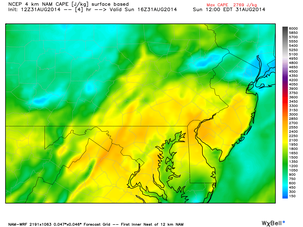
If the sun is allowed to heat the surface through the afternoon today then instability will aid the storms in producing higher clouds and frequent lightning. Here’s the expected surface-based CAPE (Convective Available Potential Energy) at noon today. As you can see values are well above 2000 j/kg (joules per kilogram). Higher (MLCAPE) is also supportive of decent thundercell development:
As far as wind shear goes, we’re looking at 30-35knots of bulk effective shear which is enough to trigger and sustain severe thunderstorms. All it takes is a few up and down-drafts to bring the stronger winds aloft to the surface. Rainfall amounts should range between .25-.50 of an inch depending on where the heavier downpours set up.
In English: Expect a warm and muggy day before showers and thunderstorms move into the region later this afternoon through evening (NWNJ first-as early as 5PM…then NENJ/CNJ/SWNJ…and lastly coastal/SENJ-as late as midnight). Some storms could produce strong winds, heavy downpours, and frequent lightning. You know I’ll be tracking on radar! As far as tomorrow goes, the Labor Day Weekend Outlook stands as called. Please be safe! JC
Model images reproduced with permission from WeatherBell Analytics.
Jonathan Carr (JC) is the founder and sole operator of Weather NJ, New Jersey’s largest independent weather reporting agency. Since 2010, Jonathan has provided weather safety discussion and forecasting services for New Jersey and surrounding areas through the web and social media. Originally branded as Severe NJ Weather (before 2014), Weather NJ is proud to bring you accurate and responsible forecast discussion ahead of high-stakes weather scenarios that impact this great garden state of ours. All Weather. All New Jersey.™ Be safe! JC


LOCAL FORECAST | INTERACTIVE RADAR | LATEST NJ WEATHER ALERTS | WEDDING FORECAST| PRIVACY POLICY
© Copyright 2026 Weather NJ LLC. All Rights Reserved.
Some information that can be found on our website is provided by a private weather station and is not an officially recognized station for weather reporting. Though we always strive to achieve accurate reporting for our own use, it is important that you do NOT depend on the data provided here for any purpose.
