

Aug 5: Watching the Weekend Rain Storm
I’ve been watching this possibility on model guidance for a few days now. It has actually been behaving like a winter storm in the sense of GFS vs Euro (SE progressive bias vs amplification bias). In this case, it looks like the Euro caved to the GFS. With that said, a synoptic-scale low pressure system should impact the mid-Atlantic US between Thursday and Saturday but there’s a decent chance that “most rain” will be held to the S and SE of New Jersey for the weekend…a “decent chance.”
It’s a little unclear and disorganized how this low pressure system will arrive into the mid-Atlantic US region. Some guidance has a clearly organized low moving in from the west while other guidance has the low only establishing definition over North Carolina on Thursday. Regardless, the low should eject into the Atlantic Ocean over the OBX region and take a traditional coastal storm track. This system will want to ride the frontal boundary that just moved through (now stalling just S of Delmarva). Our saving grace might be that boundary being a little further S than modeled earlier this week as well as weak high pressure to our north holding it down.
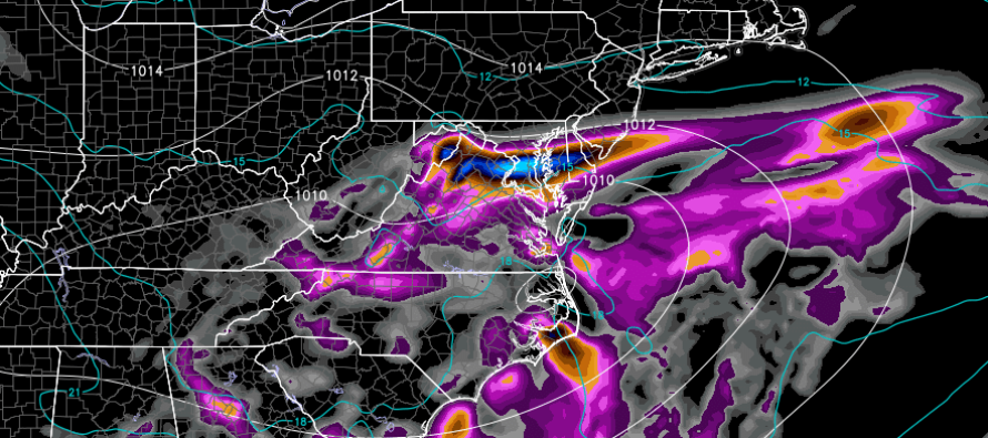
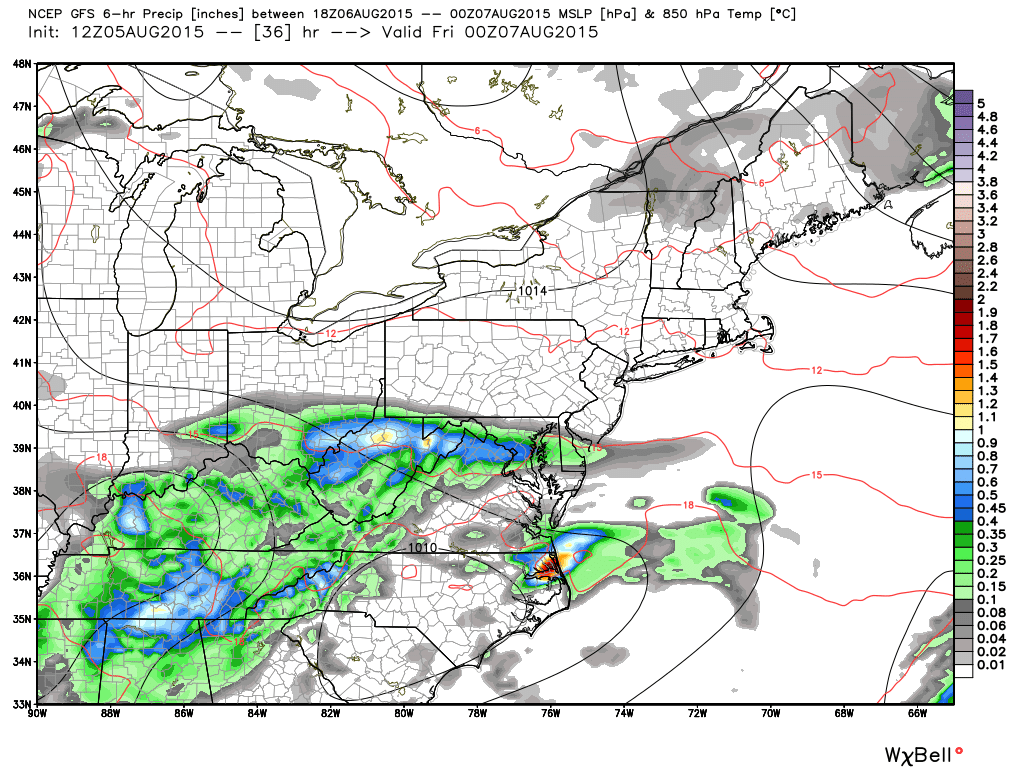
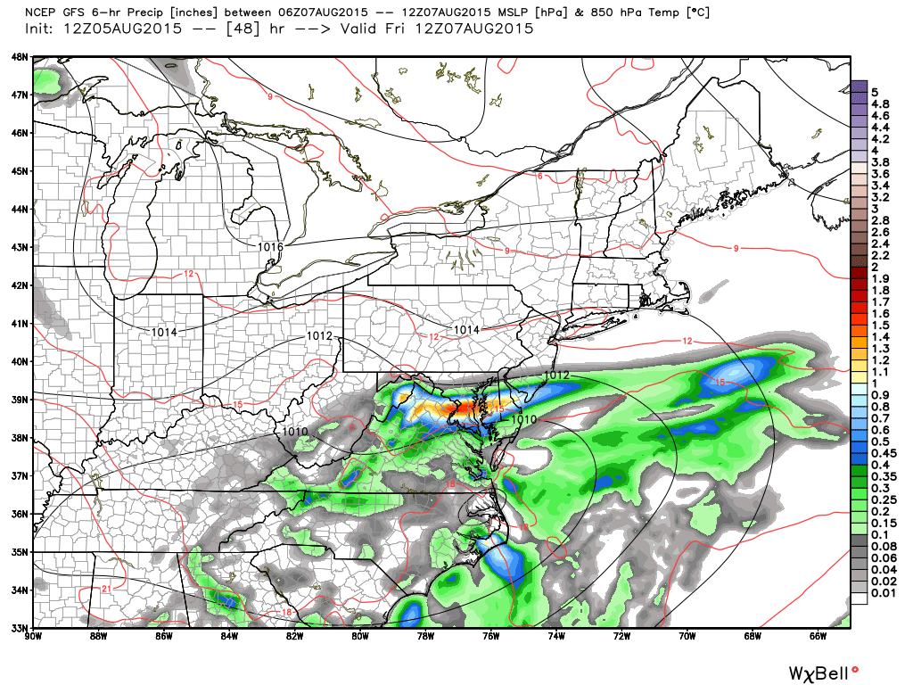
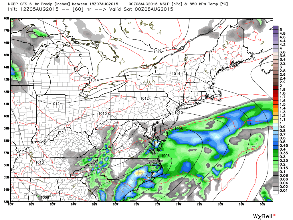
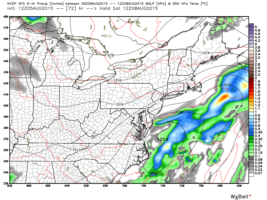
I can’t say that extreme SNJ/SENJ will be rain free during this time period (Thursday-Saturday). As you will see with guidance, some rain is possible to start the weekend for such areas. NNJ, CNJ, EPA, however, could be spared completely for the entire weekend (at least from the rain – clouds are a different and much harder story to tell right now). Here’s the latest GFS showing several timing intervals re: 850mb pressure, temperature and precipitation:
Thursday Evening:
Friday Morning:
Friday Evening:
Saturday Morning:
Saturday Evening:
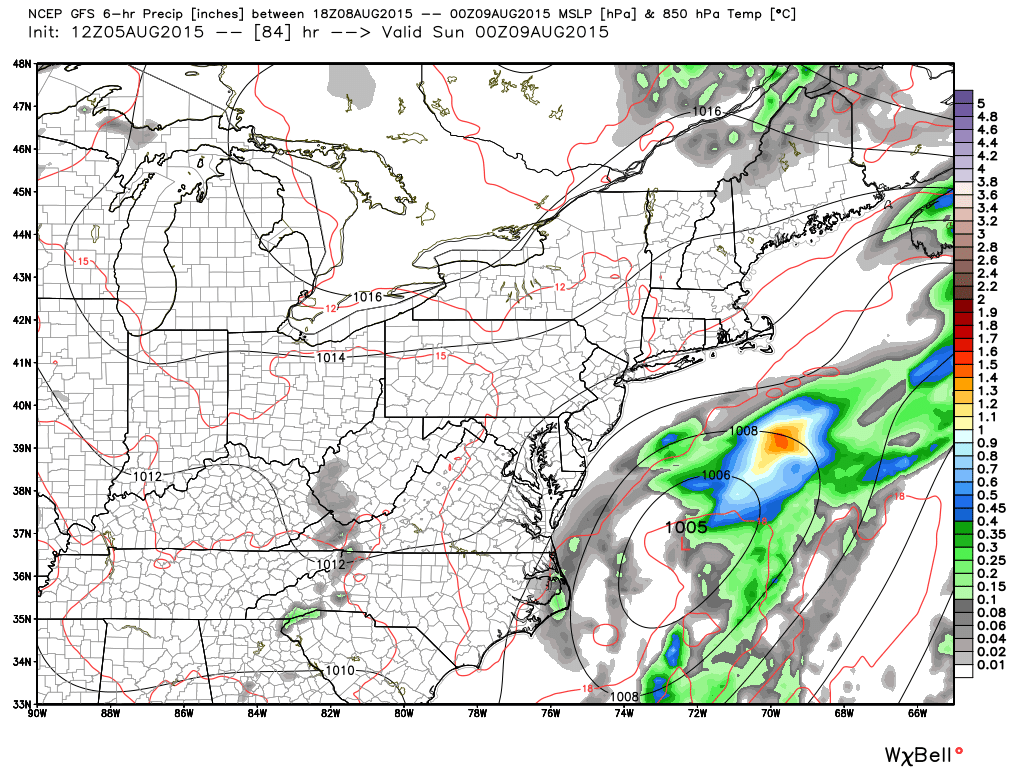
As you can see, only SNJ has a threat for some rain Thursday evening through Friday evening. This is due to the storm track being slightly S of where it was modeled all week. Again, this is because the frontal boundary is now modeled a little further south combined with minor high pressure influence to the north. This would, in effect, render Saturday and Sunday dry for New Jersey. There will be a wall of clear vs clouds on the outer fringe of the system which could drape through the area but lack of precipitation should be the headline. We still have some time but this is how it looks as of right now.
In English: My initial analysis for the Thursday-Saturday system is as follows: NNJ and CNJ should stay completely dry. SNJ could see rainfall and light-to-moderate wind between late Thursday evening and Friday afternoon/evening. Therefore Friday could be a washout for SNJ/SENJ. By Saturday morning, most of SNJ/SENJ should be clearing and/or rain free. This should be exciting news for any outdoor plans, activities or special events scheduled after noon on Saturday and through the rest of the weekend. I would like to mention, however, that surf conditions might be a bit rough through the entire weekend. Even though this system should miss for the most part, it won’t be too far out in the ocean to disrupt the coast as it steams off to the NE. Please pay attention to your lifeguards and local safety officials if you’re beaching it! This is the best I can do right now and I’ll update as needed. Be safe! JC
Model images used with permission from WeatherBell Analytics.
Jonathan Carr (JC) is the founder and sole operator of Weather NJ, New Jersey’s largest independent weather reporting agency. Since 2010, Jonathan has provided weather safety discussion and forecasting services for New Jersey and surrounding areas through the web and social media. Originally branded as Severe NJ Weather (before 2014), Weather NJ is proud to bring you accurate and responsible forecast discussion ahead of high-stakes weather scenarios that impact this great garden state of ours. All Weather. All New Jersey.™ Be safe! JC


LOCAL FORECAST | INTERACTIVE RADAR | LATEST NJ WEATHER ALERTS | WEDDING FORECAST| PRIVACY POLICY
© Copyright 2026 Weather NJ LLC. All Rights Reserved.
Some information that can be found on our website is provided by a private weather station and is not an officially recognized station for weather reporting. Though we always strive to achieve accurate reporting for our own use, it is important that you do NOT depend on the data provided here for any purpose.
