

Aug 22: Watching the Tropics Closely
Tropical development near the Leeward Islands of the Lesser Antilles has been hindered and stunted by it’s surrounding environment. It will likely remain disorganized as it passes over/just to the North of the Greater Antilles. It will then turn northwards and intensify before likely re-curving out to sea. I’m not prepared to say how far or close it will come to the east coast as uncertainty is very high beyond 72 hours of model guidance. At this point you cannot rule out fringe impact to the east coast (intensified surf, outer-band precipitation, etc). Such impacts would be expected early to mid-week.
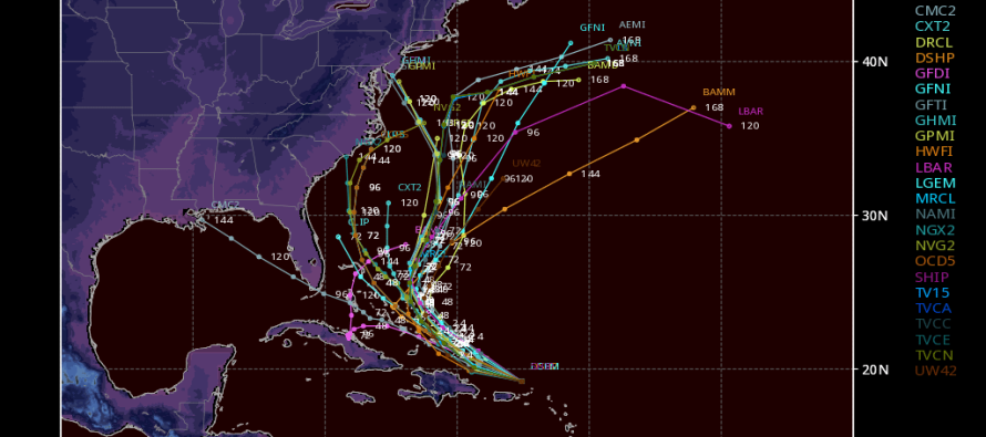
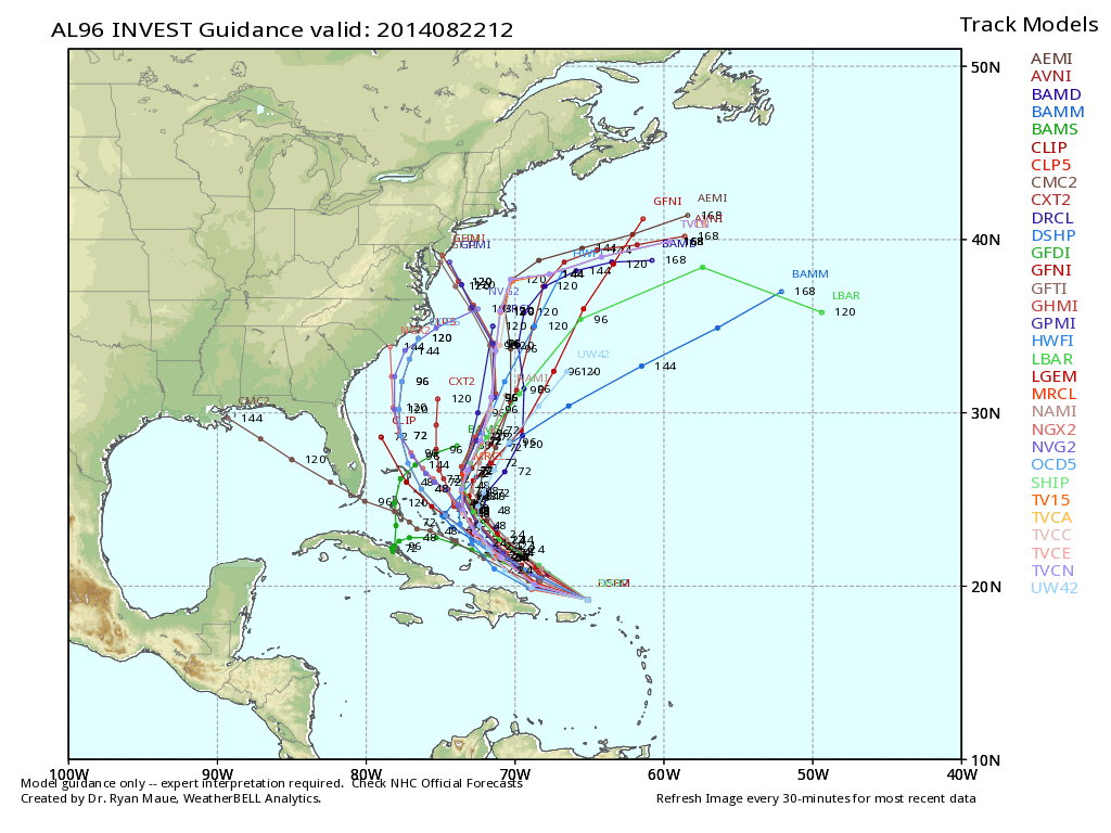 The latest spaghetti plot (all operational tropical model projected paths displayed on same map image) shows high certainty that this system will steam towards the Bahamas region throughout the course of this weekend. There is high uncertainty beyond that due to a complex interaction involving an upper-level trough of low pressure and a ridge of high pressure. The mean of this guidance indicates a general re-curve out to sea which makes the most meteorological sense. I know some of the paths indicate a Sandy-like track but take those with the grain of salt for now. We won’t know the true expected east coast impact until probably Sunday. In the meantime, have a great weekend. You know I’ll be tracking. Be safe! JC
Model images reproduced with permission from WeatherBell Analytics.
Jonathan Carr (JC) is the founder and sole operator of Weather NJ, New Jersey’s largest independent weather reporting agency. Since 2010, Jonathan has provided weather safety discussion and forecasting services for New Jersey and surrounding areas through the web and social media. Originally branded as Severe NJ Weather (before 2014), Weather NJ is proud to bring you accurate and responsible forecast discussion ahead of high-stakes weather scenarios that impact this great garden state of ours. All Weather. All New Jersey.™ Be safe! JC


LOCAL FORECAST | INTERACTIVE RADAR | LATEST NJ WEATHER ALERTS | WEDDING FORECAST| PRIVACY POLICY
© Copyright 2026 Weather NJ LLC. All Rights Reserved.
Some information that can be found on our website is provided by a private weather station and is not an officially recognized station for weather reporting. Though we always strive to achieve accurate reporting for our own use, it is important that you do NOT depend on the data provided here for any purpose.
