

Colder Air Arriving
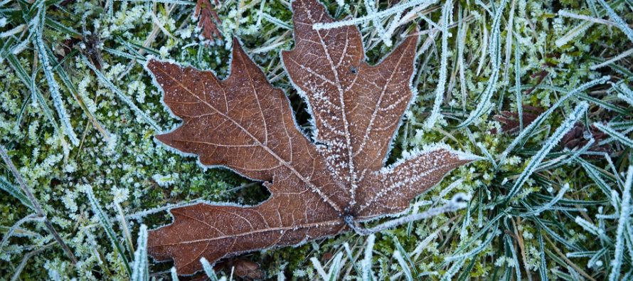
Discussion: A trough will spill into our region this week. The trough will have a positive axis with a progressive upper-level flow out of the W/SW for NJ. This flow will prevent any synoptic systems from wrapping up for our area…allowing an otherwise colder/clearer week than recent times. The only thing I see worth mentioning is some offshore coastal energy Friday. This energy looks strung out and weak but could cloud up at least ECNJ/SENJ on Friday and maybe even bring some light rain in off the ocean. We’re then likely back to a dry weekend as high pressure moves overhead. The best way I can describe how this week will feel is late-November in early-November. Not wintry yet but a good portion of NJ should experience frost, freeze, maybe even hard freeze this week. This would be most likely for NNJ elevations (NW of I-95) and possibly the interior Pine Barrens in SNJ. Coastal regions should still hang near-40 for the most part with much of the state, away from the ocean, at least falling into the 30s overnight. Daytime highs should struggle to push above 55 this week.
Monday (Nov 1) high temperatures are maxing out in the upper-50s/lower-60s range from N to S. Skies should remain clear into overnight hours as winds remain light-to-breezy out of the W/NW. Overnight lows should rage from mid-30s to mid-40s from N to S. Expect a noticeable drop in feel/temperature starting with this evening’s sundown.
Tuesday (Nov 2) high temperatures should fail to escape the 50s statewide. NNJ elevations might struggle to break 50. Stray showers are possible across CNJ/SNJ but otherwise a mix of sun and clouds is likely. Winds should be light out of the W. Overnight lows should range from near-30 to near-40 from N to S. This could present frost/freeze potential for areas away from the ocean and especially NNJ elevations.
Wednesday (Nov 3) high temperatures should fail to escape the lower-50s statewide. Skies should be mostly sunny. Winds should be light out of the W/NW. Overnight lows should fall into the 30s for much of the state. Likely 20s for NNJ elevations/SNJ Pine Barrens and maybe near-40 for immediate ECNJ/SENJ coastal areas.
Thursday (Nov 4) high temperatures should reach the low-to-mid 50s for most areas. Skies should be mixed with mostly sun but some clouds. Winds should be light out of the N/NW. Overnight lows should range from near-freezing to lower-40s from NNJ elevations to SNJ coasts.
Friday (Nov 5) high temperatures should struggle to break 50 statewide. Skies should be mostly clear with the caveat that a coastal disturbance will be out there in the ocean. This could cloud up parts of CNJ/SNJ and even produce some showers if the system were to track a little W of current guidance. Otherwise another colder day. Winds should be light out of the N. Overnight lows should range from mid-20s to near-40 from N to S.
An early look at the weekend indicates clear but cold conditions. High pressure looks to keep us dry with more highs in the 50s/lows in the 30s type stuff. Not exactly wintry but more late-fall conditions. Snow tracking is not far away though. Have a great week and please be safe! JC
Download the free Weather NJ mobile app on Apple or Android. It’s the easiest way to never miss Weather NJ content. Our premium services go even further above and beyond at the hyper-local level
Jonathan Carr (JC) is the founder and sole operator of Weather NJ, New Jersey’s largest independent weather reporting agency. Since 2010, Jonathan has provided weather safety discussion and forecasting services for New Jersey and surrounding areas through the web and social media. Originally branded as Severe NJ Weather (before 2014), Weather NJ is proud to bring you accurate and responsible forecast discussion ahead of high-stakes weather scenarios that impact this great garden state of ours. All Weather. All New Jersey.™ Be safe! JC


LOCAL FORECAST | INTERACTIVE RADAR | LATEST NJ WEATHER ALERTS | WEDDING FORECAST| PRIVACY POLICY
© Copyright 2026 Weather NJ LLC. All Rights Reserved.
Some information that can be found on our website is provided by a private weather station and is not an officially recognized station for weather reporting. Though we always strive to achieve accurate reporting for our own use, it is important that you do NOT depend on the data provided here for any purpose.
