

Colder Air Settles In
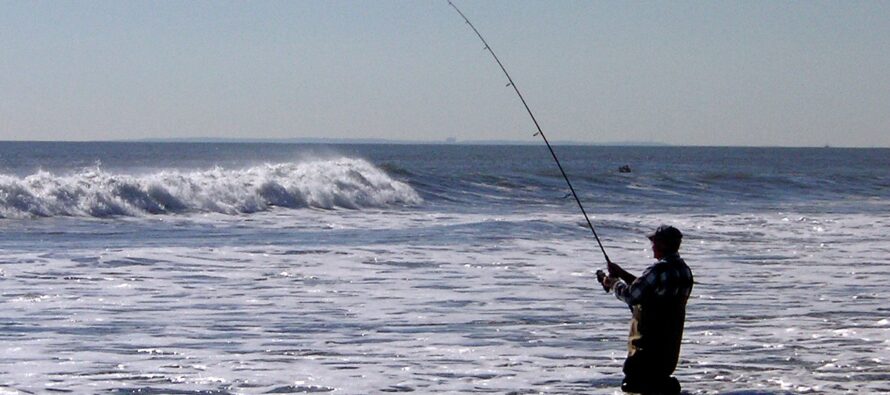
Discussion: Not seeing anything noteworthy in the upper levels for this week. A ridge will try to develop out W but not quite W US…more like W/C US. This will still reciprocate a trough for the E US (the very backside of a trough for NJ) but that still means colder NW flow aloft to usher in a colder air mass overall for NJ before things moderate later next week. On Friday (tomorrow) we have a weak sliding disturbance that should clip SNJ with some cold light rain. This system could actually bring snow flurries to WVA/VA elevations but likely just non-sticking and conversational…a testament to the colder air arriving. Once the slider pushes through NJ by Friday afternoon, the boundary will sag to the S of NJ and a colder air mass will settle in for the weekend. Saturday night into Sunday morning looks like the coldest point (pre-dawn Sunday). We should then gradually moderate from Sunday afternoon into next week. We might see some 60s again by next weekend once high pressure gets offshore. That would then lead into a synoptic storm signal around Nov 18. But at this point it does not look wintry for NJ. I’ll be sure to let you know well in advance if that changes. Other than tomorrow’s (Friday) rain, we’re dry Friday night through much of next week. I’ve seen worse surf fishing weather…I’ll be out there Sunday morning.
Thursday (Nov 9) night temperatures should range from about 40-50 from NNJ elevations to SNJ coasts with clouds increasing in coverage.
Friday (Nov 10) high temperatures should reach the low-to-mid 50s for most NJ locations. Skies should be mostly cloudy with light rain possible mainly for SNJ. Winds should be light out of the W/SW. Overnight lows should range from lower-30s to lower-40s from NNJ elevations to SNJ coasts.
Saturday (Nov 11) high temperatures should reach the low-to-mid 50s again but with clear sunny skies. Winds should be light, possibly breezy at times, out of the NW. Overnight lows should range from mid-20s to upper-30s from NNJ elevations to SNJ coasts with most of NJ away from the ocean dipping below freezing.
Sunday (Nov 12) high temperatures should struggle to escape the 40s. Perhaps a few locations in SNJ just touch 50. Skies should be mostly sunny. Winds should be light out of the N/NE. Overnight lows should range from 20-35 from NNJ elevations to SNJ coasts. Another cold night to close out the weekend.
An early look at next week indicates cool and dry conditions. Highs in the mid-to-upper 50s. Lows in the 30-40 range. Lots of sun/clear skies. Might see some lower 60s build in for next weekend before returning back to 50s the following week. No major storm systems in sight for now however I am seeing a slight storm signal for the ~Nov 18 period…likely too warm for any sort of wintry precip. Have patience Kaboomers, it’s coming. Have a great weekend and please be safe! JC
Premium Services
KABOOM Club offers inside info forecast discussion, your questions answered, and early storm impact maps (ahead of the public). At a buck per month, it’s an extremely feasible way to show support.
My Pocket Meteorologist (MPM), in partnership with EPAWA Weather Consulting, offers professional/commercial interests, whose businesses depend on outdoor weather conditions (snow plowing, landscaping, construction, etc.), with hyper-local text message alerts/forecasts and access to the MPM premium forum—the most comprehensive and technical forecast discussion available for PA and NJ.
Jonathan Carr (JC) is the founder and sole operator of Weather NJ, New Jersey’s largest independent weather reporting agency. Since 2010, Jonathan has provided weather safety discussion and forecasting services for New Jersey and surrounding areas through the web and social media. Originally branded as Severe NJ Weather (before 2014), Weather NJ is proud to bring you accurate and responsible forecast discussion ahead of high-stakes weather scenarios that impact this great garden state of ours. All Weather. All New Jersey.™ Be safe! JC


LOCAL FORECAST | INTERACTIVE RADAR | LATEST NJ WEATHER ALERTS | WEDDING FORECAST| PRIVACY POLICY
© Copyright 2026 Weather NJ LLC. All Rights Reserved.
Some information that can be found on our website is provided by a private weather station and is not an officially recognized station for weather reporting. Though we always strive to achieve accurate reporting for our own use, it is important that you do NOT depend on the data provided here for any purpose.
