

Colder Weekend Expected (Jan 13-15)
We’ll take a break from the January warm-up this weekend and likely deal with some wintry precipitation. Let’s break it down…
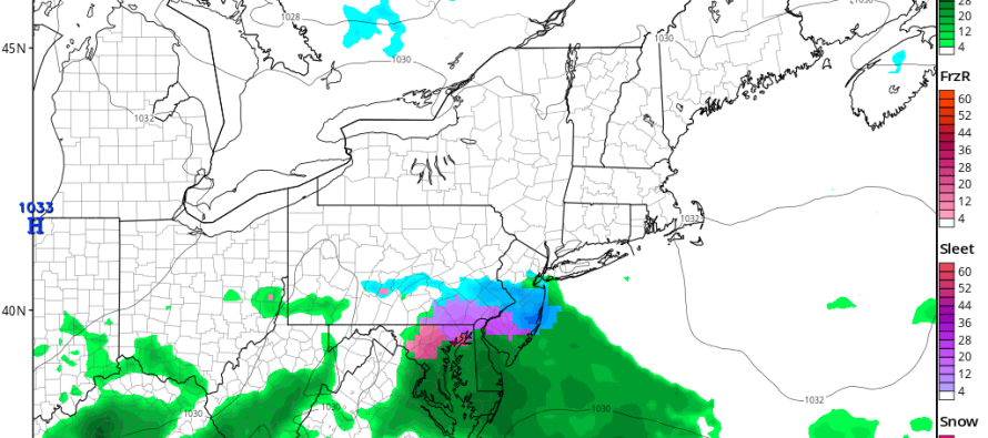
Disco: High pressure will pass to our N and lock a frontal boundary in place through the Mid-Atlantic US. This will chill us down temporarily for the weekend. Some weak energy will ride this frontal boundary and possibly produce light wintry conditions throughout the area. NNJ and CNJ would likely see snow from anything that falls. NNJ could be completely robbed by the northern extent of the precipitation shield. SNJ and coastal regions could see heavier precipitation but have a better chance of mixing with ice and/or rain due to a marginal temperature profile. Meh.
Friday (Jan 13) high temperatures were reached a few hours ago. Temperatures should fall gradually between now and overnight. Skies should remain mixed with sun and clouds. Winds should remain breezy-to-gusty out of the NW. Overnight lows should fall into the 20s for most. NNJ elevations could dip into the teens while the immediate coast hovers around 30.
Saturday (Jan 14) high temperatures should only reach the low-t0-mid 30s. Skies should be mostly cloudy. Snow is possible for NNJ/CNJ however accumulations should be light at best. SNJ and the immediate coast should see more precipitation but temperature issues could result in mixed precipitation types. Winds should be light out of the NE. Overnight lows should fall into the 20s statewide.
Sunday (Jan 15) high temperatures should reach the upper-30s/lower-40s statewide. Skies should be mostly sunny. Winds should be light out of the NE. Overnight lows should at least fall into the 20s for everyone. There’s a good chance teens are possible for interior NJ and especially the NNJ elevations.
An early look at next week indicates above-average temperatures for January. Looks like upper-40s/lower-50s during the day with lows dipping into the 30s. The week looks unsettled too with a few chances for rain. The same long-range model guidance that correctly called for this January thaw a few weeks out is suggesting the return of wintry conditions towards the end of January heading into February, FWIW. Have a great weekend and please be safe! JC
Jonathan Carr (JC) is the founder and sole operator of Weather NJ, New Jersey’s largest independent weather reporting agency. Since 2010, Jonathan has provided weather safety discussion and forecasting services for New Jersey and surrounding areas through the web and social media. Originally branded as Severe NJ Weather (before 2014), Weather NJ is proud to bring you accurate and responsible forecast discussion ahead of high-stakes weather scenarios that impact this great garden state of ours. All Weather. All New Jersey.™ Be safe! JC


LOCAL FORECAST | INTERACTIVE RADAR | LATEST NJ WEATHER ALERTS | WEDDING FORECAST| PRIVACY POLICY
© Copyright 2026 Weather NJ LLC. All Rights Reserved.
Some information that can be found on our website is provided by a private weather station and is not an officially recognized station for weather reporting. Though we always strive to achieve accurate reporting for our own use, it is important that you do NOT depend on the data provided here for any purpose.

)