

Continuing to look at Fri-Sat Dec 5-6
There’s high confidence that a strong cold front will push through Thursday afternoon/evening. This front will be driven by a piece of polar vortex energy and might as well be called an Arctic front. I think we’re starting to see some effects from the Sudden Stratospheric Warming Event (SSWE) that occurred in late-November. Remember that tropospheric propagation takes 1-2 weeks to reflect SSWEs in the lower latitudes. It looks like a train of cold and storm energy is about to set up from this Friday through at least mid-December (see 850 temp map – black arrows = the cold train).
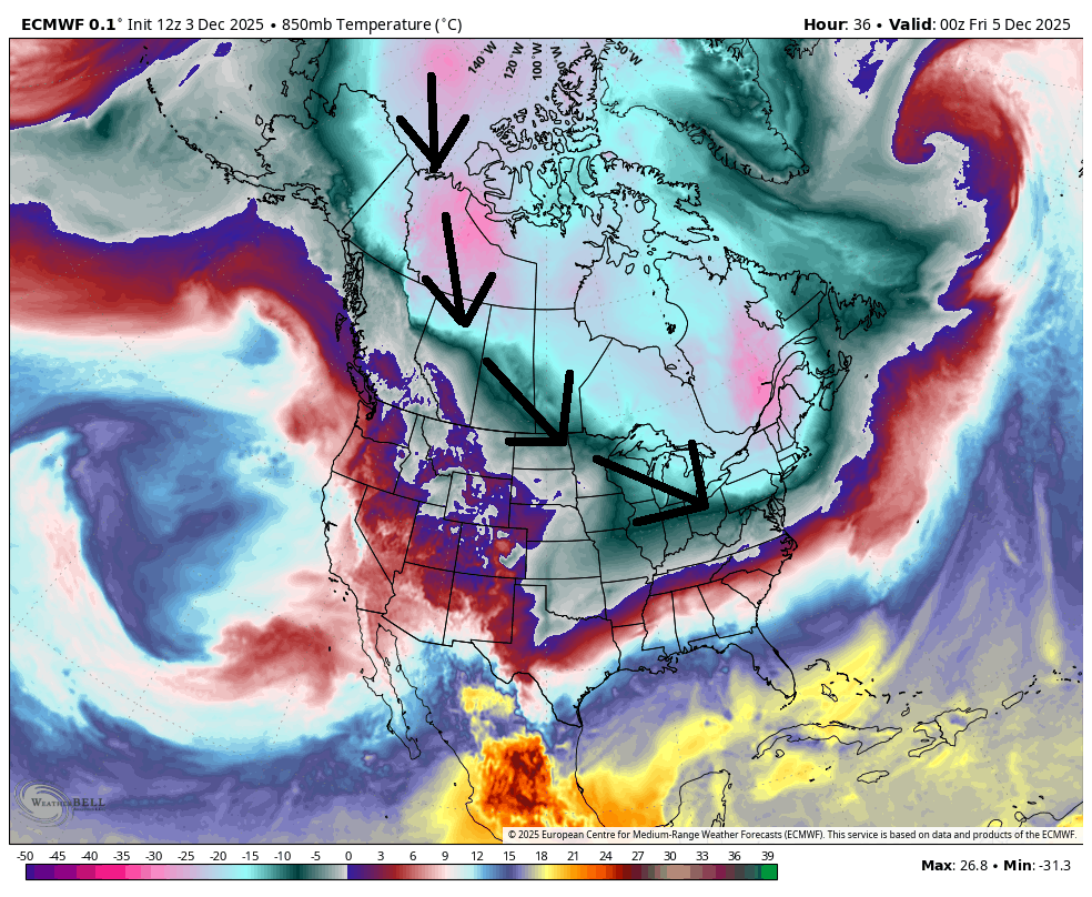
Another SSWE is setting up in a few days which would mean that cold wave shows up later in December into January. But anyway, this Thursday’s frontal passage will make for a very cold Friday. Some NJ highs not even out of the 20s.
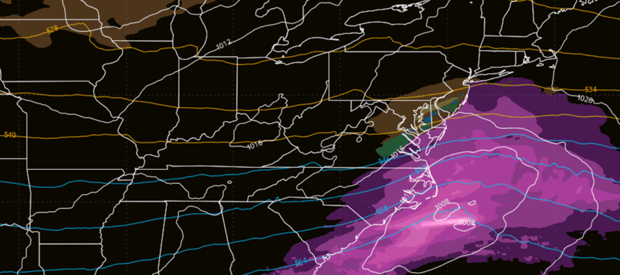
Then between Friday night and Saturday morning, a weak wave will push across the Midwest US and pass though the central Mid-Atlantic into the Atlantic Ocean. Whether or not the northern side of precipitation, from this weak wave, makes it far enough N into at least SNJ is of low confidence at this point. Only The Euro is dropping light accumulations across CNJ/SNJ. The GFS, Canadian and NAM data is suggesting a miss to the S all together. Whereas Tuesday was too warm for a statewide snow, Fri-Sat could be suppressed and possibly too cold for such.
In English: I’m watching for light snow across at least SNJ, possibly CNJ this Friday night into Saturday. This comes after an aggressive cold front Thursday night producing a well below-average Friday…so no shortage of cold with this one only a question of whether the precip will make it far enough N to get into at least SNJ. Need to see some more data. These kind of waves sometimes work out for SNJ snowfall because the precipitation shield expands northward beyond modeled expectations. But it’s not looking like big snow. At this point it would be trace-to-light if it happens. Otherwise, we’re in for a few chances of at least light snow through December, even if just clippers and/or lake effect instances. More to come. Be safe! JC
Jonathan Carr (JC) is the founder and sole operator of Weather NJ, New Jersey’s largest independent weather reporting agency. Since 2010, Jonathan has provided weather safety discussion and forecasting services for New Jersey and surrounding areas through the web and social media. Originally branded as Severe NJ Weather (before 2014), Weather NJ is proud to bring you accurate and responsible forecast discussion ahead of high-stakes weather scenarios that impact this great garden state of ours. All Weather. All New Jersey.™ Be safe! JC


LOCAL FORECAST | INTERACTIVE RADAR | LATEST NJ WEATHER ALERTS | WEDDING FORECAST| PRIVACY POLICY
© Copyright 2026 Weather NJ LLC. All Rights Reserved.
Some information that can be found on our website is provided by a private weather station and is not an officially recognized station for weather reporting. Though we always strive to achieve accurate reporting for our own use, it is important that you do NOT depend on the data provided here for any purpose.
