

Dangerous Wind Storm Approaching
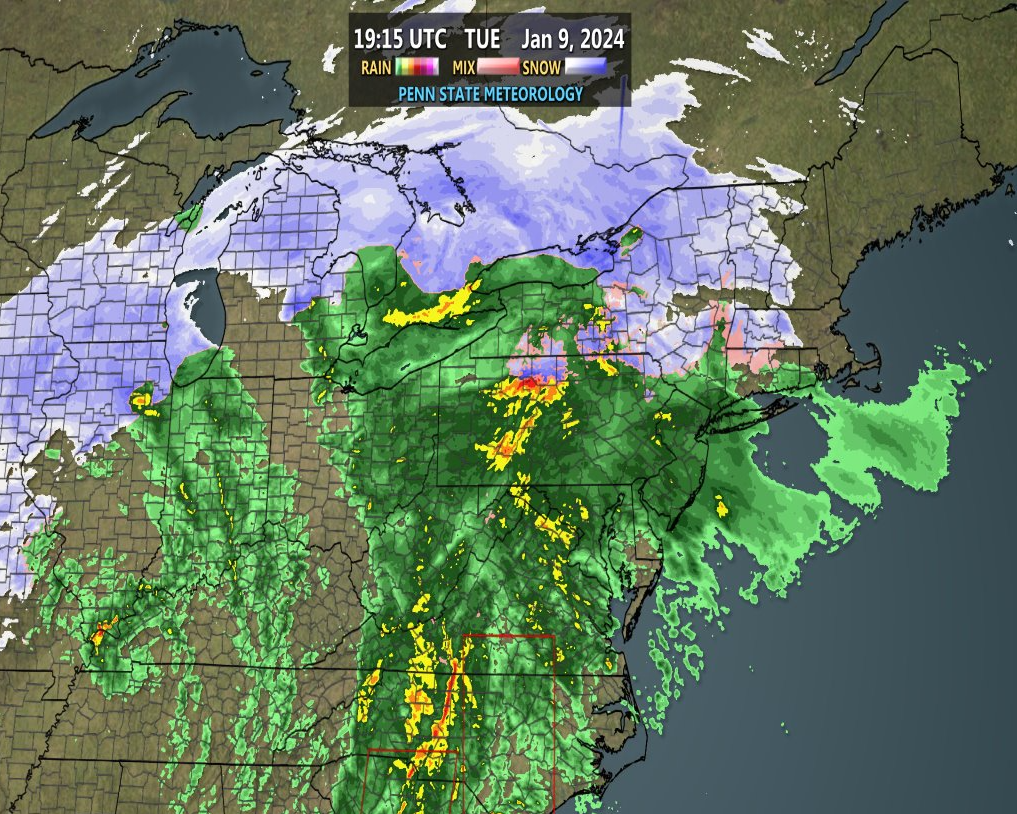
Discussion: Precipitation is well into New Jersey so it’s time to start live observations and provide a final set of expectations before the main wind storm portion arrives tonight. Some initial snow with this mainly N of I-80 and NW of I-287. This should go over to rain like the rest of NJ soon. Here is a current radar snapshot from Penn State’s Department of Meteorology:
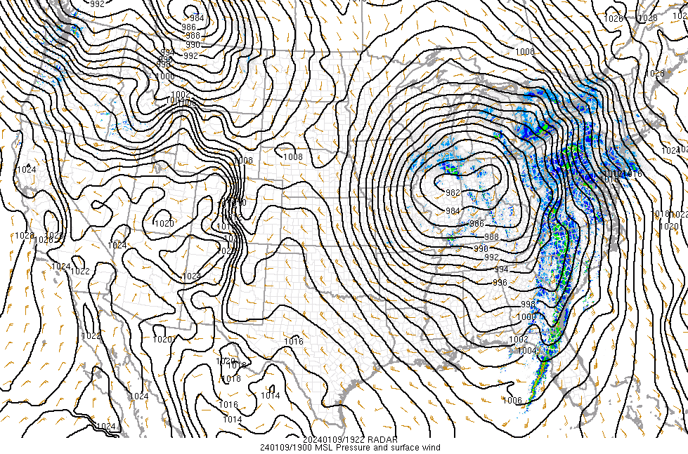
This storm system is a rapidly maturing mid-latitude cyclone with its center of circulation currently tracking from Illinois into Indiana and eventually the State of Michigan. This is known as a Great Lakes Cutter (GLC) and is, in most cases, too warm of a storm for NJ snow. The centralized pressure is down to 982mb with further deepening expected down to at least the 970s (mb). As you can see, this system has isobar control for the entire E US. Here are the current pressure observations:
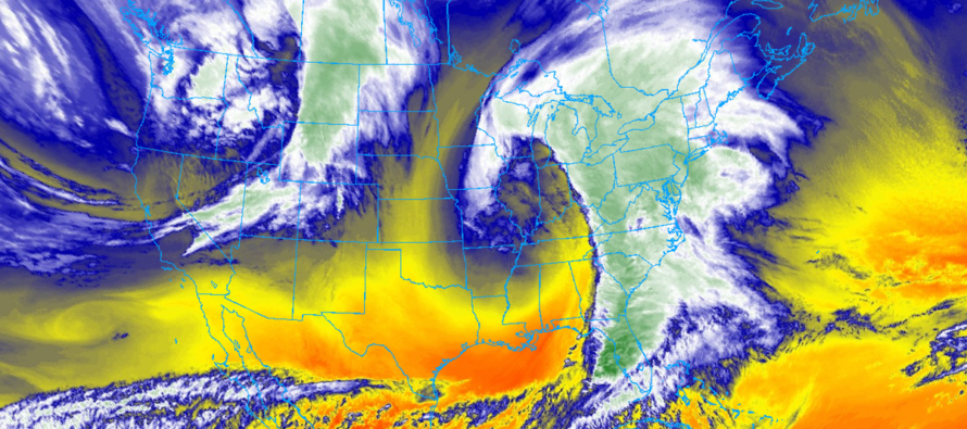
This system is bringing a crippling snowstorm/blizzard to the Great Lakes states, tornadoes to the SE US, and will bring a high wind and flooding event to New Jersey this evening through early Wednesday AM hours. This is a massive cyclone. The wind field ranges from Colorado to NJ (from W to E) and from Canada to Mexico (N to S). I imagine the satellite imagery/signature will be as remembered as March 1993, Sandy, or any other superstorm simply by visual recognition. Here is the current satellite image (rainbow colors indicating cloud top temps):
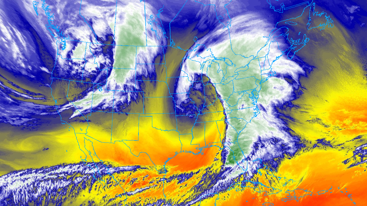
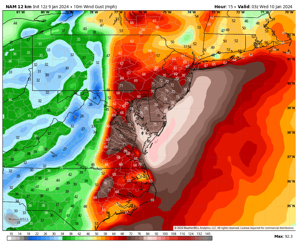
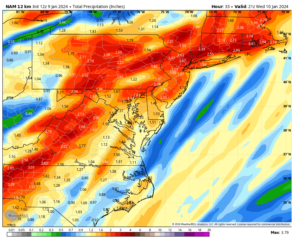
So we are into the first state now where precipitation has pushed into New Jersey and winds are just starting to pick up. Right now I’m only seeing wind gusts of 10-20mph away from the ocean and to 35mph along the coast. This will change significantly as S winds gradually build today to high/damaging levels for the 10pm to 3am window. I think wind gusts of 40-60mph during this period are a lock. I think 60-70+mph wind gusts are on the table. Either way, it’s enough to cause downed tree limbs which will likely cause localized-to-widespread power outages across New Jersey. What’s worse is the ground is very saturated…which poses a concern for downed trees, not just limbs. I hope this doesn’t happen to anyone but there’s a possibility that sump pumps could lack the necessary power to work if not on a backup power source (generator or battery). There’s a lot of unusual hazards such as above to consider with this kind of storm system. While all of NJ are on the hook for high winds, immediate coastal areas will see slightly higher wind values than say extreme NNJ. Here are the latest modeled winds and expected rainfall:
Once the cold front is through (by/around 3am overnight tonight), winds will relax to “just gusty” (25-40mph) out of the W/NW and rain will shut off outside of remnant sprinkles Wednesday. Thursday and most of Friday are then dry and colder ahead of the next system which will impact NJ with more rain and wind late-Friday night into early Saturday morning. This system has trended a hair colder in the last few days so snow is on the table for the highest NWNJ elevations. Otherwise, mostly rain for the other 90% of NJ. Winds will likely howl but more of a run-of-mill scenario and not as bad as what’s expected tonight. After that, all eyes turn towards a much colder storm signal Monday-Tuesday (January 15-16). It’s still there as snow for now and I am only looking for that to hold for a few more days before serious tracking begins. Behind that is another signal for Jan 19 and then one more before Jan 24. After Jan 24, we’re likely going to see a January thaw warmup for a week or so before the colder pattern reloads for February. Again, let’s get through one system at a time in detail.
In English: The current storm of interest has begun and the high winds for tonight are approaching. Rain is well into NJ (snowy start for NNJ elevations) but all are rain now. Rainfall should continue this evening and overnight until the cold front passes through around 3am. Total estimated rainfall varies from the 1–3 inch range in SNJ to the 2-4 inch range+ for NNJ. The highest wind values should occur a few hours ahead of the cold front. Let’s put a conservative window of between 10pm tonight and 3am tomorrow morning. The actual cold front will pass through in just 5-10 minutes of time total. It’s the few hours ahead of it that are concerning. During this time, winds should gust 40-60mph for most of New Jersey. 60-70+mph is not off the table especially for coastal regions and areas immediately ahead of the cold front. Both freshwater and saltwater flooding are possible but for this one, freshwater will likely be worse and will extend into Wednesday. At this time you should have loose objects secured outside. This includes pets and small human beings. I will be updating accordingly. Have a great rest of your Tuesday and please be safe! JC
Premium Services
KABOOM Club offers inside info forecast discussion, your questions answered, and early storm impact maps (ahead of the public). At a buck per month, it’s an extremely feasible way to show support.
My Pocket Meteorologist (MPM), in partnership with EPAWA Weather Consulting, offers professional/commercial interests, whose businesses depend on outdoor weather conditions (snow plowing, landscaping, construction, etc.), with hyper-local text message alerts/forecasts and access to the MPM premium forum—the most comprehensive and technical forecast discussion available for PA and NJ.
Get your KABOOM Inside Out pajamas and more at the KABOOM shop!
Jonathan Carr (JC) is the founder and sole operator of Weather NJ, New Jersey’s largest independent weather reporting agency. Since 2010, Jonathan has provided weather safety discussion and forecasting services for New Jersey and surrounding areas through the web and social media. Originally branded as Severe NJ Weather (before 2014), Weather NJ is proud to bring you accurate and responsible forecast discussion ahead of high-stakes weather scenarios that impact this great garden state of ours. All Weather. All New Jersey.™ Be safe! JC


LOCAL FORECAST | INTERACTIVE RADAR | LATEST NJ WEATHER ALERTS | WEDDING FORECAST| PRIVACY POLICY
© Copyright 2026 Weather NJ LLC. All Rights Reserved.
Some information that can be found on our website is provided by a private weather station and is not an officially recognized station for weather reporting. Though we always strive to achieve accurate reporting for our own use, it is important that you do NOT depend on the data provided here for any purpose.
