

Dec 12: Very Cold Air Detected!
We’ve got some pretty cold air coming this Thursday and Friday. A few words of advice…
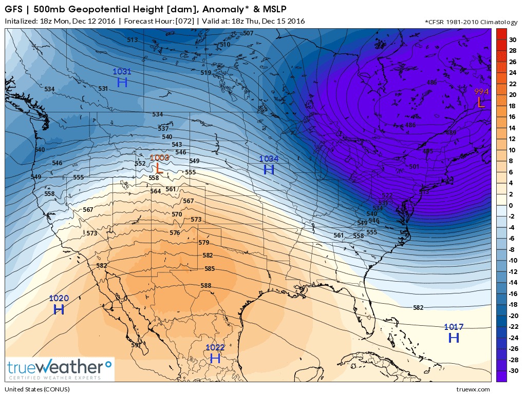
First let’s get the science out of the way. A lobe of the polar vortex is going to swing through and bring very low 500mb height anomalies to the region. This tells me that the troposphere will be very compressed with cold Arctic air from Thursday AM through Saturday AM.
Here are the 500mb (~18,000 ft) height anomalies from the 18Z GFS for Thursday AM:
Here are the 850mb (~5,000 ft) temperatures for Friday morning:
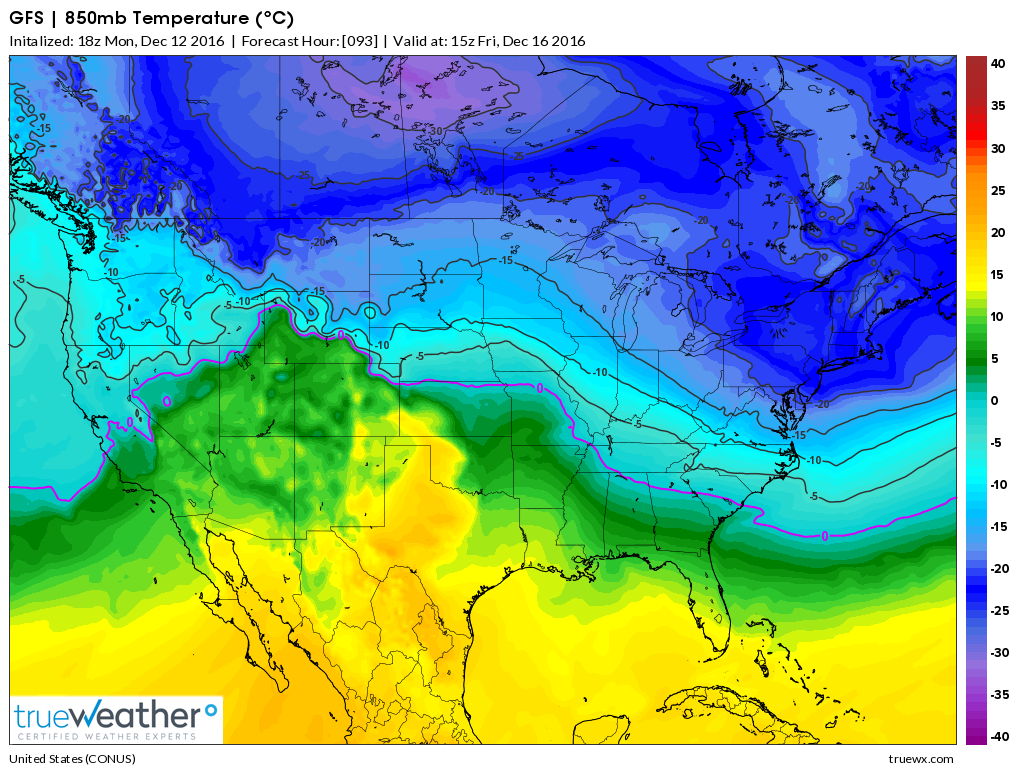
The first (top) upper-air map suggests that the 500mb pressure level will be slightly less than 17,000 feet above sea level over most of New Jersey. Normally the 500mb pressure level is closer to 18,000 feet above sea level. This is an indication of a very cold air mass. The 850mb temps (bottom) suggest that this cold will propagate easily downwards through the mid and lower levels of the atmosphere right to the surface. Also there will be a strong W/NW jet across the Great Lakes and through our region that appears stacked up to the 250mb level. So in addition to the cold air, there will be brutal wind chills, especially Thursday night into Friday morning. This should also help power some decent lake-effect snow showers/squalls which could easily reach parts of New Jersey. NWNJ would be favored over SENJ but it’s possible statewide.
In English: Aside from some light precipitation (wintry for points NW) tomorrow night into Wednesday morning, the bigger story is the approaching cold air mass for Thursday morning through Saturday morning. Highs should struggle to break 32F and possibly even fail to escape the 20s in many locations. Overnight lows should dip into the teens in many areas and possibly single-digits for NNJ elevations. We won’t moderate in temperature until Saturday when another storm system approaches. I’ll be writing about that system tomorrow. Again…for now the greatest hazard of concern is the cold air coming for Thursday and Friday.
Now would be a good time to take proactive measures regarding pipes freezing or anything else that makes sense. It’s probably a good time to change furnace air filters. Make sure your heating systems in general are up to speed because they will be running a lot between Wednesday night and at least Saturday morning—you will need it! It’s always best to think ahead and be safe! JC
Jonathan Carr (JC) is the founder and sole operator of Weather NJ, New Jersey’s largest independent weather reporting agency. Since 2010, Jonathan has provided weather safety discussion and forecasting services for New Jersey and surrounding areas through the web and social media. Originally branded as Severe NJ Weather (before 2014), Weather NJ is proud to bring you accurate and responsible forecast discussion ahead of high-stakes weather scenarios that impact this great garden state of ours. All Weather. All New Jersey.™ Be safe! JC


LOCAL FORECAST | INTERACTIVE RADAR | LATEST NJ WEATHER ALERTS | WEDDING FORECAST| PRIVACY POLICY
© Copyright 2026 Weather NJ LLC. All Rights Reserved.
Some information that can be found on our website is provided by a private weather station and is not an officially recognized station for weather reporting. Though we always strive to achieve accurate reporting for our own use, it is important that you do NOT depend on the data provided here for any purpose.
