

Dec 15: Winter Storm Approaching!
Discussion: As I said before, this system is going to break a lot of snow lover hearts in SNJ (I’m one of them) while delivering a crippling winter blow to NNJ. A NNJ KABOOM.
The trends in model guidance that have evolved over the last 72 hours have kept the heavy snow in NNJ/WCNJ and removed it from ECNJ/SNJ. Also the expected sharp cut off line (separating major snow from little to none) is not straight across CNJ…it’s angled more in parallel with how 95 runs through NJ. NNJ is straightforward…snow from start to finish and likely the NJ jackpot zone. CNJ has always been the battle zone especially surrounding 95. SNJ/SENJ snow has been taken away because there is less back-end precipitation once the system becomes cold enough to snow. Therefore the heaviest precipitation is modeled for the start and middle of the event, not the end of it. So wherever that snow/rain line sets up, it’s likely going to divide a lot of snow from nearly-none rather than a gradual lowering of amounts as you head SE.
Bobby and I went back and forth on today’s snow map quite a bit. We agreed to err on the side of caution and go with lower amounts along , and even to the NW, of 95. We’ve been discussing the slightly warm 700mb layer that could sneak in and reduce snow accumulations in this area. This is a potential problem for much of SEPA and CNJ. As I said, Bobby and I have to factor that in. However we cannot state enough how much volatility there is in our D and E zones. Given the high levels of expected frontogenesis, possible convective precipitation (listen for thundersnow) and cold air aloft, zones D and E could clearly bust high as in closer to the one foot KABOOM threshold. For our map, we went with a conservative lower estimate for zones D and E but we want you to know about this wildcard potential.
With that said, there’s wildcard potential in the other direction if the 700mb low sets up a warmer layer of flow along 95 that drops more sleet instead of snow. Again, this is for zones D and E. We’re much more confident in our assessment of zones A-C (KABOOM for all along and N of I-78) and F-H (rain and wind with little snow to end E of I-295/S of I-195). With that said, the following snow map represents our best current evidence-based assessment without factoring the above wildcards.
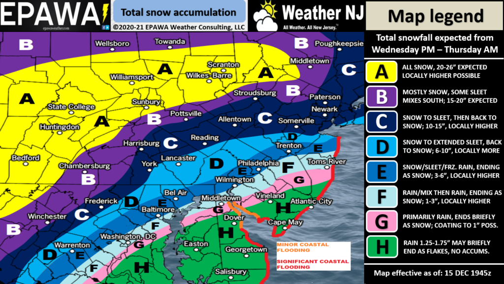
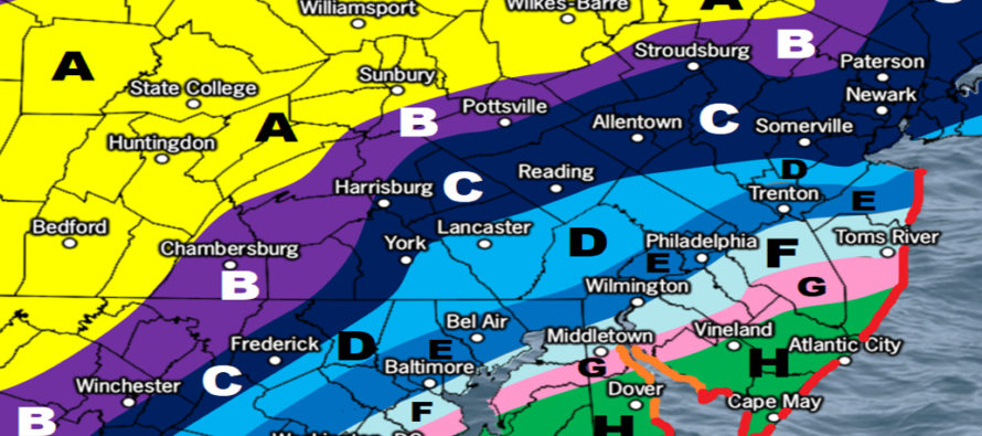
Please click here for full-resolution snow map!
Snow and rain aside, there should be some high winds with this event. Winds should gradually start to pick up through Wednesday afternoon and peak overnight into Thursday morning. For immediate coastal areas of ECNJ and SENJ, gusts of 40-60mph are possible. For the rest of NJ away from the ocean, maybe gusts in the 30-40mph range. Winds should then subside by Thursday afternoon. Widespread power outages are likely especially for immediate coastal areas.
Winds should be strong out of the E which poses a coastal flooding risk for the entire Jersey shore. This includes Delaware and Long Island beaches as well. Two high tides are of concern. First is Wednesday late-night and the second is Thursday late-morning. The Thursday AM tide should feature the highest water levels. Minor coastal flooding is a lock. Moderate is more probable. Major is possible.
In English: A solid coastal winter storm is approaching. It will start by tomorrow afternoon and end by Thursday afternoon—making Wednesday night into Thursday morning the period of peak conditions. Our snow map above shows how NNJ is favored for big snow, CNJ is favored for the wintry mix battleground, and SNJ is favored for rain and wind with a brief snowy finish possible for those closer to the Turnpike. Winds are going to crank to the point of widespread power outages and coastal flooding is likely for the ocean-facing coastal regions of ECNJ/SENJ. I would anticipate a lot of beach erosion along the Jersey coast. Probably one more update tomorrow late-morning before we enter real-time storm tracking later tomorrow. Have a great night and please be safe! JC
Download the free Weather NJ mobile app on Apple or Android. It’s the easiest way to never miss Weather NJ content. Our premium services go even further above and beyond at the hyper-local level. Get your merch on at the KABOOM shop in time for the holidays.
Jonathan Carr (JC) is the founder and sole operator of Weather NJ, New Jersey’s largest independent weather reporting agency. Since 2010, Jonathan has provided weather safety discussion and forecasting services for New Jersey and surrounding areas through the web and social media. Originally branded as Severe NJ Weather (before 2014), Weather NJ is proud to bring you accurate and responsible forecast discussion ahead of high-stakes weather scenarios that impact this great garden state of ours. All Weather. All New Jersey.™ Be safe! JC


LOCAL FORECAST | INTERACTIVE RADAR | LATEST NJ WEATHER ALERTS | WEDDING FORECAST| PRIVACY POLICY
© Copyright 2026 Weather NJ LLC. All Rights Reserved.
Some information that can be found on our website is provided by a private weather station and is not an officially recognized station for weather reporting. Though we always strive to achieve accurate reporting for our own use, it is important that you do NOT depend on the data provided here for any purpose.
