

Dec 2: Coastal Snow Storm Update
Discussion: We’re about halfway through phase 3. There’s nothing left but the second half of the snow storm that should occur between now and about 2am.
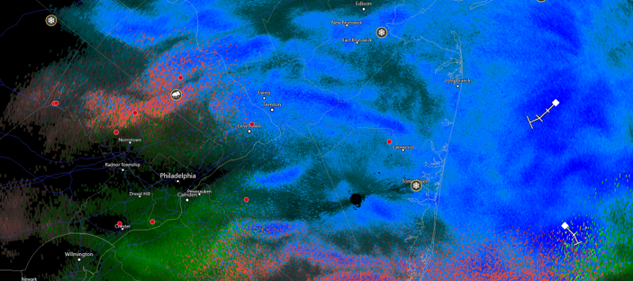
We’ve seen a lot of mesoscale banding today. The radar reflects such with a tiger stripped pattern. These are the linear segments of lifting (snowing) and sinking (not snowing) counteracting each other. We also saw the greatest frontegenic forcing from extreme NE PA through NNJ and down into ECNJ. This was the large band that rotated through earlier today.
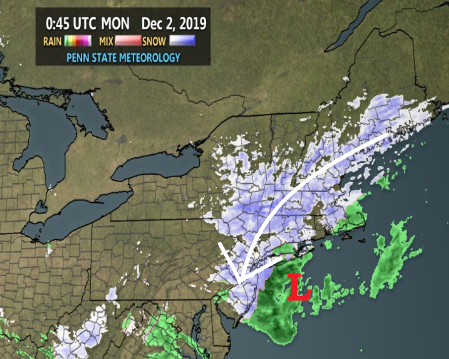
The coastal low is now by itself. The former primary has long since collapsed and all winds are now northerly at most levels. The warmth from the lakes primary was pulled through and kept the surface slightly above freezing for most of the day despite very cold air aloft. Stickage has only been possible where the precipitation brought enough cold down with it to take the surface down to 32-33. In areas that saw the sinking air (between the bands) you should have noticed that temps spiked back into the mid-to-upper 30s at times and then back down to near 32-33 when more bands moved in. For this reason a lot of what has fallen has belted especially in CNJ/SNJ. It’s still very early in December. Barely out of November. We had/have a lot of climatology against us with this shotgun start to meteorological winter.
But now temperatures are approaching freezing and even counties as far S as Ocean and Burlington are noticing some stickage. The final bands of this system will rotate in from the NE and exit to the SE as the back-edge of snowfall moves slowly from W to E. Again this should happen between now and 2am. Until then most areas of New Jersey now have the best chance to accumulate snow from this entire system that started early yesterday morning.
I am slightly concerned about wet roads under the slushy snow. A lot of meltage today that could freeze when temperatures do cross S of the 32F mark later tonight. Just please take it slow and responsible out there. There were hundreds of accidents today.
This morning was likely the highest coastal tide of the system. The next tide is around midnight tonight and that should start to subside through tomorrow. Only minor levels were reached.
In English: Pockets and bands of snowfall should continue to rotate in and through New Jersey. Snowfall should wrap up after midnight. All areas should be completely tapered off by 2am. A few more inches on top of whatever you got right now are still possible in that timeframe for areas N of the Atlantic City Expressway especially N of I-195. The snow will likely accumulate much easier on natural surfaces than paved surfaces especially if treated. Have a great rest of your Monday night and please be safe! JC
Download the new free Weather NJ mobile app on Apple and/or Android. It’s the easiest way to never miss Weather NJ content. Our premium services go even further above and beyond at the hyper-local level. Looking for industrial-caliber long-range forecasting data that I personally recommend? Check out WeatherTrends360! Visit the Weather NJ Kaboom Shop for hoodies, tees and infant onesies.
Jonathan Carr (JC) is the founder and sole operator of Weather NJ, New Jersey’s largest independent weather reporting agency. Since 2010, Jonathan has provided weather safety discussion and forecasting services for New Jersey and surrounding areas through the web and social media. Originally branded as Severe NJ Weather (before 2014), Weather NJ is proud to bring you accurate and responsible forecast discussion ahead of high-stakes weather scenarios that impact this great garden state of ours. All Weather. All New Jersey.™ Be safe! JC


LOCAL FORECAST | INTERACTIVE RADAR | LATEST NJ WEATHER ALERTS | WEDDING FORECAST| PRIVACY POLICY
© Copyright 2026 Weather NJ LLC. All Rights Reserved.
Some information that can be found on our website is provided by a private weather station and is not an officially recognized station for weather reporting. Though we always strive to achieve accurate reporting for our own use, it is important that you do NOT depend on the data provided here for any purpose.
