

Dec 27: Wintry Disturbance Detected
Snow and rain are expected this Thursday. Here’s our first call and impact map…
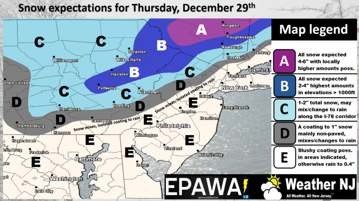
Click here to view impact map in full-resolution.
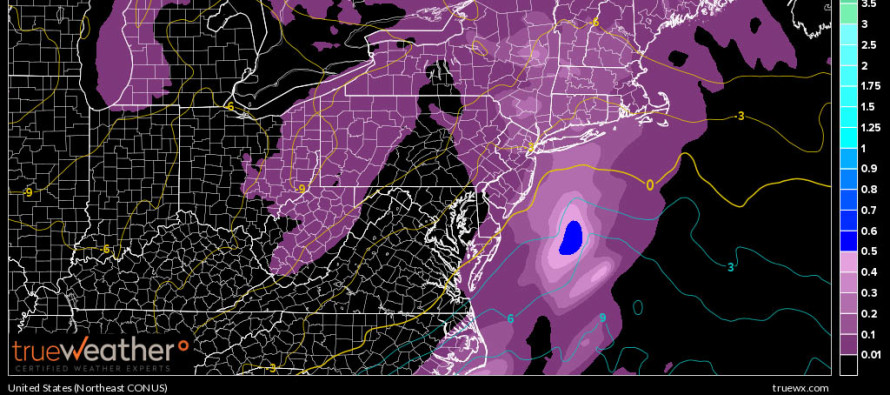
Disco: Low pressure will track across South-Central Canada to the N of the Great Lakes. High pressure to the E of it will force the low to transfer to a coastal low that should then track from the VA Beach/Delmarva area near the benchmark (40N/-70W) on Thursday then over Cape Cod and into the Gulf of Maine by Friday. Dynamics are impressive enough to drop the coastal low below 990mb but only after it leaves our favorable sweet spot for snow. The system is simply moving too fast for large-scale wintry impacts in New Jersey. Therefore, this is looking like another light wintry event for NWNJ elevations and a rain event for the lower 2/3 of New Jersey. Most of the precipitation will be falling during peak afternoon sun hours so even the I-78 corridor could deal with marginal surface issues despite colder air aloft. Might see snow falling in CNJ but melting on impact. For everyone that sees mostly rain (section E above), expect a half-inch or less of liquid to fall. It could start as early as Thursday AM and should wrap up by Thursday night. We’ll then feel the strong NW winds behind the intensifying coastal New England low overnight into Friday. These winds will correlate with another cold air mass moving in to start the weekend.
In English: Today was a freak show. Yesterday I went with “temps well into the 50s” for today in my outlook but it broke 60 in SENJ. Regardless tomorrow will be cooler and drier. On Thursday NWNJ elevations and possibly some lower NNJ areas are looking at another light snow event. Everyone else in NJ (section E above) is looking at rain with temperatures into the 40s. Northern E areas (closer to D) could see snow mix in with rain at times. Snow/rain could start as early as Thursday morning and should end by Thursday evening. NW winds should then pick up as we dry out and welcome another colder air mass from the N. Be safe! JC
Jonathan Carr (JC) is the founder and sole operator of Weather NJ, New Jersey’s largest independent weather reporting agency. Since 2010, Jonathan has provided weather safety discussion and forecasting services for New Jersey and surrounding areas through the web and social media. Originally branded as Severe NJ Weather (before 2014), Weather NJ is proud to bring you accurate and responsible forecast discussion ahead of high-stakes weather scenarios that impact this great garden state of ours. All Weather. All New Jersey.™ Be safe! JC


LOCAL FORECAST | INTERACTIVE RADAR | LATEST NJ WEATHER ALERTS | WEDDING FORECAST| PRIVACY POLICY
© Copyright 2026 Weather NJ LLC. All Rights Reserved.
Some information that can be found on our website is provided by a private weather station and is not an officially recognized station for weather reporting. Though we always strive to achieve accurate reporting for our own use, it is important that you do NOT depend on the data provided here for any purpose.
