

Dec 29: Brace Yourselves. Winter is Coming.
2016 looks to start with average to slightly-below average January temperatures which are cold enough for wintry weather. In addition, a storm signal in the January 8-12 period is supported by a favorable pattern. Let’s break the next few weeks down:
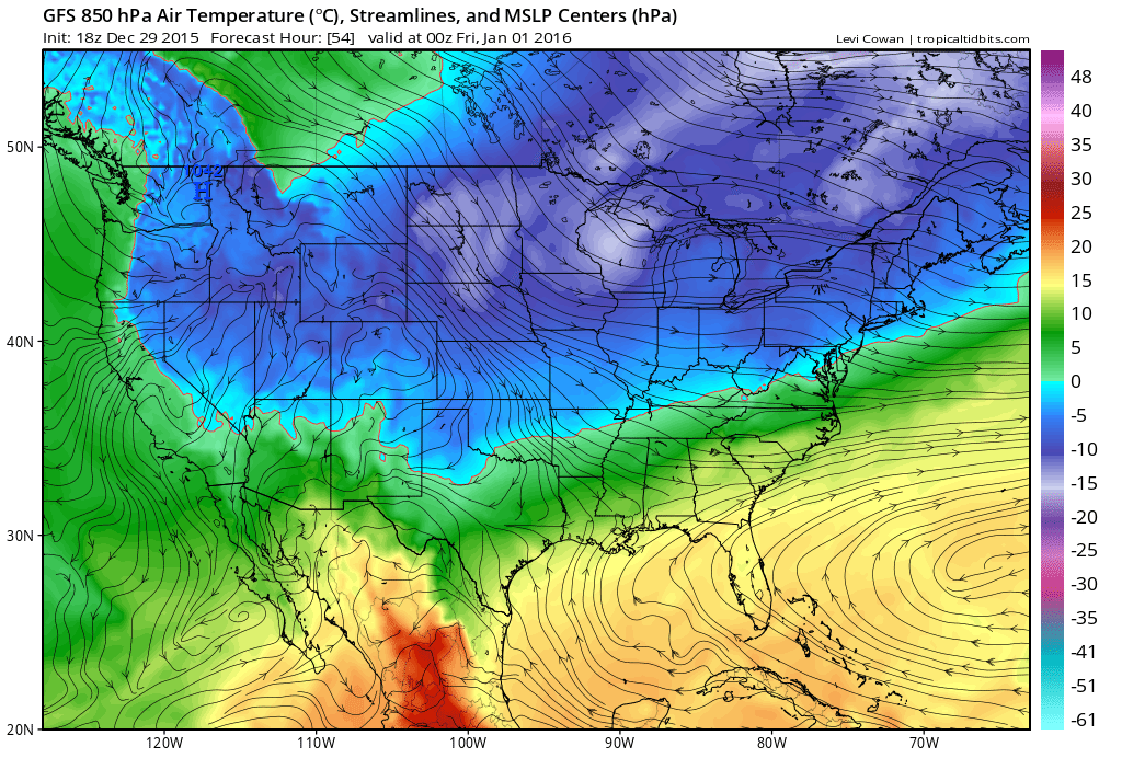
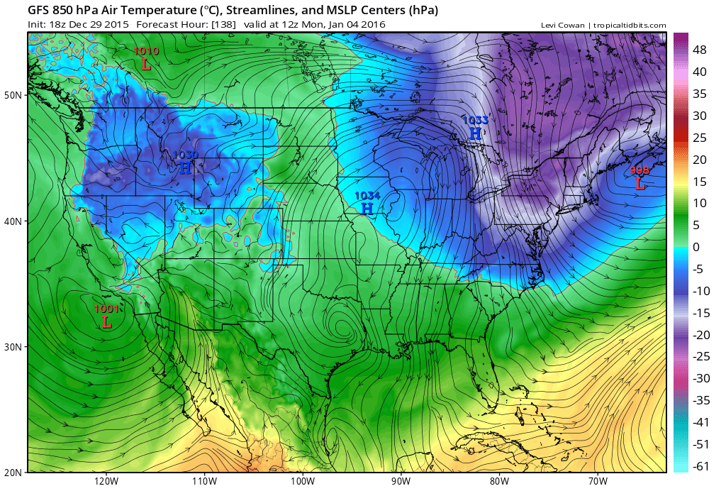
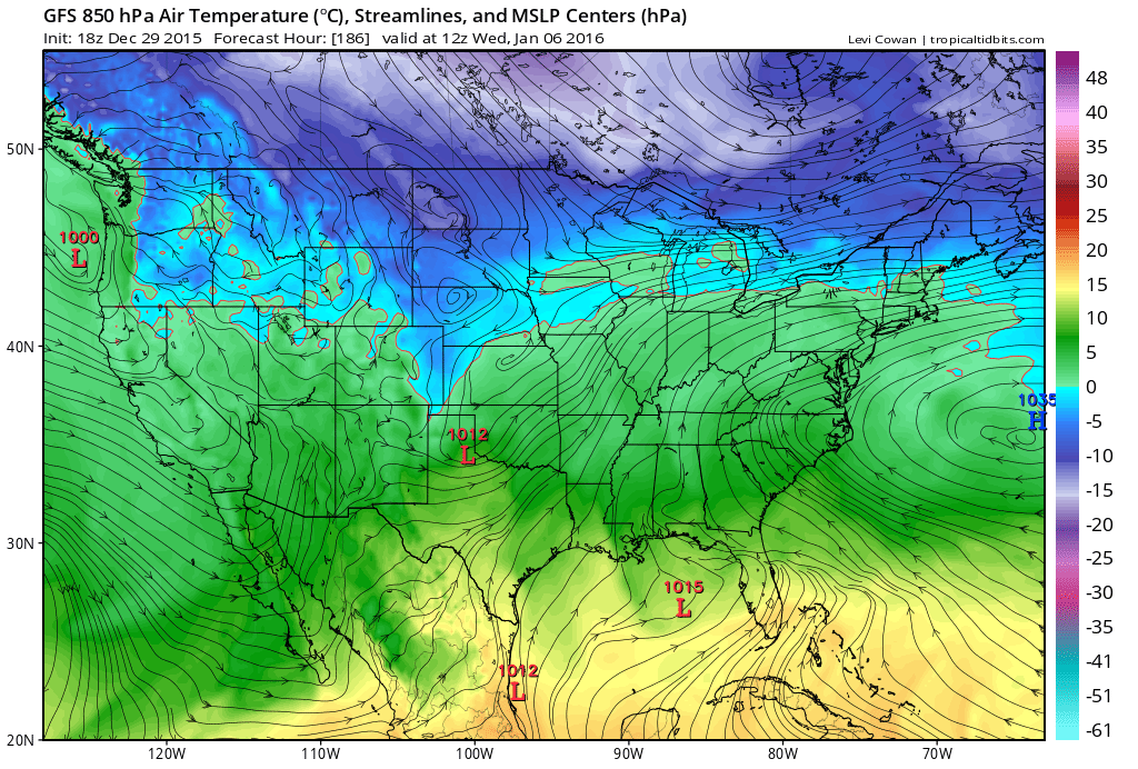
A cold front is expected to pass through between December 31 and January 1. This should then keep New Jersey cold through about ~January 4/5 but mostly dry. This supporting guidance shows 850mb (~5k feet) temperatures which will partially trickle down to the surface as well as 500mb analysis during the coldest expected period of the cold wave:
New Years Day frontal passage:
Coldest Period (Jan 4):
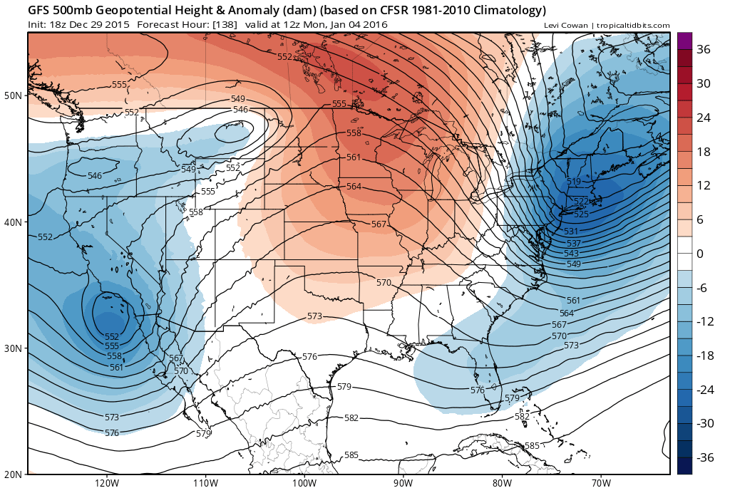
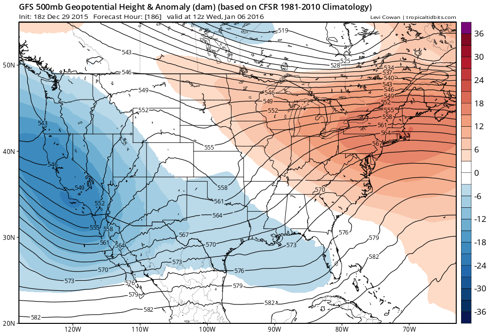
A transient warmup is then modeled between ~January 4/5-8 from southerly flow associated with the western side of passing high pressure. We’re not talking 60s and 70s again but slightly above average for January. Here’s some supporting guidance indicating the warmest period. Again 850 temps and 500mb heights:
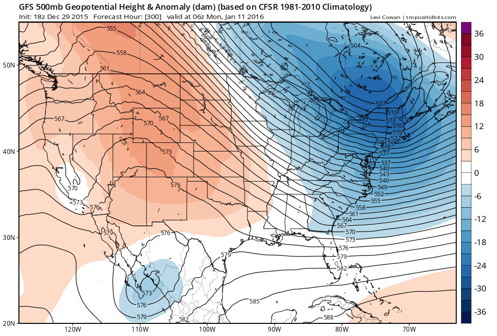
Between January 8-12, a storm signal is present. The teleconnections that drive our weather pattern are all modeled favorably for winter storm development in this time period. We’re looking at a -EPO/+PNA/-AO/-NAO. This means that we should have a trough over the Aleutian Islands, a ridge over W North America, a trough over the E Coast and blocking in the higher latitudes of the N Atlantic Ocean near Greenland. While this pattern is looking favorable for a winter storm development, we are not there yet re: any specific storm tracks. It is entirely possible that a favorable pattern could go to waste should the northern and southern energy streams not interact ideally. For now this is just a period that I’m monitoring in the long range. All ingredients will be on the table and mixed but will mother nature bake us a snow storm cake? Let’s see how we are looking in a few days re: this storm signal period. For now, the upper-level pattern looks great:
Beyond January 12, 2016 looks very cold as a strong Arctic high pressure system is modeled to move from western-central Canada into the central US. This will place our region on the E side of a strong anti-cyclone which will open the gates for Arctic air to spill down. This cold lasts as far as I can comfortably see into January which is about half way through the month. Beyond that is above my pay grade 8)
In English: Aside from last night’s transient wintry conditions in NNJ, we’ll stay mild for the rest of 2015 (which is just a few more days). We should then turn much colder and drier from Jan 1-5 as winter truly begins. Expect a slight warmup between Jan 5-8 followed by a possible winter storm signal Jan 8-12. Long range analysis then indicates a frigid/wintry January 12-forward. The bottom line is that winter is coming and you should prepare for January conditions to be much colder than what we’ve gotten used to this past November/December. Be safe! JC
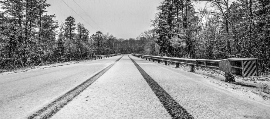
Main Image Credit: Today some snow happened by Greg Molyneux Photography
Model Images Credit: Tropical Tidbits
Jonathan Carr (JC) is the founder and sole operator of Weather NJ, New Jersey’s largest independent weather reporting agency. Since 2010, Jonathan has provided weather safety discussion and forecasting services for New Jersey and surrounding areas through the web and social media. Originally branded as Severe NJ Weather (before 2014), Weather NJ is proud to bring you accurate and responsible forecast discussion ahead of high-stakes weather scenarios that impact this great garden state of ours. All Weather. All New Jersey.™ Be safe! JC


LOCAL FORECAST | INTERACTIVE RADAR | LATEST NJ WEATHER ALERTS | WEDDING FORECAST| PRIVACY POLICY
© Copyright 2026 Weather NJ LLC. All Rights Reserved.
Some information that can be found on our website is provided by a private weather station and is not an officially recognized station for weather reporting. Though we always strive to achieve accurate reporting for our own use, it is important that you do NOT depend on the data provided here for any purpose.
