

Dec 3: Coastal Storm Approaching
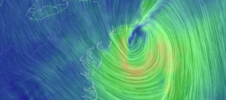
Discussion: In yesterday’s article we discussed how an Upper Level Low (ULL) in the interior SW US was handing a piece of energy off to the ULL over SE Canada/NE US. This expected transformation of cyclonic energy has not changed. What I’m seeing today is unfavorable timing for the snowier situation. The energy handoff would need to phase in with the northern branch about 3-6 hours earlier than today’s models are indicating.
This morning’s 12Z NAM did it and dropped 2-4 inches of snow on most of NJ in a deformation band area behind the low. However, this evening’s model guidance has trended away from that back towards a later phase. Given the progressive nature of the steering currents, there just wouldn’t be enough time for anything significantly wintry to happen on the back side. It might go on to drop some snow in New England but too fast and too late for most of NJ.
We still have, however, phasing upper level energy and a surface low that will eject into the Atlantic near Virginia/Delmarva latitude and track near the 40N/70W benchmark. This is still going to produce about 1-2 inches of liquid precipitation for much of NJ, moderate winds for the coast, and possible minor coastal flooding for the ocean-facing coasts of ECNJ/SENJ.
Rain should gradually move in, likely NNJ first, from noon tomorrow (Friday) and forward. Rain should fill in for the rest of NJ by Friday evening and peak overnight into Saturday morning. If any snow is going to happen, it will be Saturday morning on the backside of the low. Such snow would be dependent on heavy precipitation rates bringing colder air to the surface. This is risky business forecasting-wise and therefore this system ending with snow accumulation is a wildcard at this point. There’s a better chance of precipitation ending as a mix of non-accumulating snow and rain between Saturday morning and noon on Saturday.
For the snowier outcome we would really need the northern branch to drop/dig southward earlier than modeled. This would bring the cold with it and slow the surface low track enough to accumulate. We’re just not there.
The biggest hazard of this system remains wind gusts especially for immediate coastal regions. Model guidance is still suggesting gusts of 40-60mph right along the ocean with slightly lesser values for the rest of NJ inland. Such winds could cause power outages from downed branches, trees, etc. Coastal flooding potential remains minor.
In English: Rain should gradually start by Friday afternoon and end by late Saturday morning. Peak rainfall intensity should occur during AM hours of Saturday. 1-2 inches of rain are possible when all is said and done with a small chance of rain ending as conversational, non-accumulating snowfall. Winds could crank pretty good for coastal regions of ECNJ/SENJ during Saturday AM hours with lesser values inland. Minor coastal flooding is possible for the same areas. The rest of Saturday and Sunday look cold and dry with breezy/gusty NW winds gradually subsiding. The cold pattern should last well into next week. Have a great night and please be safe! JC
Download the free Weather NJ mobile app on Apple or Android. It’s the easiest way to never miss Weather NJ content. Our premium services go even further above and beyond at the hyper-local level. Get your merch on at the KABOOM shop in time for the holidays.
Jonathan Carr (JC) is the founder and sole operator of Weather NJ, New Jersey’s largest independent weather reporting agency. Since 2010, Jonathan has provided weather safety discussion and forecasting services for New Jersey and surrounding areas through the web and social media. Originally branded as Severe NJ Weather (before 2014), Weather NJ is proud to bring you accurate and responsible forecast discussion ahead of high-stakes weather scenarios that impact this great garden state of ours. All Weather. All New Jersey.™ Be safe! JC


LOCAL FORECAST | INTERACTIVE RADAR | LATEST NJ WEATHER ALERTS | WEDDING FORECAST| PRIVACY POLICY
© Copyright 2026 Weather NJ LLC. All Rights Reserved.
Some information that can be found on our website is provided by a private weather station and is not an officially recognized station for weather reporting. Though we always strive to achieve accurate reporting for our own use, it is important that you do NOT depend on the data provided here for any purpose.
