

Jan 4: AM Winter Storm Update
Discussion: The storm has and is still rapidly intensifying. Current central low pressure is 965mb. While over 300 miles to our E, the center of the storm is still S of our latitude.
Over the next 6-9 hours the low will track to the NE just outside of the 40N/70W benchmark. Wind direction should rock from N/NE to the N as this occurs while precipitation persists. Once the low gets N of our latitude the wind direction will rock from N to N/NW. At that point snow will taper off from SW to NE across New Jersey.
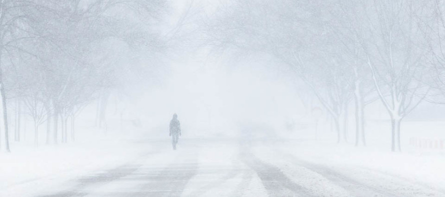
Winds are very noticeable now and I’m not surprised given the rapid intensification of the low. High winds will persist into tomorrow as extremely cold air filters in behind this departing storm. Therefore the wind chills should be no joke tonight and tomorrow. You should expect the coldest air mass we’ve seen yet this winter through the weekend.
I would expect current conditions to continue through the afternoon and possibly into the early evening. I don’t see any reason to make chances to the forecast at this point. We went 9-12+ for the SENJ jackpot for a reason. The + will likely verify for many SNJ shore points.
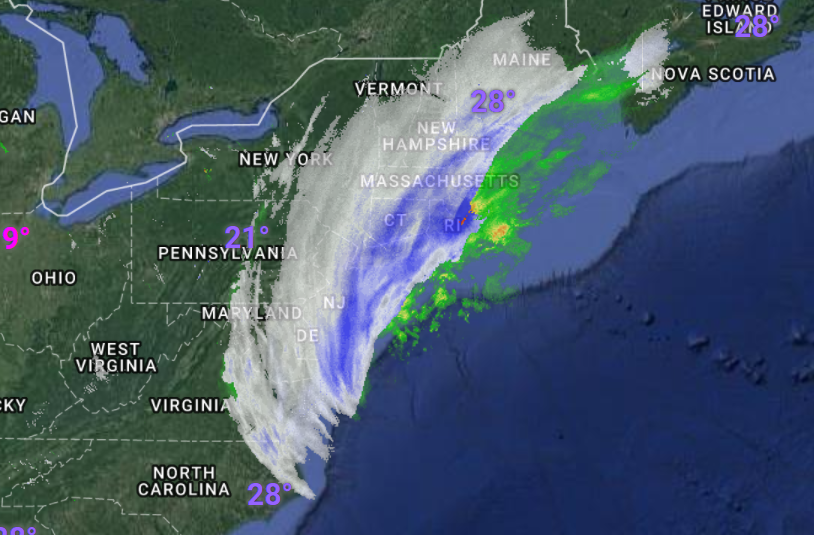
Coastal flooding should stay within minor stage. As I mentioned last night, coastal flooding would be much worse if we had a direct E onshore flow. The northerly winds work in favor of preventing higher stages of flooding. They come at the cost of power outages however.
In English: No changes to the current forecast. I would like to point out that the plus will likely be realized for some of our 9-12+ zone. It’s very hard to measure snowfall accumulations with bear-blizzard/blizzard conditions…lots of drifting. Snow should wrap up from SW to NE between late-afternoon and early-evening. Winds will stay strong and gusty generally out of the N through tomorrow. Dangerously low temperatures and wind chills are expected. This weekend should feature the coldest air yet of the season followed by a temperature moderation for next week. Stay warm and be safe! JC
For comprehensive and interactive hyper-local analysis that goes way above and beyond the detail of this public forecast, check out our premium services which include text notifications and premium forum access.
Jonathan Carr (JC) is the founder and sole operator of Weather NJ, New Jersey’s largest independent weather reporting agency. Since 2010, Jonathan has provided weather safety discussion and forecasting services for New Jersey and surrounding areas through the web and social media. Originally branded as Severe NJ Weather (before 2014), Weather NJ is proud to bring you accurate and responsible forecast discussion ahead of high-stakes weather scenarios that impact this great garden state of ours. All Weather. All New Jersey.™ Be safe! JC


LOCAL FORECAST | INTERACTIVE RADAR | LATEST NJ WEATHER ALERTS | WEDDING FORECAST| PRIVACY POLICY
© Copyright 2025 Weather NJ LLC. All Rights Reserved.
Some information that can be found on our website is provided by a private weather station and is not an officially recognized station for weather reporting. Though we always strive to achieve accurate reporting for our own use, it is important that you do NOT depend on the data provided here for any purpose.
