

Dec 4: Coastal Storm Update
Model guidance continues to spray a wide variety of solutions for the possible coastal storm early next week. The timing now looks like Monday night into possibly Wednesday but again, that can drift up to a day earlier or later as we approach. The key takeaway point here is that a storm is showing. The first part of the equation is the track of the storm system and that will have primary focus in the next few days.
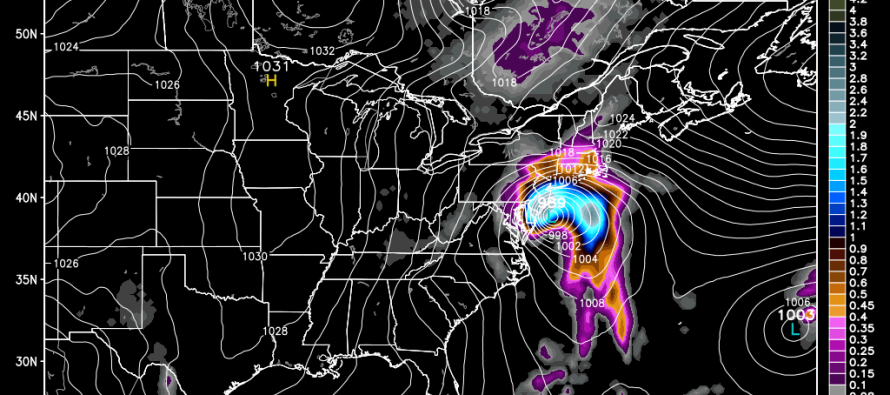
This possibility involves a cut off low from the northern stream and a surface low that forms off the SE US coast. Depending on how much these systems interact will determine the track and that’s what I’m currently watching. While snow is a small possibility away from the ocean, the main concern here is coastal impact which includes beach erosion and flooding from possible storm surge, especially during high tides. The reason that’s my primary concern is because of duration. This is the Canadian showing 850mb pressure and precipitation. It shows a strong low positioned off the Jersey Shore for a period of rain and winds that lasts almost 36 hours:
Monday night into early Tuesday:
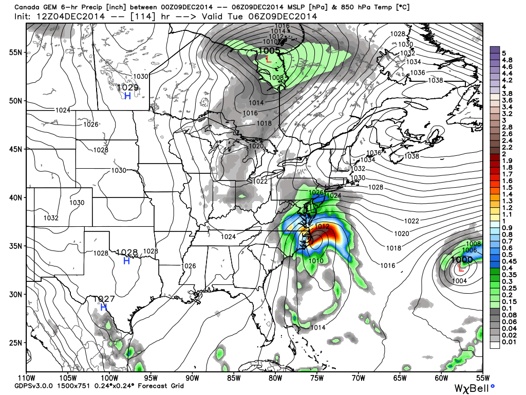
Tuesday Afternoon:
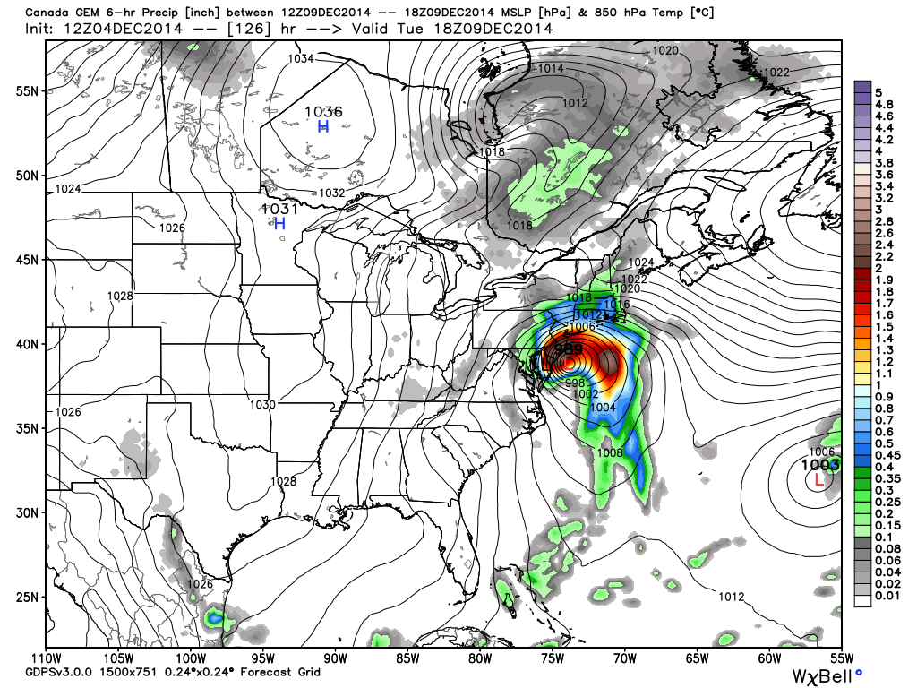
Tuesday Night:
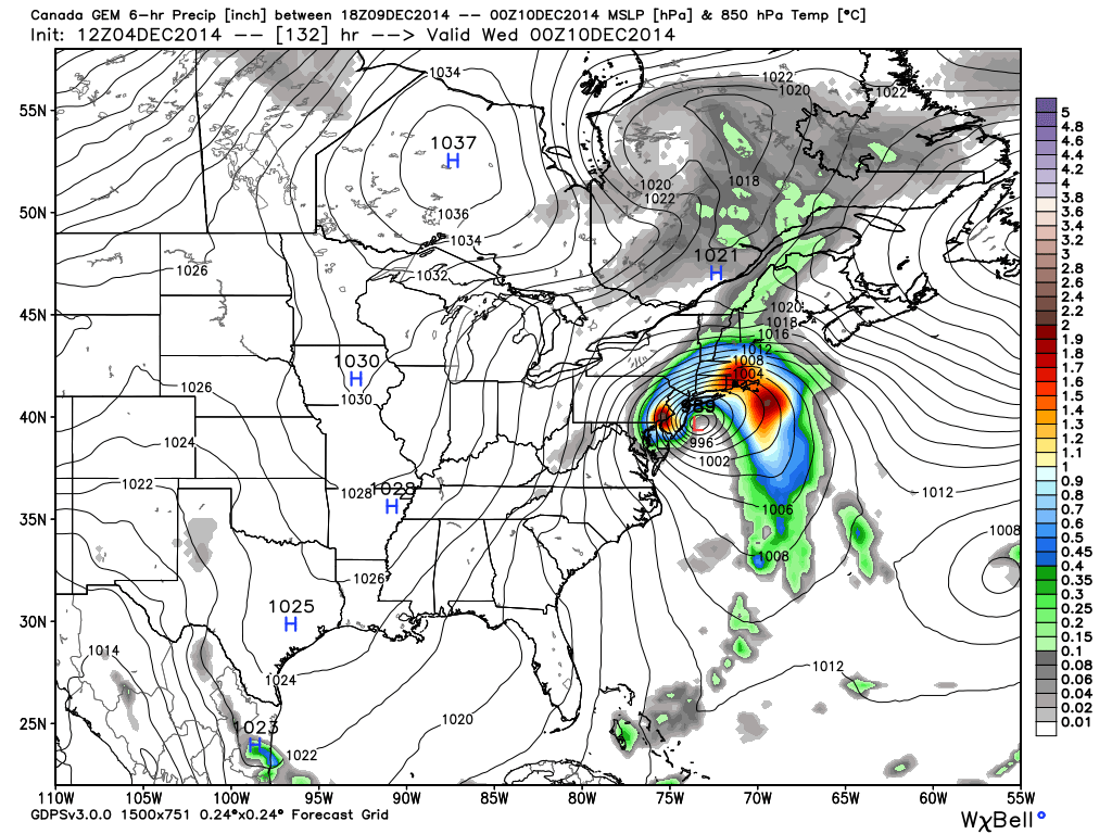
Wednesday Morning
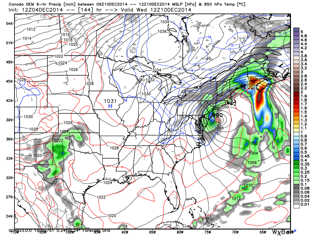
As currently modeled on the Canadian, the system finally pulls away by Wednesday afternoon. The GFS has the storm but further east and out to sea (expected bias of the model at this range). Unfortunately most of your point and click web/app forecasts are generated off the GFS. I wish I had a dime every time some said “but the 10-day forecast says warm and sunny.” The European and UK models are in agreement with the Canadian but have a slightly faster solution that’s gone by Wednesday morning. That would be a more ideal situation in regards to coastal flooding. Model mayhem continues…
In English: A long period (Monday night through Wednesday afternoon) of rain and wind is possible for New Jersey. Greatest impact would be along the coast. Very little snow is modeled with this system. If that’s going to happen it will be further away from the coast and maybe even W/NW of New Jersey. Be safe! JC
All model image graphics used with permission from Ryan Maue of WeatherBell Analytics.
Jonathan Carr (JC) is the founder and sole operator of Weather NJ, New Jersey’s largest independent weather reporting agency. Since 2010, Jonathan has provided weather safety discussion and forecasting services for New Jersey and surrounding areas through the web and social media. Originally branded as Severe NJ Weather (before 2014), Weather NJ is proud to bring you accurate and responsible forecast discussion ahead of high-stakes weather scenarios that impact this great garden state of ours. All Weather. All New Jersey.™ Be safe! JC


LOCAL FORECAST | INTERACTIVE RADAR | LATEST NJ WEATHER ALERTS | WEDDING FORECAST| PRIVACY POLICY
© Copyright 2026 Weather NJ LLC. All Rights Reserved.
Some information that can be found on our website is provided by a private weather station and is not an officially recognized station for weather reporting. Though we always strive to achieve accurate reporting for our own use, it is important that you do NOT depend on the data provided here for any purpose.
