

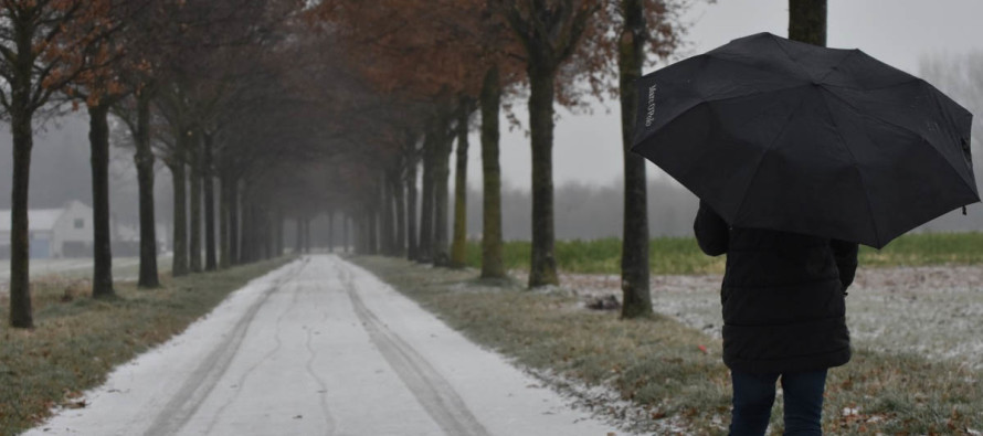
Dec 5: Talking Snow
Discussion: Let’s talk about the first frontal passage real quick. Precipitation is likely just ahead and along the cold front this evening into tomorrow morning. I’m expecting most of this precipitation to fall as rain overnight however the last part of it tomorrow morning could change over to sleet and/or a snow. I’m not expecting accumulations from this tomorrow morning, more of a conversational “wintry tapering off” away from the ocean. NWNJ would be favored for such over SENJ.
Currently we’re seeing SW flow ahead of the cold front which is the culprit for milder temperatures. Once the front is through tomorrow, winds will switch to the NW (maybe W/NW) and temperatures will fall slightly for Wednesday through Friday with colder and drier flow. You might notice that Wednesday and Thursday afternoon high temperatures are expected to reach above-freezing for many and even near-50 for SENJ. Overnight low temperatures however will likely fall below freezing for most of the state Wednesday and Thursday night with SENJ hanging slightly above-freezing.
Friday and Saturday temperatures are expected to take another shift colder. For this period I expect those NW of I-95/NJTP to struggle escaping the 30s for afternoon highs with overnight lows dipping into the teens/20s. For those SE of I-95/NJTP, I expect afternoon highs to top out near-40 with overnight low temperatures dropping to near-freezing. A weak coastal low (more like just a wave) will be passing by in the ocean. The latest model guidance suggests that precipitation from this low could make it far enough to the NW to bring mixed-precipitation to parts of New Jersey. Right now, SENJ is favored over NWNJ. Therefore I’m not expecting much of anything to extend NW beyond I-95/NJTP. I’m also expecting the immediate coast to hang at or just above freezing during precipitation. It is important to note that this possibility could stay just offshore, inhibiting the precipitation shield to make it far enough NW to reach NJ off the ocean. We still have some time to track.
This means that the immediate coast from Sandy Hook down through Cape May and around the Delaware Bay is subject to a mix of snow and rain with little accumulation. This also means that there will likely be a sharp cut-off in precipitation around I-95/NJTP. Lastly, it means that the area between I-95/NJTP and the immediate coast (areas like W Ocean County, E Burlington County, W Atlantic County for example) are best-positioned to possibly see light accumulations. This kind of snowfall would likely be low-ratio wet snow. Therefore I wouldn’t expect much road disruption (slushy coating at most) however natural surfaces could possibly do better. With that said, between about 7PM Friday evening and 7AM on Saturday morning, a conversational-to-mildly disruptive light/wet snow event is possible. I’ll discuss this in more detail as we closer approach.
After this Friday-Saturday wave moves through, temperatures will take another shift even colder for next week. This should be a prolonged-duration of Arctic-influenced air. The upper-levels suggest that a piece of the polar vortex energy will break off and influence a few weak clipper-like systems at the very least. The lake-effect snow machine should also be turned on. With that said we should at least expect a few trace/light snow events next week into next weekend. No major synoptic winter storms are currently modeled but one cannot ignore the favorable pattern for winter storm development. Basically, we could be looking at a pretty wild December/start to winter. I’ll take each reasonable forecasting period at a time.
In English: Expect rain between this evening and tomorrow morning. Rain could end as snow away from the ocean tomorrow morning since a fairly strong cold front is behind it all. Little-to-no accumulations are expected from this. We’re then slightly colder Wednesday and Thursday but not as cold as what’s coming soon. Friday into Saturday should be even colder and could feature wintry precipitation for SENJ (SE of I-95/NJTP). This is a weak event so not expecting significant accumulations from this either. If it pans out as modeled however it would be more than what anyone sees tomorrow morning from the cold front. The immediate coast might be too warm for snow to stick at all but areas just away from the ocean could see a sloppy trace/light event IF, and only IF, the precipitation shield makes it far enough NW off the ocean. I’ll be watching this closely. Areas NW of I-95/NJTP are likely too far NW for any precipitation at all. We then turn even colder Sunday-forward with various light snow events possible next week into next weekend (lake-effect snow and a few clippers). Nothing big is on the table as of right now but this next week should be a conversational start to winter, at the least. if a bigger storm pops up, you know I’ll be on it. The bottom is that the cold is guaranteed but the snow is iffy through this weekend. Be safe! JC
For comprehensive and interactive hyper-local analysis that goes way above and beyond the detail of this public forecast, check out our premium services.
Jonathan Carr (JC) is the founder and sole operator of Weather NJ, New Jersey’s largest independent weather reporting agency. Since 2010, Jonathan has provided weather safety discussion and forecasting services for New Jersey and surrounding areas through the web and social media. Originally branded as Severe NJ Weather (before 2014), Weather NJ is proud to bring you accurate and responsible forecast discussion ahead of high-stakes weather scenarios that impact this great garden state of ours. All Weather. All New Jersey.™ Be safe! JC


LOCAL FORECAST | INTERACTIVE RADAR | LATEST NJ WEATHER ALERTS | WEDDING FORECAST| PRIVACY POLICY
© Copyright 2026 Weather NJ LLC. All Rights Reserved.
Some information that can be found on our website is provided by a private weather station and is not an officially recognized station for weather reporting. Though we always strive to achieve accurate reporting for our own use, it is important that you do NOT depend on the data provided here for any purpose.
