

Dec 7: Here Comes Winter!
The incoming cold air is certain. In addition, a few snow possibilities are starting to show between now and Christmas. Let’s break it down…
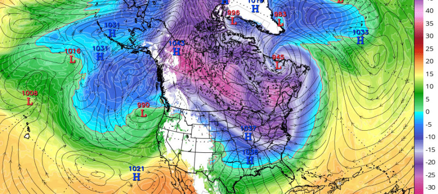
First let’s talk about the incoming cold air mass. This will be the coldest air of the second half of 2016. For interior NJ, especially elevations, this likely means highs in the 30s/lows in the teens. For SNJ and the immediate coastal areas, this likely means highs struggling to break 40/lows in the 20s. While it’s not record-breaking cold, the strong NW winds are going to send wind chills right through your hoodies and jeans upon arrival. Friday looks like the windier day. Once the air mass halts advancement and rocks over our area, winds should subside. So Friday could feel colder from wind chills but Saturday and Sunday would likely drop colder overnight due to relaxed winds and clear skies. Either way, we’re likely cold Thursday night through Sunday. Get the coats/winter gear out and make sure your heating system is in working order.
Now let’s talk about the Dec 11-12 possibility (this Sunday-Monday). I’ve been noticing a colder trend in model guidance over the last 24-48 hours. The latest 18Z GFS now has the 850mb line failing to come N of even Cape May. Prior runs showed this reaching just north of Sussex County. So I think we’re going to be cold enough to support wintry precipitation types under higher intensity precipitation. 500mb thickness is a bit on the higher side of where I’d like to see it but we know the surface will be cold. We have a weak low tracking through the Great Lakes in collaboration with departing high pressure. This should provide some southerly return flow but I just don’t see our area warming as guidance suggests verbatim. The low could then redevelop off the Mid-Atlantic Coast behind the departing high. Elevations are likely a green light for snow. SNJ and the immediate coast are subject to warmer SST especially with any onshore or southerly wind component. This could be the first system however that takes accumulations down into the I-95 corridor. We need to watch the coastal re-development to see whether this system will be a light event or something more moderate.
Let’s move on to next week. I’m far from confident on any particular solution but it does appear like something is going to happen, especially with the intrusion of an even colder air mass than this coming weekend. However, the dynamics of SW flow ahead of a cold front can be real tricky. I simply need to see more guidance and live observations of the E Pacific/Arctic regions before committing to anything beyond the Dec 11-12 system. It is noteworthy however that models are flirting with Dec 14-15 and Dec 17-18 as stormy/unsettled periods with our second Arctic shot of cold air surrounding that general period of Dec 14-18.
Check out the My Pocket Meteorologist premium services by clicking the image just below…a must for snow removal business or anyone who needs real-time text alerts before and during a snow storm. These premium services go far above and beyond what has always been and will always be offered here for free.

In English: This weekend is going to be very cold statewide so bundle up from Friday-Sunday. Watch out for any lake-effect flurries or flizzards in this period. Sunday into Monday could feature another system with NWNJ favored over SENJ for snow but colder than the two systems we saw this week. With that said, the snow/rain line could come down to the I-95 corridor and possibly even SE of that. SNJ and immediate coastal areas would likely be just on the warm side and be subject to cold rain or a mix. I’ll be watching this closely over the next few days. Next week we should see another Arctic cold shot with even more snow possibilities. Let’s get through the weekend first. Regardless, there are lots of cold and snowy possibilities between now and Christmas—naturally elevating the hype of a White Christmas. I’d say those along and NE of I-95 have a decent chance while those SE of such might need to wait until January-February. We’ll see. Let’s take it one mid-range forecasting period at a time. Have a great night, get your winter clothes ready and be safe! JC
Jonathan Carr (JC) is the founder and sole operator of Weather NJ, New Jersey’s largest independent weather reporting agency. Since 2010, Jonathan has provided weather safety discussion and forecasting services for New Jersey and surrounding areas through the web and social media. Originally branded as Severe NJ Weather (before 2014), Weather NJ is proud to bring you accurate and responsible forecast discussion ahead of high-stakes weather scenarios that impact this great garden state of ours. All Weather. All New Jersey.™ Be safe! JC


LOCAL FORECAST | INTERACTIVE RADAR | LATEST NJ WEATHER ALERTS | WEDDING FORECAST| PRIVACY POLICY
© Copyright 2025 Weather NJ LLC. All Rights Reserved.
Some information that can be found on our website is provided by a private weather station and is not an officially recognized station for weather reporting. Though we always strive to achieve accurate reporting for our own use, it is important that you do NOT depend on the data provided here for any purpose.
