

Dec 8: Blowtorch Detected
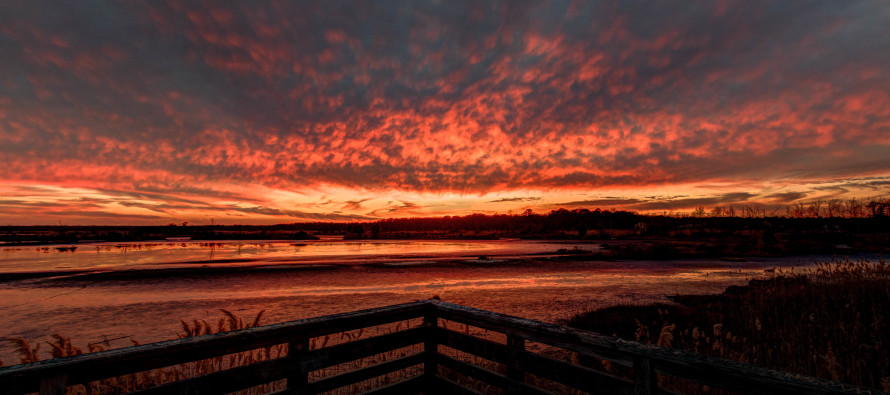
I took this photo just a few hours ago and it reminds me of blowtorch fire—which is what this weekend’s temperatures will feel like for December. First, hats off to Sunset Wx for calling another great sunset…these guys are good! They do sunrise and sunset models and so far I’ve found them to be very accurate.
It appears that high pressure will set up near Bermuda this Saturday-Monday. The anti-cyclonic flow of that high pressure’s western side should help bring very mild temperatures for this time of year to the region…hence the blowtorch. Here’s some supporting model guidance of the developing east coast ridge (latest GFS showing 850mb (~5000ft) temperatures in degrees C)…a snapshot of Sunday afternoon:
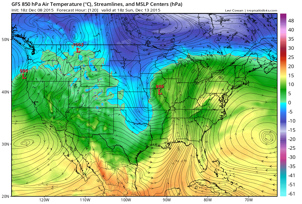
Temperatures should gradually increase each day heading into the weekend but should peak in the Saturday-Monday period. Eventually a cold front should come through by Tuesday but until then, blowtorch from the south. Notice the 989mb low in NE Missouri? That will assist the blowtorch from the south with the eastern side of its cyclonic flow, working in-tandem with with high near Bermuda.
In English: Expect daily temperatures to slowly climb heading into the weekend. Then expect very mild conditions Saturday through Monday. Highs should easily get into the 60s for most. The mild temperatures should then recede on or by Tuesday but still likely above average. Be safe! JC
Jonathan Carr (JC) is the founder and sole operator of Weather NJ, New Jersey’s largest independent weather reporting agency. Since 2010, Jonathan has provided weather safety discussion and forecasting services for New Jersey and surrounding areas through the web and social media. Originally branded as Severe NJ Weather (before 2014), Weather NJ is proud to bring you accurate and responsible forecast discussion ahead of high-stakes weather scenarios that impact this great garden state of ours. All Weather. All New Jersey.™ Be safe! JC


LOCAL FORECAST | INTERACTIVE RADAR | LATEST NJ WEATHER ALERTS | WEDDING FORECAST| PRIVACY POLICY
© Copyright 2026 Weather NJ LLC. All Rights Reserved.
Some information that can be found on our website is provided by a private weather station and is not an officially recognized station for weather reporting. Though we always strive to achieve accurate reporting for our own use, it is important that you do NOT depend on the data provided here for any purpose.
