

Dry and Mild leads to Stormy then Colder
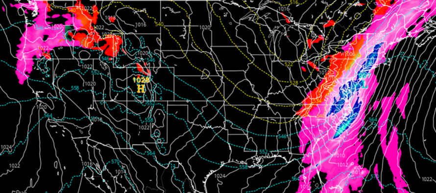
Discussion: A decent transition from dry and mild to stormy and cold will take place between now and Monday. Weekend conditions will initially be dominated by a ridge covering most of the E US (northern 2/3). This makes the forecast very easy. Dry and mild until a frontal system pushes through NJ between Sunday PM and Monday AM. This frontal system should bring moderate-to-heavy rain and moderate winds at times. It will likely see its own low ride the front and enhance the rainfall. It will lead a weak/shallow trough into the region for a colder next week as the upper flow relaxes into a zonal pattern. While temps next week will be on the colder side, they should still be a little above average for this time of year. The next precipitation event after this Sunday-Monday’s frontal system is showing up in the Dec 17-19 period. A storm signal gaining consistency on models but in an overall environment too mild for snow. I will be watching that closely in case a colder solution evolves (from adiabatic cooling/cut-off upper low/trough tilt/etc.). But as modeled right now verbatim, a rainy nor’easter-like system. After that, the super long-range signals are indicating something to watch for Dec 23. But I won’t do anything more than mention the general signal for now. Enjoy the milder weekend until the rain pushes in by early Sunday afternoon. Sunday morning/early-afternoon should spike into the 60s as the warm sector flow maxes ahead of the front. A much different colder feel Monday morning.
Friday (Dec 8) high temperatures are maxing in the low-to-mid 50s for most NJ locations. Skies are mostly sunny and it feels milder after the recent colder conditions. Winds should remain light out of the S/SE as overnight low temperatures range from 30-45 from NNJ elevations to SNJ coasts.
Saturday (Dec 9) high temperatures should reach the low-to-mid 50s for most NJ locations, maybe slightly higher in SNJ away from the ocean. Skies should be mixed with sun and clouds. Winds should be light out of the S/SE. Overnight lows should range from 35-50 from NNJ elevations to SNJ coasts.
Sunday (Dec 10) high temperatures should spike into the lower-60s during morning/early afternoon hours. Skies should be mostly cloudy by the time the sun rises or at least be filling in through mid-to-late morning with SW winds. Periods of moderate-to-heavy rain should push into NJ from W to E as early as late-morning/noon-ish…but likely by 2pm. Winds could be gusty, especially during the heaviest rainfall and afterwards with the cold front. Rain and wind should persist overnight, ending by sunrise Monday morning—as overnight temps fall to around 40 for most NJ locations.
An early look at next week indicates a cold windy start Monday. Most of next week looks colder with highs in the 40s and lows in the 20s/30s. Not frigid but cold. Not seeing any precipitation until a storm signal showing up for Dec 17-19 (Sunday-Tuesday). Looking just too warm for wintry precip at the moment but I will be watching this in case more cold air gets involved. Pretty strong coastal storm showing though and for a few runs now. Next signal after that is around Dec 23. Two periods to watch. Have a great weekend and please be safe! JC
Premium Services
KABOOM Club offers inside info forecast discussion, your questions answered, and early storm impact maps (ahead of the public). At a buck per month, it’s an extremely feasible way to show support.
My Pocket Meteorologist (MPM), in partnership with EPAWA Weather Consulting, offers professional/commercial interests, whose businesses depend on outdoor weather conditions (snow plowing, landscaping, construction, etc.), with hyper-local text message alerts/forecasts and access to the MPM premium forum—the most comprehensive and technical forecast discussion available for PA and NJ.
Get your KABOOM Inside Out pajamas and more at the KABOOM shop!
Jonathan Carr (JC) is the founder and sole operator of Weather NJ, New Jersey’s largest independent weather reporting agency. Since 2010, Jonathan has provided weather safety discussion and forecasting services for New Jersey and surrounding areas through the web and social media. Originally branded as Severe NJ Weather (before 2014), Weather NJ is proud to bring you accurate and responsible forecast discussion ahead of high-stakes weather scenarios that impact this great garden state of ours. All Weather. All New Jersey.™ Be safe! JC


LOCAL FORECAST | INTERACTIVE RADAR | LATEST NJ WEATHER ALERTS | WEDDING FORECAST| PRIVACY POLICY
© Copyright 2026 Weather NJ LLC. All Rights Reserved.
Some information that can be found on our website is provided by a private weather station and is not an officially recognized station for weather reporting. Though we always strive to achieve accurate reporting for our own use, it is important that you do NOT depend on the data provided here for any purpose.
