

Dude Where’s my Trash Cans?
Discussion: Ok all small human beings need to listen up. Thursday into Friday could be a rough night wind-wise. Let’s break it down into phases:
Phase I: The Warm Sector Rip – NJ will be in the warm sector for all of Thursday…fed by a Bermuda high return flow and reinforced by a low that will track well to the NW of NJ. For these reasons, expect a very mild feel on Thursday (near-50 to near-60 from N to S). It looks mostly cloudy though. The sun might peak through in a few spots but overcast skies are more likely. The wind direction should be S/SW for most of Thursday. Winds should pick up between morning and afternoon hours and really start howling by evening. Any rain should be light/misty as the main slug doesn’t come through until likely after midnight (early Friday AM). Wind gusts for this phase will be felt harder for coastal areas. 40-60mph (maybe higher) seems like a realistic wind gust range and again, out of the S/SW. A warm front, attached to the low, should pass through from SW to NE just after midnight which could actually drive temperatures even warmer than they were during the day on Thursday before the cold front comes through.
Phase II: The Cold Front – At some point between early and late Friday morning, the actual cold front, attached to the low, should push through NJ from NW to SE. Let’s call it from 4am to 9am from NWNJ to SENJ. This should be a few-hour period when rainfall could become moderate-to-heavy. You might even see some boomers or hail with it (SNJ favored over NNJ). But it doesn’t seem like a frequent light show, more of a boomers here and there kind of thing. If any winds are going to spin, it would be along/just ahead of the cold front (this phase). Winds should transition from S/SW to NW right along the front and thunderstorms could produce their own gusty conditions separate from the warm sector. But for many, winds will lessen by the end of the frontal rain. Again, expect the warmer temp feel to last right up until the cold front hits you. It could still be 50F+ in many locations after midnight and through the first half of Friday AM.
Phase III: Listen to the Wind Blow. Watch the Sun Rise – Once the front is through (by mid-morning for most), straight-line winds should unify out of the NW in direction with lesser speeds. Sustained winds of 15-25mph with gusts in the 25-35mph range seems realistic for Friday through afternoon hours before subsiding for Friday night. These NW winds should prevent Friday from breaking out of the 30-40 range for afternoon temperatures. If you see a high of 60 for Friday on your apps, that’s happening in the first 6 hours of the day. Temperatures should then drop into the 20s statewide Friday night into Saturday morning.
Why could the winds be a little crazy Thursday PM-Friday AM? First, an upper-level disturbance is digging into Arizona and kicking another just ahead of it from Texas up through the Great Lakes. It’s creating a positive vorticity advection zone favorable for lifting and expansion. This allows mid-to-upper level wind currents (jet streams) to amplify. I don’t want to scare anyone but winds just 5,000ft up should be 80-100mph. And it gets even crazier as you increase altitude. 30,000 feet up you’re looking at 150mph. These upper dynamics enhance lifting (for precipitation). The lifting will then want to balance out with sinking and those are the meteorological forces that can bring a fraction of those high values down to the surface for damaging surface winds gusts in excess of 60mph. I do see a temperature inversion on soundings however in the 800-850mb layer. This could help moderate the downward propagation of the 60mph+ stuff and keep more areas in the 40-60mph wind gust range. We’ll see. But I do think phase I will have the strongest winds prior to the frontal passage.
After temperatures moderate by the end of the weekend/early next week, colder conditions should return before February closes out. Last week’s long-range model guidance suggested a warm rest of February into March. The end of February is looking a little colder now. This is exactly why I take every 7 days at a time and see the entre winter as a 9-inning baseball game. We’re still in the 6th about to head into 7th around President’s day. 3 innings left where any player could hit one out of the park. These milder snaps have been pleasant but winter is not over.
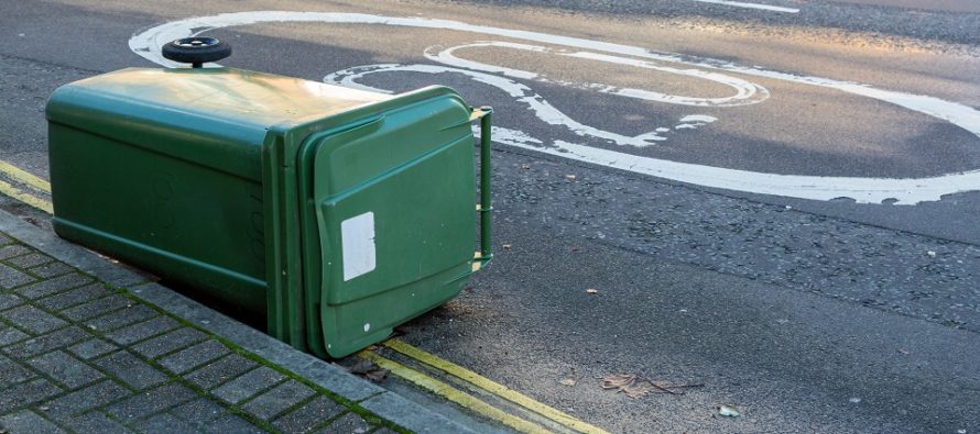
In English: Thursday should feel very mild after recent times. Skies should be overcast and winds should pick up throughout the day. By Thursday evening (let’s call it sunset), winds should intensify and howl overnight into Friday. Winds could reach damaging values (in excess of 60mph), especially along the coast, but most should see at least 40-60mph. Not much rainfall on Thursday, just increasing winds. Moderate-to-heavy rainfall is then likely, possibly thunderstorms, early Friday morning followed by stiff/gusty NW winds behind the cold front lasting into Friday afternoon/early evening. I recommend securing small items, trash cans, pets, and of course small human beings for the approaching high winds. Friday night into Saturday morning will be quite a different feel with temps down into the 20s. We then moderate some over the weekend and spike back into the 50s/60s again early next week. It then looks like the wintry cold should return before March 1 instead of after. Have a great Thursday and please be safe! JC
Jonathan Carr (JC) is the founder and sole operator of Weather NJ, New Jersey’s largest independent weather reporting agency. Since 2010, Jonathan has provided weather safety discussion and forecasting services for New Jersey and surrounding areas through the web and social media. Originally branded as Severe NJ Weather (before 2014), Weather NJ is proud to bring you accurate and responsible forecast discussion ahead of high-stakes weather scenarios that impact this great garden state of ours. All Weather. All New Jersey.™ Be safe! JC


LOCAL FORECAST | INTERACTIVE RADAR | LATEST NJ WEATHER ALERTS | WEDDING FORECAST| PRIVACY POLICY
© Copyright 2026 Weather NJ LLC. All Rights Reserved.
Some information that can be found on our website is provided by a private weather station and is not an officially recognized station for weather reporting. Though we always strive to achieve accurate reporting for our own use, it is important that you do NOT depend on the data provided here for any purpose.
