

Feb 1: SNJ Express Arriving
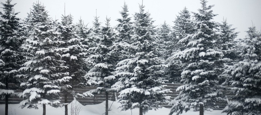

Discussion: A clipper system is approaching from the W and targeting SNJ. These systems are generally moisture-starved as they originate from colder streams of energy and travel across the N US towards NJ through very dry air. However the snowfall that does make it to the ground is very light and fluffy. With the melting aspect completely removed the snow stacks up higher than it would in an environment closer to 32F. Most snowfall today should fall with a surface temperature between 18-22F. And obviously temperature decreases with altitude especially up into the key dendrite growth zone.
The system has trended back and forth on model guidance all week. Yesterday morning it almost dropped-off completely. Last night and overnight/morning guidance has trended back to showing it. It was never a major snow storm. However I think SNJ has the chance for solid light accumulations especially extreme SNJ. If anyone is going to see that it will be S of the line drawn from Philadelphia to Toms River maybe even Wilmington to Manahawkin.
Once this system finishes up by this evening the rest of the weekend looks pretty good as the ridge starts to build for next week. Next week looks very above-average for temperatures while under the ridging. The furthest I can see out is about next weekend when the milder temperatures should begin relaxing. The colder air will likely return with increased blocking in the Feb 8-12 period. From now until then it’s a NJ snow lover’s nightmare or snow hater’s piece of mind.
In English: Snow is moving into SNJ from the W. It is already hitting the ground in some locations. This should continue through afternoon hours and wrap up by early evening at the latest. It’s a fast mover but could throw down light accumulations very quickly. I expect anything from a coating to an inch or two for the N part of SNJ. Let’s call that Burlington, Ocean, Camden and Gloucester Counties. I expect 1-3 inches for Salem, Cumberland, Atlantic and Cape May Counties. Cape May, Cumberland and Atlantic Counties would have the best shot at exceeding 3 inches. The rest of the weekend looks better. Milder temperatures for Saturday and Sunday but still somewhat cold. 30s and 40s should feel amazing after this crap. Next week be bake in above-average temperatures but should return to a colder pattern starting next weekend. Download the new free Weather NJ mobile app on Apple and/or Android. It’s the easiest way to never miss Weather NJ content. Have a great weekend and please be safe! JC
Jonathan Carr (JC) is the founder and sole operator of Weather NJ, New Jersey’s largest independent weather reporting agency. Since 2010, Jonathan has provided weather safety discussion and forecasting services for New Jersey and surrounding areas through the web and social media. Originally branded as Severe NJ Weather (before 2014), Weather NJ is proud to bring you accurate and responsible forecast discussion ahead of high-stakes weather scenarios that impact this great garden state of ours. All Weather. All New Jersey.™ Be safe! JC


LOCAL FORECAST | INTERACTIVE RADAR | LATEST NJ WEATHER ALERTS | WEDDING FORECAST| PRIVACY POLICY
© Copyright 2025 Weather NJ LLC. All Rights Reserved.
Some information that can be found on our website is provided by a private weather station and is not an officially recognized station for weather reporting. Though we always strive to achieve accurate reporting for our own use, it is important that you do NOT depend on the data provided here for any purpose.
