

Feb 1: Winter Storm Update
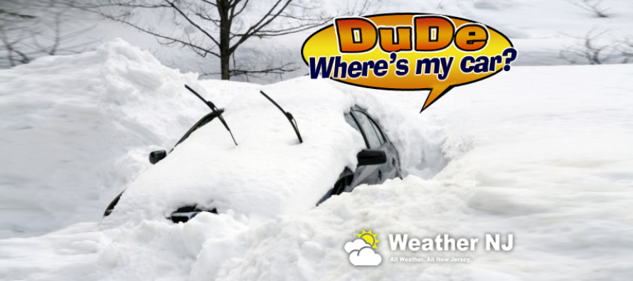
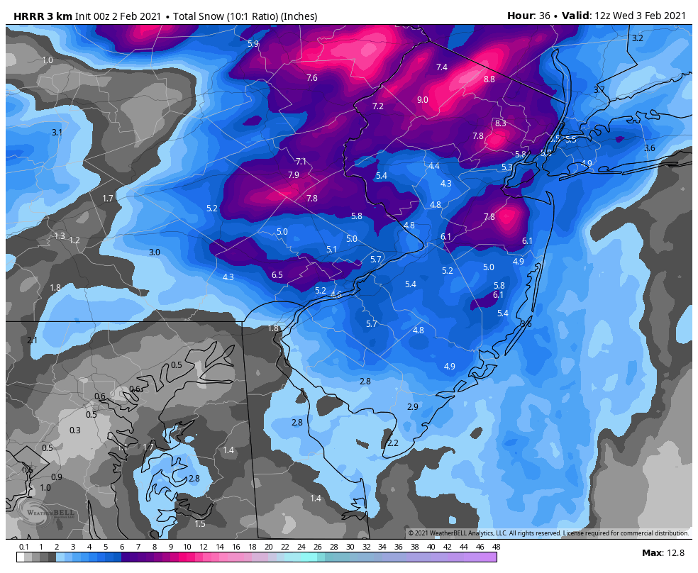
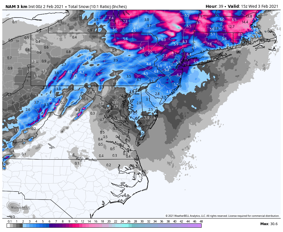
Discussion: This is quite a winter storm. I’m upgrading NNJ to DUDE WHERE’S MY CAR? status. There’s no doubt in my mind that areas up that way exceed 24” of total storm snow accumulation in many spots. Some of you are almost there now. Most of CNJ is already a solid KABOOM. SNJ has had it’s expected issues so far but has a decent amount of snowfall left in the third and final phase of this system tomorrow. Here are the latest short-range HRRR and NAM 3K outputs for snowfall ADDITIONAL to anything you’ve seen so far (since this begun on Sunday).
The coastal low is intensifying with a very slow track to the N/NE. As of right now it’s about 200 miles E of Cape May at 994mb of pressure. After another headfake towards the coast overnight tonight, the low is then expected to track slowly away from NJ to the E/NE and reach a sub-990mb intensity near the 40N/70W benchmark tomorrow night (Tuesday). This is a great recipe for areas of light-to-moderate snow to push through NJ from N/NW to S/SE tomorrow. You might even see some heavy snow under areas of mesoscale banding (convective precipitation). The upper level low will be moving through NJ which will allow additional lifting to enhance areas of snowfall. And it will be cold enough statewide for snow.
For tonight (Monday) through tomorrow morning (Tuesday) I would expect more of the same of what you are seeing now…heavy snow across NNJ/WNJ. Icing issues up and down ENJ. SNJ (10+ miles away from the ocean) cold enough to snow but not yet into the heavier precipitation intensity. By noon tomorrow (Tuesday), the heavier precipitation should return to even the full Jersey coast. Then from noon until midnight tomorrow night, it should continue snowing on and off. It might be early Wednesday AM before the last flurries taper off.
Winds have likely past their peak intensity for at least ECNJ/SENJ coastal regions. With the low due E of NJ, most winds are now northerly rather than onshore. Coastal flooding reached solid minor/low-end moderate flooding levels during the near-noon high tide today. Tonight we’ll likely see similar high tides around midnight, maybe even a little less than the noon one. But wind and coastal flooding concerns are now over with the completion of phase two.
The Euro is showing two more winter storm signals, one Sunday-Monday (Feb 7-8) and another Feb 10-11. Let’s obviously get through this system first but the pattern remains active and favorable to support winter storm development. Once we level off tomorrow night from this system I’ll see what Wednesday through the weekend looks like in anticipation of the next winter storm signal.
In English: DUDE WHERE’S MY CAR for NNJ. KABOOM for CNJ. SNJ/ECNJ had a nice little colder front-end on Sunday (phase one) but has since dealt with rain/sleet today as expected (phase two). All of NJ, including SNJ, should still see significant snowfall tomorrow through tomorrow night (phase three) to end this very long and powerful winter storm (see model snow maps above). Please be careful of slick roads, especially in SNJ where temperatures are below freezing after a day of mostly rain and ice. I am watching a few more winter storm signals in the future. The next one could be here as early as this weekend. Have a great night and I’ll check back in the morning. Be safe! JC
Our premium services go even further above and beyond at the hyper-local level. Get your merch on at the KABOOM shop.
Jonathan Carr (JC) is the founder and sole operator of Weather NJ, New Jersey’s largest independent weather reporting agency. Since 2010, Jonathan has provided weather safety discussion and forecasting services for New Jersey and surrounding areas through the web and social media. Originally branded as Severe NJ Weather (before 2014), Weather NJ is proud to bring you accurate and responsible forecast discussion ahead of high-stakes weather scenarios that impact this great garden state of ours. All Weather. All New Jersey.™ Be safe! JC


LOCAL FORECAST | INTERACTIVE RADAR | LATEST NJ WEATHER ALERTS | WEDDING FORECAST| PRIVACY POLICY
© Copyright 2026 Weather NJ LLC. All Rights Reserved.
Some information that can be found on our website is provided by a private weather station and is not an officially recognized station for weather reporting. Though we always strive to achieve accurate reporting for our own use, it is important that you do NOT depend on the data provided here for any purpose.
