

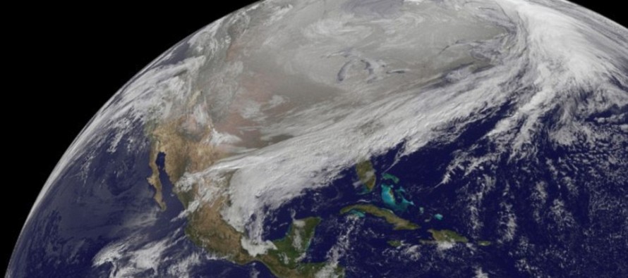
Feb 10: Arctic Outbreak Detected!
Models are unanimously in agreement about a very cold period in the ~February 13-18 time-frame. A piece of the Polar Vortex will break off and drop over the E. US. The trough could reach as far south as Florida. This is different than traditional Arctic high suppression in the sense that instead of a bone-dry static cold environment, there will be cold and unsettled conditions. In this scenario, smaller clippers and disturbances tend to rotate around the bottom of the trough while being enhanced by the piece of the Polar Vortex energy. The potential light snow event this Thursday-Friday will usher in the initial energy that should peak (cold-wise) around ~February 15-16—after another even stronger disturbance transfers through.
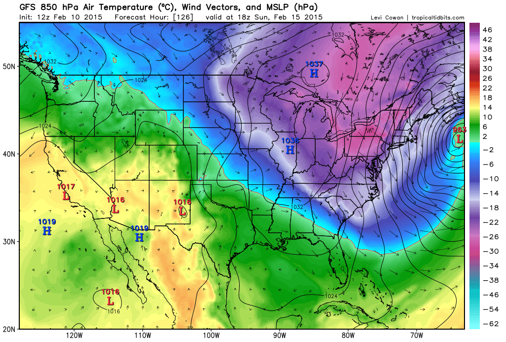
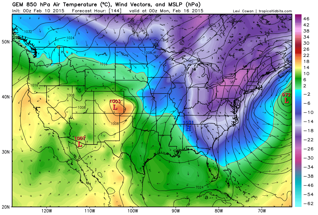
I can already hear the “models can’t even predict 2 days ahead, how are we supposed to believe a week out?” comments. FYI, tracking low pressure disturbances is a much more volatile environment than tracking large-scale synoptic warm and cold spells. The purpose of this article is to get as many people as possible prepared for probably the coldest air of the season regardless of storms vs. no storms. Let’s look at some supporting guidance from the GFS, Canadian, and Euro:
The GFS:
The Canadian:
The European:
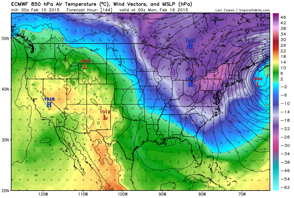
The pink and purple areas represent the coldest of the air (-22C to -30C at 5000ft altitude). The surface will be warmer than that (maybe -5F to 15F for lows and 15F to 25F for highs—NWNJ to SENJ). Not all cold will extrapolate to the surface. If you notice, there is a high pressure system dipping into the Ohio Valley area working in tandem with strong developing low pressure off the eastern seaboard. The high is spinning clockwise and the low is spinning counter-clockwise. The two wheels will spin cold air southward together. How close that low gets to the coast will determine if the Saturday-Sunday snow threat comes to fruition—yes that’s right the Saturday-Sunday potential which is after this Thursday-Friday potential. Regardless of these disturbances hitting or missing, the cold is coming no matter what.
In English: The February 13-18 period should feature temperatures well below average for this time of year. We have two potential snow events (this Thursday-Friday and then Saturday-Sunday). They are both very volatile clipper-transfers that could easily bust like previous storms this season but we still have to watch them in case they do produce. Whether they hit or miss will have little effect on the certainty of the incoming cold. It’s coming so have a plan to stay warm and be safe! JC

Jonathan Carr (JC) is the founder and sole operator of Weather NJ, New Jersey’s largest independent weather reporting agency. Since 2010, Jonathan has provided weather safety discussion and forecasting services for New Jersey and surrounding areas through the web and social media. Originally branded as Severe NJ Weather (before 2014), Weather NJ is proud to bring you accurate and responsible forecast discussion ahead of high-stakes weather scenarios that impact this great garden state of ours. All Weather. All New Jersey.™ Be safe! JC


LOCAL FORECAST | INTERACTIVE RADAR | LATEST NJ WEATHER ALERTS | WEDDING FORECAST| PRIVACY POLICY
© Copyright 2025 Weather NJ LLC. All Rights Reserved.
Some information that can be found on our website is provided by a private weather station and is not an officially recognized station for weather reporting. Though we always strive to achieve accurate reporting for our own use, it is important that you do NOT depend on the data provided here for any purpose.
